


.png)

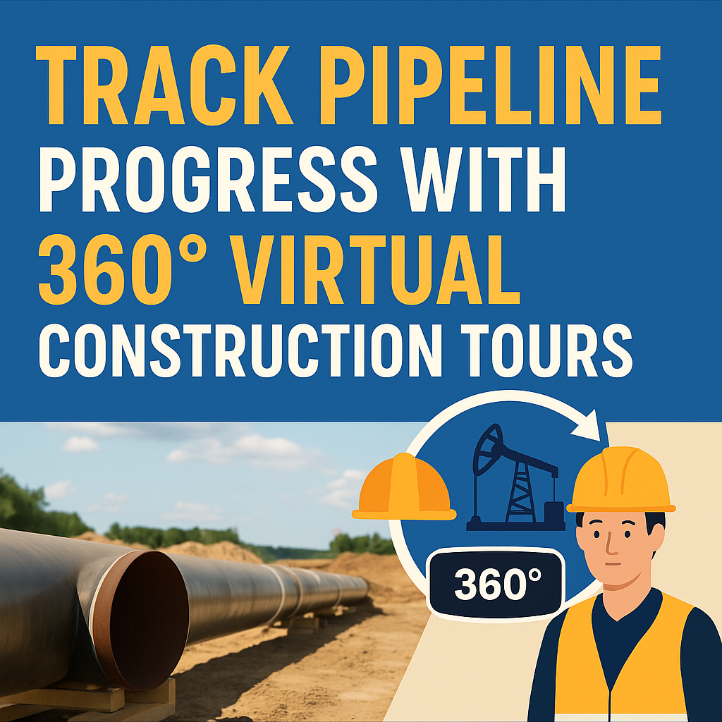
Pipeline construction projects are massive, complex, and span vast distances — often across challenging terrain and multiple jurisdictions. Coordinating teams, ensuring compliance, and keeping stakeholders informed can feel like a logistical nightmare. 😰
That’s why forward-thinking operators are turning to 360° virtual construction tours — an immersive, cloud-based way to monitor, document, and share pipeline progress in real time. 🌐📸
In this post, we’ll explore how virtual tours are reshaping how pipelines are built, inspected, and handed off — without constant boots on the ground.
Traditional pipeline oversight typically relies on:
This results in delays, disorganization, and limited real-time awareness. Virtual tours eliminate these friction points by providing a visual, interactive record that any stakeholder can access anytime, anywhere.
🔗 Related: Cut Site Visits, Not Visibility: 360 Virtual Tours for Oilfields
A 360° virtual tour is a navigable digital replica of a real construction site. Created using a 360° camera or drone, it captures every angle of the jobsite and uploads it to a cloud platform where users can:
🔗 Related: Building a Centralized Oilfield Documentation System with 360 Tours
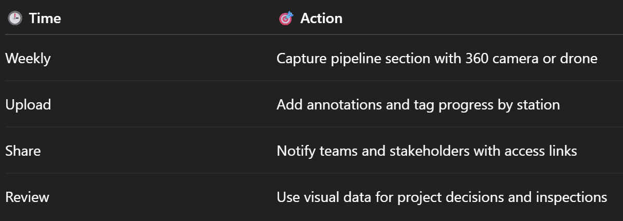
360° captures allow you to view trenching, welding, and pipe-laying processes remotely. No need for daily on-site walkthroughs.
Supervisors and inspectors can remotely verify quality, flag issues, and document completion in real time.
🔗 Related: Streamlining Oilfield Inspections Using 360 Virtual Tours
Track PPE zones, emergency egress points, and environmental buffers through immersive safety tours.
🔗 Related: Remote Oilfield Safety Training with 360 VR Technology
Monitor daily or weekly progress, compare before-and-after visuals, and archive time-stamped scenes for future audits.
🔗 Related: Real-Time Oilfield Development Tracking with 360° Virtual Tours
Create shared tour links to update clients, investors, and government officials without flying them to remote regions.
🔗 Related: Cloud-Based Oilfield Reporting with Virtual Tours
🔗 Related: Best Cameras and Drones for Oilfield Virtual Tours in 2025
Use a virtual tour platform like CloudPano to:
🔗 Related: Virtual Site Updates: How 360° Virtual Tours Improve Oilfield Oversight
A West Texas pipeline crew adopted 360° virtual construction tours for a 40-mile crude oil project. In just 6 months:
🔗 Related: Case Study: Virtual Tour Implementation for Oilfield Workflow Visibility
🔗 Related: Smarter Oilfield Management Starts with 360 Virtual Documentation
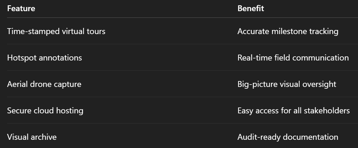
360° virtual tours help eliminate silos, reduce rework, and keep everyone accountable — visually. 🎯📊
✅ Choose your camera or drone
✅ Map your weekly or milestone-based capture schedule
✅ Select a hosting platform like CloudPano
✅ Train teams on tagging and annotations
✅ Share links with stakeholders and monitor progress live
With a few simple tools and a repeatable process, your pipeline project can go from outdated reports to a fully immersive digital twin. 🧠🛢️

Compact, ready to go anywhere
Interchangeable lens that’s upgradeable
Dual 1-inch sensors for improved clarity and low light performance
Dynamic range and 6K 360° capture
360° photo resolution at 21MP

8K 360° video recording for ultra-detailed visuals.
4K single-lens mode for traditional wide-angle shots.
Invisible selfie stick effect for drone-like perspectives.
2.5-inch touchscreen with Gorilla Glass protection.
Waterproof up to 33ft for underwater shooting.

360° photo resolution in 23MP
Slim design at 24 mm thick
Built-in image stabilization for smooth video capture.
Internal 19GB storage for photo and video storage.
Wireless connectivity for remote control and sharing.

60MP 360° still images for high-resolution photography.
5.7K 360° video recording at 30fps.
2.25-inch touchscreen for intuitive control.
USB Type-C port for fast charging and data transfer.
MicroSD card slot for expandable storage.
.png)
.png)

Try it free. No credit card required. Instant set-up.


