Cloud-Based Oilfield Reporting with Virtual Tours

Cloudpano
July 25, 2025
5 min read
Share this post

☁️ Cloud-Based Oilfield Reporting with Virtual Tours: A Complete Guide 🛢️📊

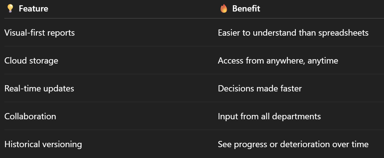
In oil and gas operations, accurate reporting is everything — but traditional reporting tools often fall short. Spreadsheets, PDF files, and static reports are hard to keep updated, harder to interpret, and often disconnected from what’s really happening on-site.

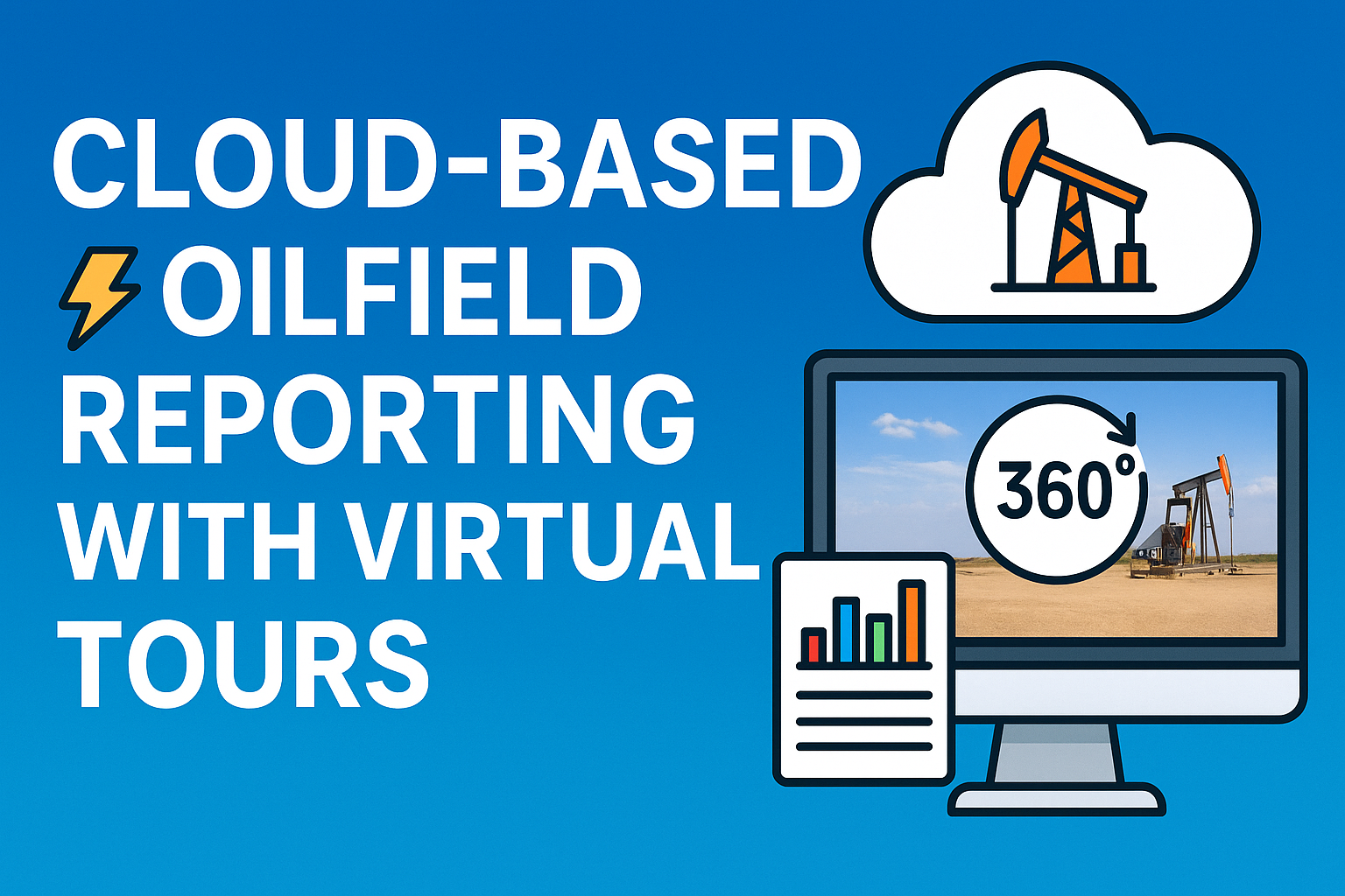
That’s why modern operators are turning to cloud-based oilfield reporting powered by 360° virtual tours. This powerful combination turns your daily field data into a dynamic, visual-first reporting system — accessible from anywhere, anytime. 🌍💻

In this guide, we’ll break down exactly how to use cloud-based virtual tours for reporting, what tools to use, and how to boost visibility, compliance, and communication across your oilfield operations.

🧾 The Problem with Traditional Oilfield Reports

Let’s face it. The old way of reporting includes:

  • 📄 PDF summaries that quickly go out of date
  • 📷 Photos without context or location tags
  • 🧾 Spreadsheets no one wants to open
  • 🕐 Delays between what’s happening in the field and what gets reported

As a result, decision-makers are blind, teams work in silos, and regulatory submissions become a nightmare.

🔗 Related: Building a Centralized Oilfield Documentation System with 360 Tours

🌀 Enter: Cloud-Based Reporting with 360° Virtual Tours

360° virtual tours allow you to capture real, immersive visuals of your sites — and cloud-based reporting platforms let you organize, timestamp, annotate, and share those visuals in real time.

Benefits include:

✅ Instant visibility into remote sites
✅ Versioned records with historical comparisons
✅ Interactive reports with embedded notes and files
✅ One-click sharing for internal teams, clients, or regulators

🔗 Related: From Ground to Cloud: Tracking Oilfield Workflows with 360 Virtual Tours

🛠️ What You Need to Build a Cloud-Based Reporting System

1. 360° Capture Tools

Use 360° cameras or drones to document sites visually:

  • Insta360 One RS – Great for walk-throughs
  • Ricoh Theta Z1 – High-resolution stills
  • DJI Mavic 3 Enterprise – Perfect for aerial overviews

🔗 More options: Best Cameras and Drones for Oilfield Virtual Tours in 2025

2. Virtual Tour & Reporting Software (e.g. CloudPano)

These platforms let you:

  • Upload and organize 360° images
  • Add hotspots, labels, and inspection notes
  • Timestamp changes over time
  • Export or share reports with stakeholders

3. Cloud Storage & Access Control

Store all visual data in the cloud with:

  • Secure login permissions
  • View/edit roles for teams
  • Device-agnostic access (mobile, tablet, desktop)

✅ Step-by-Step: How to Implement Cloud-Based Reporting

🔍 Step 1: Define What to Report

Choose what matters most to your team:

  • Daily equipment status 📦
  • Weekly construction progress 🏗️
  • Monthly compliance inspections 📋
  • Incident reporting and root cause tracking 🚧

📸 Step 2: Capture the Visuals

Use your 360° camera or drone to capture:

  • Site entrances
  • Equipment areas
  • Storage and tank locations
  • Control rooms and walkways

🔗 Related: 360° Virtual Tours for Oilfield Project Updates: A Complete Guide

🧠 Step 3: Build the Report in Your Virtual Tour Platform

Inside the platform:

  • Upload the imagery
  • Tag critical areas
  • Add checklists and comments
  • Include embedded PDFs or inspection forms

🔗 Related: Streamlining Oilfield Inspections Using 360 Virtual Tours

📤 Step 4: Share and Collaborate

Generate secure links for:

  • Internal teams
  • Project managers
  • Regulators or auditors
  • Clients or vendors

Allow stakeholders to comment directly inside the tour — no need for email threads or phone calls.

🔁 Step 5: Version and Archive

Keep weekly or monthly versions to compare:

  • Equipment installations
  • Repairs and maintenance
  • Compliance checks
  • Spill or hazard remediation

🔗 Related: Real-Time Oilfield Development Tracking with 360° Virtual Tours

🔍 Real-World Use Case

A midstream operator in Texas implemented cloud-based reporting with 360° tours across five compressor stations.

Results included:

  • ⏱️ 60% faster project update reviews
  • 🧾 Reduced reporting errors by 80%
  • 📤 Shared real-time visuals with regulatory bodies during permit audits
  • ✅ Created a permanent visual archive for every milestone

📌 Full story here: Case Study: Virtual Tour Implementation for Oilfield Workflow Visibility

🔐 Use Cases for Cloud-Based Oilfield Reporting

🛠️ Construction Project Updates

Show real-time visual proof of project milestones.

📋 Safety & Compliance Records

Embed incident documentation and verify that safety gear, signage, and fire suppression systems are in place.

🧪 Asset Inspections

Document tank conditions, pipeline welds, and equipment status visually.

🧠 Executive Dashboards

Let stakeholders browse and understand site conditions without visiting the field.

📈 Why It Works: Key Benefits

🎯 Final Thoughts

In 2025 and beyond, oilfield reporting must evolve — not just to keep up with regulations, but to unlock efficiency, transparency, and smarter decisions.

360° virtual tours combined with cloud-based platforms offer:

✅ Remote visibility
✅ Faster reporting
✅ Stronger compliance
✅ Permanent, searchable records

If your reports still live in folders and email threads, it's time to upgrade your process — and your visibility. 💡

Share this post
Cloudpano

Choose The Right 360° Camera

Insta360 ONE RS 1-Inch 360 Edition

  • Compact, ready to go anywhere

  • Interchangeable lens that’s upgradeable

  • Dual 1-inch sensors for improved clarity and low light performance

  • Dynamic range and 6K 360° capture

  • 360° photo resolution at 21MP

Learn More

Insta360 X4

  • 8K 360° video recording for ultra-detailed visuals.

  • 4K single-lens mode for traditional wide-angle shots.

  • Invisible selfie stick effect for drone-like perspectives.

  • 2.5-inch touchscreen with Gorilla Glass protection.

  • Waterproof up to 33ft for underwater shooting.

Learn More

Ricoh Theta Z1

  • 360° photo resolution in 23MP

  • Slim design at 24 mm thick

  • Built-in image stabilization for smooth video capture.

  • Internal 19GB storage for photo and video storage.

  • Wireless connectivity for remote control and sharing.

Learn More

Ricoh Theta X

  • 60MP 360° still images for high-resolution photography.

  • 5.7K 360° video recording at 30fps.

  • 2.25-inch touchscreen for intuitive control.

  • USB Type-C port for fast charging and data transfer.

  • MicroSD card slot for expandable storage.

Learn More
Property Marketing
Allows potential buyers to explore properties in detail from anywhere, enhancing the real estate marketing process.
Automotive Spins
Create an interactive virtual showroom and engage affluent digital buyers with live 360º video calls, all through the CloudPano mobile app for a complete automotive sales solution.
Interactive Floor Plans
Create 2D and 3D floor plans with measurements in 4 minutes or less, all from your phone. Download the Floor Plan Scanner app and get your first scan free.

360 Virtual Tours With CloudPano.com. Get Started Today.

Try it free. No credit card required. Instant set-up.

Try it free
Latest posts

See our other posts

Interviews, tips, guides, industry best practices, and news.

Start a Profitable Drone, Virtual Tour & AI Video Agency Fast

This post walks you step-by-step through how to start a profitable drone, virtual tour, and AI video agency in 2025. You’ll discover why local businesses need immersive media, which niches to target first, and how to bundle services like 360° virtual tours, drone videography, AI-powered real estate videos, and property websites into high-ticket packages. Plus, learn how to generate recurring revenue with hosting fees, retainers, and national-scale contracts — all powered by the 360 Profit Software Bundle.
Read post

7-Day Blueprint: Launch Your Virtual Tour, Drone & AI Video Business

This guide walks entrepreneurs step-by-step through launching a profitable virtual tour, drone, and AI video company in just 7 days. Covering everything from setting up software tools like CloudPano, PhotoAIVideo, and LeadStack, to securing clients in high-demand industries such as real estate, healthcare, and local businesses, this blueprint shows you how to package and sell digital media services fast. With AI automation, 360° tours, and remote workflows, anyone can build a scalable business in 2025–2026 while saving time and increasing revenue.
Read post

How to Start a Virtual Tour, Drone & AI Video Company in 7 Days (2025–2026 Guide)

This guide walks entrepreneurs step-by-step through launching a profitable digital media company in just 7 days. Using tools like CloudPano for virtual tours, PhotoAIVideo for AI-powered real estate videos, and bundled software such as Pictastic and 21 Lead Finder, you’ll learn how to package and sell services like drone shoots, real estate photography, virtual staging, and marketing automation. From identifying high-value niches (dentists, nursing homes, real estate brokerages) to pricing strategies and upsell models, this post provides a complete roadmap for building a scalable business that attracts recurring revenue in 2025–2026.
Read post