Real-Time Oilfield Development Tracking with 360° Virtual Tours

Cloudpano
July 25, 2025
5 min read
Share this post

🛢️ Real-Time Oilfield Development Tracking with 360° Virtual Tours 🚧📡

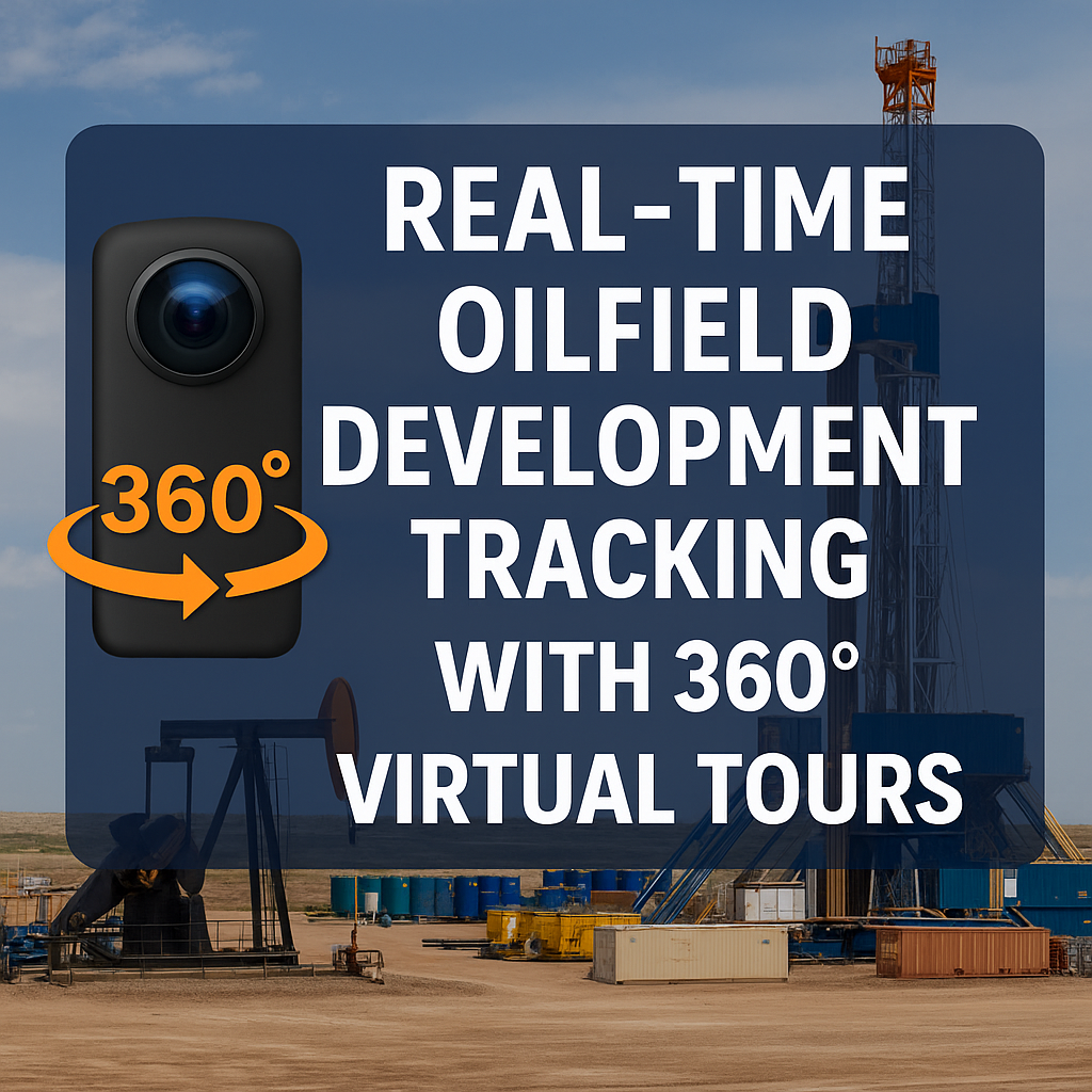
Tracking the development of oilfield projects — from land clearing to production — is often a massive logistical challenge. Delays, miscommunication, and blind spots in project status can cost millions. But in 2025, leading operators are eliminating guesswork by using 360° virtual tours for real-time tracking of oilfield development.

Whether you're managing multiple well sites, building out infrastructure, or overseeing third-party contractors, 360° tours give you visual control — no matter where you are.

In this complete guide, we’ll break down how 360° virtual tours are changing the game in oilfield development tracking — and how to implement them across your projects. 📈📷

📍 The Problem with Traditional Development Tracking

Oilfield development requires coordination across:

  • Engineers
  • Construction crews
  • Safety teams
  • Regulators
  • Executives

And the traditional tracking tools? They’re outdated:

  • Spreadsheets that go stale overnight 📉
  • Reports without real context 📄
  • Delayed progress photos 📸
  • Field visits that eat time and budget ⏱️💰

That’s a recipe for scope creep, missed milestones, and expensive rework.

🔗 Related: Streamlining Oilfield Inspections Using 360 Virtual Tours

🌀 Real-Time Tracking with 360° Tours: How It Works

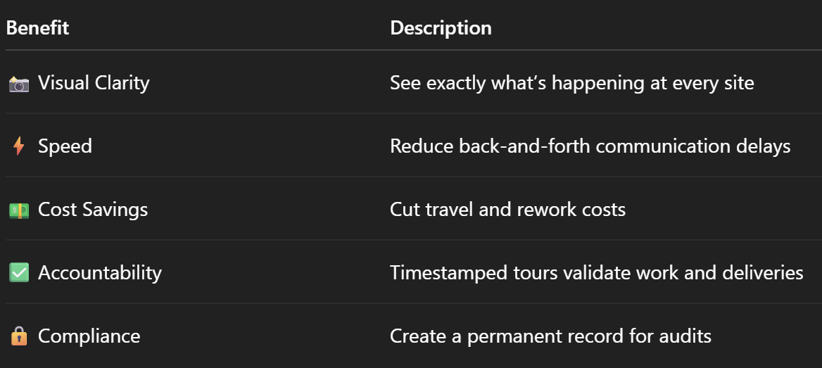
With 360° virtual tour technology, you can:

✅ Capture high-resolution walkthroughs of your site
✅ Upload them to a cloud platform (like CloudPano)
✅ Annotate milestones, label zones, and track issues
✅ Share updates instantly with stakeholders

This lets you see progress visually, spot delays early, and make informed decisions from anywhere in the world 🌍.

🔗 Related: From Ground to Cloud: Tracking Oilfield Workflows with 360 Virtual Tours

🔧 What You’ll Need to Track Development in Real-Time

1. 360° Camera or Drone

For ground-level and aerial site documentation, use:

  • Insta360 One RS
  • DJI Mavic 3 Enterprise
  • Ricoh Theta Z1

🔗 Read: Best Cameras and Drones for Oilfield Virtual Tours in 2025

2. Virtual Tour Software (CloudPano, Matterport, etc.)

  • Build interactive site walkthroughs
  • Tag progress by area (e.g., pad A, tank battery)
  • Add voice or text notes for team instructions
  • Export reports from visual data

3. A Capture Cadence

Set a weekly or milestone-based capture plan:

  • Site grading
  • Foundation completion
  • Equipment delivery
  • Electrical install
  • Pre-production review

🔗 Related: 360° Virtual Tours for Oilfield Project Updates: A Complete Guide

🚀 Step-by-Step: Using 360° Tours for Oilfield Development

✅ Step 1: Create a Capture Plan

Decide what areas you’ll document:

  • Entry/exit roads
  • Drill pads
  • Laydown yards
  • Pipeline corridors
  • Living quarters

Set calendar reminders and assign team members.

✅ Step 2: Capture and Upload

Use your camera or drone to shoot the site. Upload to your virtual tour software and tag each key area by development phase.

🔗 Need to organize documentation? Building a Centralized Oilfield Documentation System with 360 Tours

✅ Step 3: Compare Tours Over Time

Most platforms let you create “versions.”
Compare Week 1 vs. Week 4 side-by-side to:

  • Track material delivery 📦
  • Spot crew delays 👷‍♂️
  • Verify work completed 🧱
  • Ensure compliance 📋

✅ Step 4: Share Visual Updates

Generate links to send to:

  • Executives for progress reviews
  • Safety teams for hazard checks
  • Clients for milestone approvals
  • Contractors for punch list reviews

✅ Step 5: Use for Real-Time Decision Making

Your team can now:

  • Approve field changes faster
  • Resolve disputes with visual records
  • Adjust timelines based on actual site visuals
  • Prepare regulators with virtual walkthroughs

No waiting. No guessing.

🔄 Real-Time Use Cases in Oilfield Development

🛠️ New Well Construction

Track pad leveling, rig arrival, frac tanks, and more.

🛢️ Tank Battery Buildouts

Follow tank installation, piping, electrical work, and fencing progress visually.

📦 Logistics & Delivery Verification

Use timestamps and tags to verify when key materials arrive.

🧯 Safety Compliance Monitoring

Ensure fire extinguishers, signage, escape routes, and fencing are always documented and up to spec.

📊 Real-World Example

A Permian Basin operator deployed weekly drone captures stitched into 360° tours for 8 concurrent sites.

They were able to:

  • Spot a faulty compressor delivery early
  • Avoid $50K in rework by verifying equipment layout
  • Resolve a contractor billing dispute using timestamped tour data
  • Reduce project management travel by 80%

🧠 Benefits of Real-Time Virtual Tour Tracking

🔮 The Future Is Visual

360° virtual tour technology isn’t just about looking cool. It’s about gaining visibility and making faster, smarter decisions.

In oil and gas, that means:

  • Beating deadlines
  • Avoiding scope creep
  • Increasing margins
  • Impressing stakeholders

If your development tracking still relies on spreadsheets and secondhand updates… it’s time to go visual. 👁️💡

Share this post
Cloudpano

Choose The Right 360° Camera

Insta360 ONE RS 1-Inch 360 Edition

  • Compact, ready to go anywhere

  • Interchangeable lens that’s upgradeable

  • Dual 1-inch sensors for improved clarity and low light performance

  • Dynamic range and 6K 360° capture

  • 360° photo resolution at 21MP

Learn More

Insta360 X4

  • 8K 360° video recording for ultra-detailed visuals.

  • 4K single-lens mode for traditional wide-angle shots.

  • Invisible selfie stick effect for drone-like perspectives.

  • 2.5-inch touchscreen with Gorilla Glass protection.

  • Waterproof up to 33ft for underwater shooting.

Learn More

Ricoh Theta Z1

  • 360° photo resolution in 23MP

  • Slim design at 24 mm thick

  • Built-in image stabilization for smooth video capture.

  • Internal 19GB storage for photo and video storage.

  • Wireless connectivity for remote control and sharing.

Learn More

Ricoh Theta X

  • 60MP 360° still images for high-resolution photography.

  • 5.7K 360° video recording at 30fps.

  • 2.25-inch touchscreen for intuitive control.

  • USB Type-C port for fast charging and data transfer.

  • MicroSD card slot for expandable storage.

Learn More
Property Marketing
Allows potential buyers to explore properties in detail from anywhere, enhancing the real estate marketing process.
Automotive Spins
Create an interactive virtual showroom and engage affluent digital buyers with live 360º video calls, all through the CloudPano mobile app for a complete automotive sales solution.
Interactive Floor Plans
Create 2D and 3D floor plans with measurements in 4 minutes or less, all from your phone. Download the Floor Plan Scanner app and get your first scan free.

360 Virtual Tours With CloudPano.com. Get Started Today.

Try it free. No credit card required. Instant set-up.

Try it free
Latest posts

See our other posts

Interviews, tips, guides, industry best practices, and news.

Hardware to Software: Perfecting Real Estate Mobile-to-Desktop 3D Documentation

The article addresses the critical "Data Gap" in property management, insurance, and restoration. It argues that traditional manual measurements (tape and paper) are no longer just slow—they are a liability. By moving to a Scan-to-Sketch Workflow, firms can decouple their growth from their headcount.
Read post

Building Interactive 3D Real Estate Property Reports for Stakeholder Review

This long-form guide positions CloudPano 3D Measure as the definitive ROI-driven solution for property managers, insurance adjusters, and restoration professionals.
Read post

The Science of Real Estate Virtual Room Perimeter Scaling in 3D Environments

CloudPano 3D Measure is redefining spatial documentation for property professionals. This post explores the technical shift from manual tape measurements to Virtual Room Perimeter Scaling, a process that converts 360° imagery into precise, actionable data.
Read post