Virtual Site Updates: How 360° Virtual Tours Improve Oilfield Oversight

Cloudpano
July 25, 2025
5 min read
Share this post

🌐 Virtual Site Updates: How 360° Virtual Tours Improve Oilfield Oversight 🛢️🛰️

In the high-stakes world of oil and gas operations, oversight is everything. From ensuring safety and regulatory compliance to tracking construction and maintenance workflows — visibility across every site is critical.

But when your assets are scattered across miles of remote terrain, how do you keep everyone aligned without flying field crews out daily?

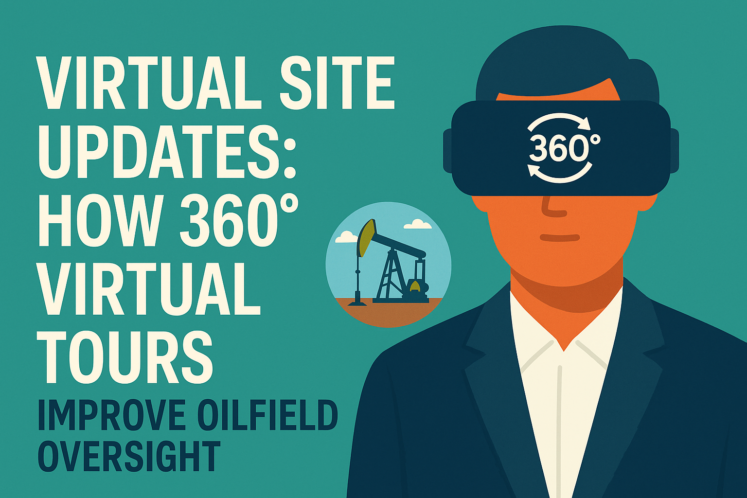
Enter the game-changer: 360° virtual tours for virtual site updates. 🚁📸

These immersive, cloud-based walkthroughs provide real-time visibility into oilfield operations — without the need for boots on the ground. In this post, we’ll break down how 360° virtual tours revolutionize oilfield oversight and how you can start using them today.

👀 The Oversight Challenge in Oil & Gas

Oilfield executives, safety officers, and project managers all face the same struggle:

  • ⛽ Sites are remote and widespread
  • 🧑‍🏭 Field personnel are stretched thin
  • 📝 Traditional updates (PDFs, photos, emails) lack context
  • 🧭 Delayed reports = slow decisions = lost money

🔗 Related: From Ground to Cloud: Tracking Oilfield Workflows with 360 Virtual Tours

🌀 What Are 360° Virtual Tours for Site Updates?

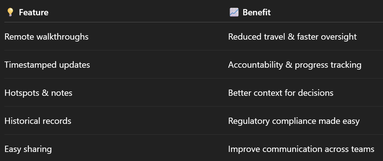
360° virtual tours are immersive panoramic images or videos of your oilfield site, viewable in any browser. These aren’t just pretty pictures — they’re interactive, annotated, and timestamped visual records of your site.

You can:

✅ Walk through compressor stations, tank farms, or well pads
✅ Click on hotspots to access notes or documents
✅ Compare progress over time
✅ Share updates with internal teams or external stakeholders — in real-time

🔗 Related: 360° Virtual Tours for Oilfield Project Updates: A Complete Guide

🔍 Why Virtual Site Updates Work So Well

🎯 1. Remote Oversight

Your managers, clients, and regulators can view progress from anywhere — no flights, no delays.

⏱️ 2. Real-Time Updates

Upload new virtual tours weekly or daily to reflect current conditions.

🧾 3. Visual Documentation

Photos alone don’t show context. Virtual tours provide situational awareness.

🛡️ 4. Better Compliance & Safety Tracking

Inspect safety zones, signage, or spill response readiness — all remotely.

📈 5. Track Progress Over Time

Compare versions to spot delays, verify installations, or confirm corrective actions.

🔗 Related: Real-Time Oilfield Development Tracking with 360° Virtual Tours

🛠️ How to Create Virtual Site Updates

✅ Step 1: Capture the Site in 360°

Use cameras or drones like:

  • Insta360 One RS – Portable and high-res
  • DJI Mavic 3 Enterprise – For aerial shots
  • Ricoh Theta Z1 – Perfect for tight indoor spaces

📸 Pro tip: Capture from the same spots regularly to track changes over time.

🔗 Related: Best Cameras and Drones for Oilfield Virtual Tours in 2025

✅ Step 2: Upload to a Virtual Tour Platform

Use a system like CloudPano to:

  • Organize the imagery
  • Add hotspots (e.g. inspection logs, permits)
  • Embed videos, PDFs, or safety procedures
  • Timestamp and archive for audit trail

🔗 Related: Building a Centralized Oilfield Documentation System with 360 Tours

✅ Step 3: Share the Tour with Stakeholders

Send links to:

  • Regional managers
  • Maintenance coordinators
  • Safety inspectors
  • Regulatory agencies
  • Clients or investors

Let them walk through the site from their laptop or phone. 📱💻

🔗 Related: Cloud-Based Oilfield Reporting with Virtual Tours

✅ Step 4: Repeat & Compare

Upload updated tours every week or milestone. Use historical comparisons to:

  • Track installations
  • Spot new hazards
  • Verify cleanup or corrections
  • Keep a permanent visual record

🧠 Use Cases for Virtual Site Oversight

🏗️ Construction Projects

Keep track of infrastructure development across phases.
🔗 Related: Enhancing Oilfield Visibility and Reporting Through 360 Virtual Tours

🚧 Safety Walkthroughs

Do safety reviews without setting foot on-site.
🔗 Related: Streamlining Oilfield Inspections Using 360 Virtual Tours

🧪 Maintenance Tracking

Document repairs, replacements, or shut-ins.

📋 Regulatory Submissions

Provide immersive proof for audits or permits.

🧯 Training & Orientation

New hires can tour the site virtually.
🔗 Related: Remote Oilfield Safety Training with 360 VR Technology

🧾 Real-World Example: Permian Basin Deployment

A Texas-based operator managing 14 well sites deployed weekly virtual site updates using drones and 360° cameras.

They saw:

  • 🕐 70% reduction in supervisor travel time
  • 📉 50% fewer compliance gaps
  • 🧠 3x better visibility across departments
  • 📤 Instant sharing with regulators via private URLs

🔗 Related: Case Study: Virtual Tour Implementation for Oilfield Workflow Visibility

📦 Benefits Recap

🚀 Getting Started

Here’s what you need to launch virtual site updates at your oilfield:

✅ A 360° camera or drone
✅ A virtual tour platform (like CloudPano)
✅ Clear SOPs for regular capture
✅ Stakeholder buy-in
✅ Scheduled upload and comparison cycles

🎯 Final Thoughts

360° virtual tours aren’t just cool visuals — they’re essential tools for modern oilfield oversight.

Whether you're managing new development, ongoing operations, or regulatory reporting, virtual site updates give your team the clarity, consistency, and speed they need to succeed in today’s complex energy environment.

In 2025, smart operators don’t just send emails — they send immersive site walkthroughs. 🎥📍

Share this post
Cloudpano

Choose The Right 360° Camera

Insta360 ONE RS 1-Inch 360 Edition

  • Compact, ready to go anywhere

  • Interchangeable lens that’s upgradeable

  • Dual 1-inch sensors for improved clarity and low light performance

  • Dynamic range and 6K 360° capture

  • 360° photo resolution at 21MP

Learn More

Insta360 X4

  • 8K 360° video recording for ultra-detailed visuals.

  • 4K single-lens mode for traditional wide-angle shots.

  • Invisible selfie stick effect for drone-like perspectives.

  • 2.5-inch touchscreen with Gorilla Glass protection.

  • Waterproof up to 33ft for underwater shooting.

Learn More

Ricoh Theta Z1

  • 360° photo resolution in 23MP

  • Slim design at 24 mm thick

  • Built-in image stabilization for smooth video capture.

  • Internal 19GB storage for photo and video storage.

  • Wireless connectivity for remote control and sharing.

Learn More

Ricoh Theta X

  • 60MP 360° still images for high-resolution photography.

  • 5.7K 360° video recording at 30fps.

  • 2.25-inch touchscreen for intuitive control.

  • USB Type-C port for fast charging and data transfer.

  • MicroSD card slot for expandable storage.

Learn More
Property Marketing
Allows potential buyers to explore properties in detail from anywhere, enhancing the real estate marketing process.
Automotive Spins
Create an interactive virtual showroom and engage affluent digital buyers with live 360º video calls, all through the CloudPano mobile app for a complete automotive sales solution.
Interactive Floor Plans
Create 2D and 3D floor plans with measurements in 4 minutes or less, all from your phone. Download the Floor Plan Scanner app and get your first scan free.

360 Virtual Tours With CloudPano.com. Get Started Today.

Try it free. No credit card required. Instant set-up.

Try it free
Latest posts

See our other posts

Interviews, tips, guides, industry best practices, and news.

Mastering Compliance: The Future of Automated Property Video

This article provides a definitive guide for real estate professionals on navigating strict MLS branding regulations through AI-driven automation. It addresses the risks of compliance violations, details the limitations of manual editing workflows, and introduces a scalable, "compliance-first" system for generating high-quality, MLS-approved property videos. The post serves as a strategic blueprint for agents aiming to maintain listing visibility, avoid regulatory penalties, and streamline their marketing operations.
Read post

Future-Proofing Your Business with MLS Safe AI Video for Listings

This high-authority guide focuses on long-term operational stability and the strategic advantages of leveraging artificial intelligence to bypass the industry-wide friction between high-impact marketing and regulatory compliance. Key Takeaways & Content Structure: The Reputation-Risk Factor: Explains the high cost of compliance errors, focusing on how a single technical oversight—such as a misplaced logo or branded watermark—can trigger a systemic board audit, leading to immediate listing suspension and lasting reputational damage with sellers. The Production Disconnect: Breaks down the "two-version" operational tax, where marketing teams suffer from repetitive rendering, file-management bloat, and the persistent danger of human error when manually managing branded vs. unbranded media assets. AI as a Compliance Engine: Defines how advanced AI media platforms move beyond mere aesthetics to function as regulatory safeguards. It illustrates the technical architecture where the AI engine isolates branding data from structural property data at the rendering level, effectively "forking" the output into two distinct, safe-to-use tracks. Operational Blueprint: Maps out a transparent, 6-step automation funnel that takes a listing from flat photograph ingestion to syndicate-ready, neutral-hosted media in minutes. Strategic Scalability: Demonstrates why centralizing production into a single SaaS platform is the only way for growing brokerages to maintain consistency, remove contractor-level liability, and recover significant administrative time. The PhotoAIVideo.com Edge: Concludes by positioning the platform as a purpose-built solution that combines high-definition parallax AI motion with an automated "compliance-first" export workflow, ensuring Realtors can generate professional, engaging video content that passes even the most stringent board audits on the first attempt.
Read post

Streamlining Your Workflow with a Specialized MLS Compliant Real Estate Media App

This article functions as a tactical operations guide for real estate marketers and brokerage leaders focused on reducing technical friction and human error in their media publishing pipeline. Key Takeaways & Content Structure: The "Stop-Work" Order: Addresses the high-stakes reality of MLS compliance flags, where automated rules block properties from IDX feeds due to accidental branding, causing immediate listing velocity loss. The Fragmented Workflow Problem: Identifies the "manual bottleneck"—the inefficiency of having field photographers deliver single assets that then require internal staff to manually strip, re-render, and verify separate branded and unbranded versions. Architecture of Dual-Path Rendering: Illustrates the technological shift toward programmatic asset management. It explains how a modern app processes a single source file into two isolated rendering tracks: a lead-gen-heavy marketing track and a strictly compliant, unbranded track for MLS syndication. Operational Workflow Mapping: Provides a clear, 6-step blueprint for moving from raw photography ingestion to compliant deployment, including automated motion application, metadata scrubbing, and neutral link hosting. Risk Mitigation for Brokerages: Highlights how centralized management dashboards eliminate the "wild west" of agent-led media creation, providing brokers with a single-pane-of-glass view to ensure compliance across all active listings. The PhotoAIVideo.com Advantage: Positions the platform as the ideal MLS compliant real estate media app that leverages AI to inject cinematic motion into flat listing photos, effectively automating the entire compliance-forking process and increasing overall production capacity by up to 94%.
Read post