Track Oilfield Development in Real-Time with 360 Virtual Tours

Cloudpano
July 24, 2025
5 min read
Share this post

🛢️ Track Oilfield Development in Real-Time with 360 Virtual Tours 🚀

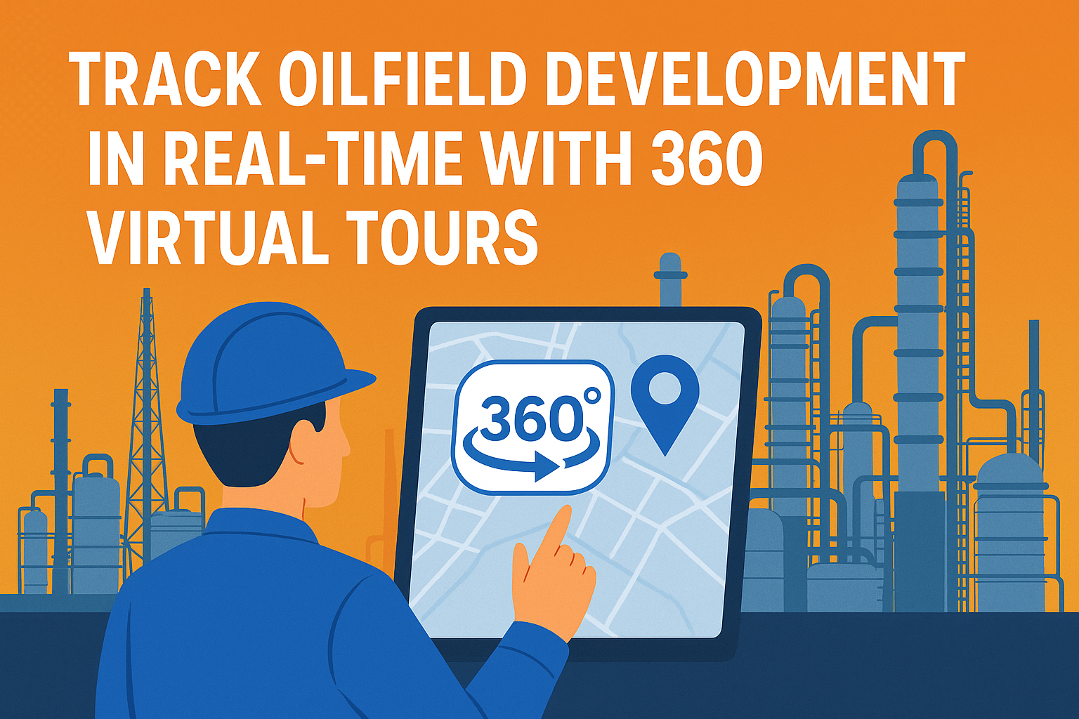
In the fast-paced world of oil and gas, timing and precision are everything. 📊 From planning and construction to safety and production, every second counts — and so does every decision. That’s why leading energy companies are turning to 360° virtual tours for real-time oilfield development tracking.

Forget outdated maps and static reports. With 360 virtual tours, stakeholders can now step inside an active oilfield — anytime, from anywhere — and gain visual, spatial, and temporal insights that are revolutionizing the way projects are managed.

👷‍♂️ What Are 360 Virtual Tours in Oilfield Monitoring?

360° virtual tours combine high-resolution panoramic imagery with clickable navigation and embedded data points. These tours allow project managers, engineers, and compliance officers to:

  • Walk through live job sites remotely 🖥️
  • View updated equipment, pipeline routes, and terrain changes 🔧
  • Collaborate with remote teams and contractors in real time 🤝
  • Log progress photos, voice notes, and documentation 🎙️

Compared to traditional field reports, these immersive tools are faster, smarter, and more scalable.

🔗 Want a deeper look at site monitoring upgrades? Read: Cut Downtime and Improve Accuracy with Remote Oil & Gas Site Monitoring

⏱️ Real-Time Progress Tracking: Why It Matters

When managing multi-million-dollar assets in volatile environments, real-time updates can save you from costly errors and delays.

✅ With 360 virtual tours, you can:

  • Track the exact state of infrastructure at any phase
  • Flag slowdowns in excavation, rig setup, or road access
  • Ensure compliance with deadlines and safety regulations

Whether you’re overseeing an offshore platform or onshore shale rig, having up-to-date visual data improves accountability and decision-making.

🛠️ Learn how this tech applies to jobsite oversight in: Virtual Job Site Walk-Throughs for Oil and Gas: A New Era of Inspection

🛰️ Integrated with Drones and IoT Sensors

Modern oilfields are digitized. By integrating drones and IoT sensors with 360 documentation software, operators can:

  • Auto-capture visual updates of key zones via programmed drone flights 🚁
  • Overlay sensor data for temperature, pressure, or chemical metrics 📡
  • Schedule recurring tours for consistent weekly check-ins 🔁

This ecosystem forms the backbone of what’s known as the Digital Twin — a real-time virtual replica of your physical oilfield.

Read more: How Drones and 360° Virtual Tours Power Remote Oil and Gas Inspections

📋 Use Cases for Development Tracking

Here’s how 360 virtual tours enhance every stage of the oilfield development lifecycle:

🛠️ Construction and Rig Setup

Monitor pad preparation, pipeline trenches, and equipment installation remotely.

🧯 Safety Compliance

Ensure safety stations, escape routes, and hazard signage are visible and accessible.

📚 Dive deeper into safety: Boost Safety in Oil and Gas with VR-Based Hazard Recognition Virtual Tours

🧪 Environmental Monitoring

Capture before/after views of land usage and vegetation. Quickly verify reclamation compliance.

🏗️ Infrastructure Expansion

Visually track progress of new compressor stations, storage tanks, or access roads.

🌎 Remote Teams? No Problem.

One of the biggest advantages of virtual tours is that any stakeholder can view site conditions without setting foot on site. Whether your project director is in Houston or your compliance manager is in Calgary, they can:

  • Review project status
  • Annotate issues with comments
  • Share links with vendors, engineers, or investors

It’s a modern solution for a global workforce. 🌐

👀 Also see: Oil and Gas Industry Adopts Virtual Walk-Throughs for Remote Collaboration

📈 Analytics + Reporting in One Dashboard

Cloud-based 360 tools (like CloudPano) offer analytics dashboards where users can:

  • Compare site states from different dates side-by-side 📅
  • Create custom reports for upper management 📑
  • Track user access, time on site, and heatmaps of attention zones 🔍

All this helps you turn visual tours into actionable insights — and stay audit-ready. ✅

🔐 Stay Secure and Compliant

With advanced security permissions, you can:

  • Set access levels for different teams 🔐
  • Lock sensitive areas behind authentication 🔒
  • Keep an immutable record of tour changes for legal or environmental audits 📜

Compliance just got easier and more transparent.

🚀 Future-Proof Your Oilfield Operations

As the energy sector continues to digitize, the use of immersive tech like 360° tours isn’t just a “nice-to-have” — it’s a competitive advantage. Companies leveraging this tech:

  • Reduce field travel time by 50% or more ✈️
  • Catch and resolve issues earlier in the pipeline ⚠️
  • Improve stakeholder transparency and investor confidence 📈

🧠 Explore more in: The Role of Virtual Walk-Throughs in Modern Oil and Gas Infrastructure

📌 Final Thoughts

Oilfield development is complex. But with 360° virtual tours, tracking your site progress becomes simple, safe, and efficient. If you're not already using these tools, you’re missing out on real-time visibility, enhanced communication, and operational agility.

Ready to bring your oilfield into the digital age?

Share this post
Cloudpano

Choose The Right 360° Camera

Insta360 ONE RS 1-Inch 360 Edition

  • Compact, ready to go anywhere

  • Interchangeable lens that’s upgradeable

  • Dual 1-inch sensors for improved clarity and low light performance

  • Dynamic range and 6K 360° capture

  • 360° photo resolution at 21MP

Learn More

Insta360 X4

  • 8K 360° video recording for ultra-detailed visuals.

  • 4K single-lens mode for traditional wide-angle shots.

  • Invisible selfie stick effect for drone-like perspectives.

  • 2.5-inch touchscreen with Gorilla Glass protection.

  • Waterproof up to 33ft for underwater shooting.

Learn More

Ricoh Theta Z1

  • 360° photo resolution in 23MP

  • Slim design at 24 mm thick

  • Built-in image stabilization for smooth video capture.

  • Internal 19GB storage for photo and video storage.

  • Wireless connectivity for remote control and sharing.

Learn More

Ricoh Theta X

  • 60MP 360° still images for high-resolution photography.

  • 5.7K 360° video recording at 30fps.

  • 2.25-inch touchscreen for intuitive control.

  • USB Type-C port for fast charging and data transfer.

  • MicroSD card slot for expandable storage.

Learn More
Property Marketing
Allows potential buyers to explore properties in detail from anywhere, enhancing the real estate marketing process.
Automotive Spins
Create an interactive virtual showroom and engage affluent digital buyers with live 360º video calls, all through the CloudPano mobile app for a complete automotive sales solution.
Interactive Floor Plans
Create 2D and 3D floor plans with measurements in 4 minutes or less, all from your phone. Download the Floor Plan Scanner app and get your first scan free.

360 Virtual Tours With CloudPano.com. Get Started Today.

Try it free. No credit card required. Instant set-up.

Try it free
Latest posts

See our other posts

Interviews, tips, guides, industry best practices, and news.

Mastering Compliance: The Future of Automated Property Video

This article provides a definitive guide for real estate professionals on navigating strict MLS branding regulations through AI-driven automation. It addresses the risks of compliance violations, details the limitations of manual editing workflows, and introduces a scalable, "compliance-first" system for generating high-quality, MLS-approved property videos. The post serves as a strategic blueprint for agents aiming to maintain listing visibility, avoid regulatory penalties, and streamline their marketing operations.
Read post

Future-Proofing Your Business with MLS Safe AI Video for Listings

This high-authority guide focuses on long-term operational stability and the strategic advantages of leveraging artificial intelligence to bypass the industry-wide friction between high-impact marketing and regulatory compliance. Key Takeaways & Content Structure: The Reputation-Risk Factor: Explains the high cost of compliance errors, focusing on how a single technical oversight—such as a misplaced logo or branded watermark—can trigger a systemic board audit, leading to immediate listing suspension and lasting reputational damage with sellers. The Production Disconnect: Breaks down the "two-version" operational tax, where marketing teams suffer from repetitive rendering, file-management bloat, and the persistent danger of human error when manually managing branded vs. unbranded media assets. AI as a Compliance Engine: Defines how advanced AI media platforms move beyond mere aesthetics to function as regulatory safeguards. It illustrates the technical architecture where the AI engine isolates branding data from structural property data at the rendering level, effectively "forking" the output into two distinct, safe-to-use tracks. Operational Blueprint: Maps out a transparent, 6-step automation funnel that takes a listing from flat photograph ingestion to syndicate-ready, neutral-hosted media in minutes. Strategic Scalability: Demonstrates why centralizing production into a single SaaS platform is the only way for growing brokerages to maintain consistency, remove contractor-level liability, and recover significant administrative time. The PhotoAIVideo.com Edge: Concludes by positioning the platform as a purpose-built solution that combines high-definition parallax AI motion with an automated "compliance-first" export workflow, ensuring Realtors can generate professional, engaging video content that passes even the most stringent board audits on the first attempt.
Read post

Streamlining Your Workflow with a Specialized MLS Compliant Real Estate Media App

This article functions as a tactical operations guide for real estate marketers and brokerage leaders focused on reducing technical friction and human error in their media publishing pipeline. Key Takeaways & Content Structure: The "Stop-Work" Order: Addresses the high-stakes reality of MLS compliance flags, where automated rules block properties from IDX feeds due to accidental branding, causing immediate listing velocity loss. The Fragmented Workflow Problem: Identifies the "manual bottleneck"—the inefficiency of having field photographers deliver single assets that then require internal staff to manually strip, re-render, and verify separate branded and unbranded versions. Architecture of Dual-Path Rendering: Illustrates the technological shift toward programmatic asset management. It explains how a modern app processes a single source file into two isolated rendering tracks: a lead-gen-heavy marketing track and a strictly compliant, unbranded track for MLS syndication. Operational Workflow Mapping: Provides a clear, 6-step blueprint for moving from raw photography ingestion to compliant deployment, including automated motion application, metadata scrubbing, and neutral link hosting. Risk Mitigation for Brokerages: Highlights how centralized management dashboards eliminate the "wild west" of agent-led media creation, providing brokers with a single-pane-of-glass view to ensure compliance across all active listings. The PhotoAIVideo.com Advantage: Positions the platform as the ideal MLS compliant real estate media app that leverages AI to inject cinematic motion into flat listing photos, effectively automating the entire compliance-forking process and increasing overall production capacity by up to 94%.
Read post