How Drones and 360° Virtual Tours Power Remote Oil and Gas Inspections

Cloudpano
July 24, 2025
5 min read
Share this post

🚁 How Drones and 360° Virtual Tours Power Remote Oil and Gas Inspections

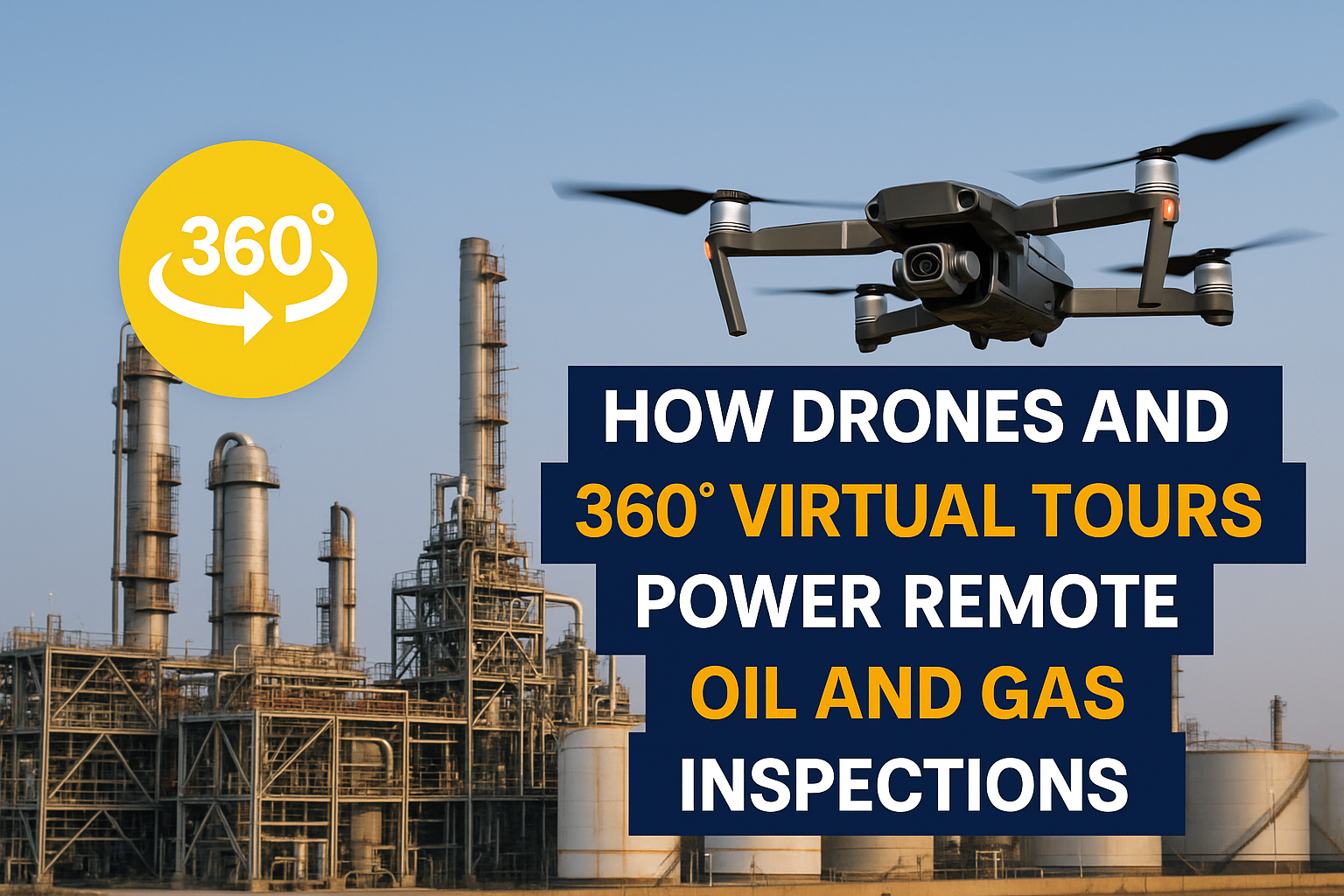
The oil and gas industry is no stranger to innovation—but when it comes to inspections, we’re now seeing a true leap forward. Drones paired with 360° virtual tour technology are revolutionizing how site inspections are conducted in upstream, midstream, and downstream operations. 🔍

Gone are the days of costly on-site visits, delayed reporting, and safety risks for field crews. With the rise of remote inspections, companies can now capture immersive visuals, monitor infrastructure in real time, and make critical decisions faster—without stepping foot on location. 🚨

In this post, we’ll break down the biggest benefits of combining drone tech and 360° tours, with real use cases from oil and gas operators around the world.

🛢️ Why Remote Inspections Are the New Standard

The traditional oil and gas inspection model relied heavily on in-person visits, specialized equipment, and manual data capture. Not only was this expensive and time-consuming, but it often put personnel at risk—especially in hazardous or remote environments.

Now, thanks to drones equipped with high-res cameras and 360° virtual documentation software, inspections can happen remotely with minimal crew. Platforms like CloudPano let operators build full visual maps and walkthroughs from drone footage—accessible on any device.

Key advantages:

  • Real-time asset monitoring
  • Reduced travel and insurance costs
  • Enhanced visual documentation
  • Safety for personnel
  • Faster issue detection and decision-making

👉 Dive deeper in our article: Revolutionizing Oil and Gas: How Remote Site Inspections Save Time and Costs

🚁 How Drones Capture Critical Data

Modern inspection drones are engineered to go where humans can’t—and do it safer, faster, and cheaper. These aerial workhorses collect:

  • High-resolution 360° photos and video
  • Thermal imaging for leak detection
  • Topographical mapping
  • Infrastructure wear and corrosion visibility

From flare stacks to underwater pipelines, drones can scan vast areas in minutes. Then, with software like CloudPano 360 Tour Creator, this footage becomes an interactive walkthrough you can explore, annotate, and share with stakeholders anywhere in the world. 🌍

🔗 Learn more: The Future of Oil and Gas Inspections: Remote Technology Explained

🔄 360° Virtual Tours: A Digital Twin of the Worksite

Imagine clicking through a digital replica of your offshore platform, zooming in on valves, pressure systems, and rust-prone zones. With 360° virtual tours, this is no longer imagination—it’s standard procedure.

📌 Benefits of 360 virtual tours for inspections:

  • Document pre- and post-maintenance conditions
  • Provide remote engineers with “eyes on the ground”
  • Train new inspectors or vendors using actual site data
  • Ensure accountability with visual history logs

These digital twins can be securely hosted and integrated with other systems, like SCADA or ERP tools.

👀 Related read: Boost Efficiency with Remote Site Inspections for Oil and Gas Operations

🧯 Enhanced Safety Through Remote Monitoring

By keeping inspectors out of confined spaces, elevated structures, or H2S zones, remote inspections directly reduce safety incidents.

Real-time monitoring also supports early detection of leaks, structural anomalies, or environmental hazards before they escalate.

📊 Use case: One midstream operator used drone + 360° systems to monitor tank battery sites, reducing monthly field visits by 70% while still maintaining compliance and reducing spill risk.

💡 Read more: Enhancing Safety with Remote Site Inspections in the Oil and Gas Sector

🌎 Global Collaboration and Compliance

With remote inspection assets stored in the cloud, global teams can collaborate in real time, whether they’re in Houston, Dubai, or offshore in the North Sea.

This dramatically improves:

  • Engineering workflows
  • ESG compliance documentation
  • Audit readiness
  • Supplier transparency

📎 Example: A production facility in Canada used 360° tours to share their environmental upgrades with both internal safety officers and regulatory bodies—completing the inspection process in half the time.

✍️ Dive deeper: Top Benefits of Remote Inspections in Oil and Gas Exploration and Production

🔧 Integration With Smart Documentation Tools

Combining drone data and 360° visuals with platforms like CloudPano or PropertyEdits.ai allows teams to:

  • Attach comments and reports directly to visual hotspots
  • Generate auto-logs of inspection activity
  • Export annotated inspections for regulatory reporting

It’s not just about better visuals—it’s about building an integrated inspection ecosystem that scales.

🔗 Related post: How Virtual Reality is Revolutionizing Hazard Detection in Oil and Gas Sites

📈 Final Thoughts: Time to Modernize Inspections

Remote inspections powered by drones and 360° virtual tours aren’t a futuristic concept—they’re already saving time, money, and lives for modern oil and gas companies.

Whether your goal is safer operations, faster repairs, or lower inspection costs, adopting this visual-first strategy is a game-changer for your business.

🚀 Next Steps

📖 Explore more blog topics:

Share this post
Cloudpano

Choose The Right 360° Camera

Insta360 ONE RS 1-Inch 360 Edition

  • Compact, ready to go anywhere

  • Interchangeable lens that’s upgradeable

  • Dual 1-inch sensors for improved clarity and low light performance

  • Dynamic range and 6K 360° capture

  • 360° photo resolution at 21MP

Learn More

Insta360 X4

  • 8K 360° video recording for ultra-detailed visuals.

  • 4K single-lens mode for traditional wide-angle shots.

  • Invisible selfie stick effect for drone-like perspectives.

  • 2.5-inch touchscreen with Gorilla Glass protection.

  • Waterproof up to 33ft for underwater shooting.

Learn More

Ricoh Theta Z1

  • 360° photo resolution in 23MP

  • Slim design at 24 mm thick

  • Built-in image stabilization for smooth video capture.

  • Internal 19GB storage for photo and video storage.

  • Wireless connectivity for remote control and sharing.

Learn More

Ricoh Theta X

  • 60MP 360° still images for high-resolution photography.

  • 5.7K 360° video recording at 30fps.

  • 2.25-inch touchscreen for intuitive control.

  • USB Type-C port for fast charging and data transfer.

  • MicroSD card slot for expandable storage.

Learn More
Property Marketing
Allows potential buyers to explore properties in detail from anywhere, enhancing the real estate marketing process.
Automotive Spins
Create an interactive virtual showroom and engage affluent digital buyers with live 360º video calls, all through the CloudPano mobile app for a complete automotive sales solution.
Interactive Floor Plans
Create 2D and 3D floor plans with measurements in 4 minutes or less, all from your phone. Download the Floor Plan Scanner app and get your first scan free.

360 Virtual Tours With CloudPano.com. Get Started Today.

Try it free. No credit card required. Instant set-up.

Try it free
Latest posts

See our other posts

Interviews, tips, guides, industry best practices, and news.

Mastering Compliance: The Future of Automated Property Video

This article provides a definitive guide for real estate professionals on navigating strict MLS branding regulations through AI-driven automation. It addresses the risks of compliance violations, details the limitations of manual editing workflows, and introduces a scalable, "compliance-first" system for generating high-quality, MLS-approved property videos. The post serves as a strategic blueprint for agents aiming to maintain listing visibility, avoid regulatory penalties, and streamline their marketing operations.
Read post

Future-Proofing Your Business with MLS Safe AI Video for Listings

This high-authority guide focuses on long-term operational stability and the strategic advantages of leveraging artificial intelligence to bypass the industry-wide friction between high-impact marketing and regulatory compliance. Key Takeaways & Content Structure: The Reputation-Risk Factor: Explains the high cost of compliance errors, focusing on how a single technical oversight—such as a misplaced logo or branded watermark—can trigger a systemic board audit, leading to immediate listing suspension and lasting reputational damage with sellers. The Production Disconnect: Breaks down the "two-version" operational tax, where marketing teams suffer from repetitive rendering, file-management bloat, and the persistent danger of human error when manually managing branded vs. unbranded media assets. AI as a Compliance Engine: Defines how advanced AI media platforms move beyond mere aesthetics to function as regulatory safeguards. It illustrates the technical architecture where the AI engine isolates branding data from structural property data at the rendering level, effectively "forking" the output into two distinct, safe-to-use tracks. Operational Blueprint: Maps out a transparent, 6-step automation funnel that takes a listing from flat photograph ingestion to syndicate-ready, neutral-hosted media in minutes. Strategic Scalability: Demonstrates why centralizing production into a single SaaS platform is the only way for growing brokerages to maintain consistency, remove contractor-level liability, and recover significant administrative time. The PhotoAIVideo.com Edge: Concludes by positioning the platform as a purpose-built solution that combines high-definition parallax AI motion with an automated "compliance-first" export workflow, ensuring Realtors can generate professional, engaging video content that passes even the most stringent board audits on the first attempt.
Read post

Streamlining Your Workflow with a Specialized MLS Compliant Real Estate Media App

This article functions as a tactical operations guide for real estate marketers and brokerage leaders focused on reducing technical friction and human error in their media publishing pipeline. Key Takeaways & Content Structure: The "Stop-Work" Order: Addresses the high-stakes reality of MLS compliance flags, where automated rules block properties from IDX feeds due to accidental branding, causing immediate listing velocity loss. The Fragmented Workflow Problem: Identifies the "manual bottleneck"—the inefficiency of having field photographers deliver single assets that then require internal staff to manually strip, re-render, and verify separate branded and unbranded versions. Architecture of Dual-Path Rendering: Illustrates the technological shift toward programmatic asset management. It explains how a modern app processes a single source file into two isolated rendering tracks: a lead-gen-heavy marketing track and a strictly compliant, unbranded track for MLS syndication. Operational Workflow Mapping: Provides a clear, 6-step blueprint for moving from raw photography ingestion to compliant deployment, including automated motion application, metadata scrubbing, and neutral link hosting. Risk Mitigation for Brokerages: Highlights how centralized management dashboards eliminate the "wild west" of agent-led media creation, providing brokers with a single-pane-of-glass view to ensure compliance across all active listings. The PhotoAIVideo.com Advantage: Positions the platform as the ideal MLS compliant real estate media app that leverages AI to inject cinematic motion into flat listing photos, effectively automating the entire compliance-forking process and increasing overall production capacity by up to 94%.
Read post