Top Benefits of Using 360 Virtual Tours for Emergency Response

Cloudpano
July 23, 2025
5 min read
Share this post

🚨 Top Benefits of Using 360° Virtual Tours for Emergency Response in Oil & Gas

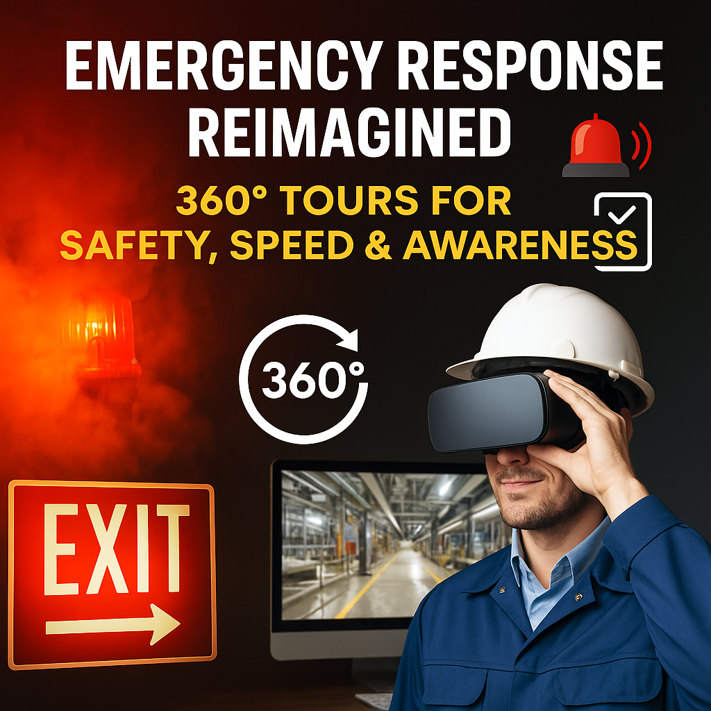
In the oil and gas industry, emergencies don’t wait for training to catch up. Fires, chemical leaks, and equipment failures can escalate in seconds — which means your teams need more than procedures. They need immersive preparedness. 💥⛽

That’s why 360° virtual tours are becoming the new gold standard for emergency response training.

In this post, we break down the top benefits of using 360° tours for preparing your teams to respond confidently — and quickly — when it matters most. Plus, we’ll link to related blog posts like Boost Safety and Efficiency with Virtual Refinery Induction Tours and Virtual Tours for Oilfield Safety Training: Remote, Scalable, Effective to help you level up your safety program. 🔗

🧠 1. Boost Situational Awareness Before Day One

Emergency readiness depends on knowing where things are — exits, extinguishers, gas shutoffs, assembly points. If a new hire or contractor has never seen the facility, they’re at a disadvantage from the start.

With 360° virtual tours, trainees can visually walk through your facility from anywhere — before their first shift. 🏭👀

They’ll know:

  • 🔥 Where fire extinguishers are
  • 🚪 Which exit paths to follow
  • 🚨 Where alarms and gas detectors are
  • 🧭 How to reach emergency assembly points

🔗 Related: Oil Rig Onboarding Simplified With Interactive Virtual Tours

⏱️ 2. Faster Emergency Response Time

When seconds count, hesitation kills. Traditional safety training — paper maps, text manuals, or 2D schematics — often fall short.

But 360° virtual tours help workers:

  • Visually recall evacuation paths
  • Recognize high-risk areas on sight
  • Make faster decisions under pressure

Immersive training builds muscle memory — the kind that helps staff take action without stopping to think.

🔗 Related: How 360 Virtual Tours Enhance Emergency Response Training

🔁 3. Scalable, Repeatable Drills

Live drills are disruptive and time-consuming. But with a 360° tour:

  • Teams can run virtual drills anytime
  • Scenarios can be repeated on demand
  • Safety walkthroughs become self-paced

Virtual walkthroughs create consistent training across departments and locations, reducing human error and delivering the same quality of instruction.

🧑‍🏫 Ideal for:

  • Contract crews
  • Remote sites
  • Shift handoffs

🌐 4. Remote Access for Distributed Teams

Have field crews across states — or rigs around the globe? 🌍

360° tours let safety managers:

  • Train distributed teams without flying them in
  • Onboard offshore contractors remotely
  • Review emergency protocols site-by-site

Even your corporate emergency planning team can walk the site virtually — without setting foot in hazardous zones.

📚 5. Better Knowledge Retention

The science is clear: we retain up to 75% more when learning visually compared to reading.

360° emergency tours offer:

  • Immersive walkthroughs 🧠
  • Interactive hotspots for safety labels 🔎
  • Pop-up videos simulating fire/gas emergencies 🔥

This approach improves:

  • Retention
  • Engagement
  • Confidence under pressure

🎓 6. Easier Cross-Training and Skill Refreshers

Need to cross-train team members for new areas? Instead of sending them on-site, just give them access to a 360° safety walkthrough.

Use it to:

  • Re-certify team members
  • Validate knowledge before major shutdowns
  • Reinforce policies after an incident

⚙️ Pro tip: Combine 360° tours with short quizzes inside your LMS to verify safety comprehension.

💬 7. Post-Incident Reviews and Debriefs

After an emergency, you need to know:

  • Who went where
  • Which routes were used
  • What slowed down response

Using a 360° tour during incident debriefs lets teams:

  • Re-walk the event virtually
  • Identify bottlenecks or confusion points
  • Improve future emergency procedures

🔗 Related: Next-Level Refinery Onboarding with CloudPano Virtual Tours

⚠️ 8. Hazard Awareness Without Risk Exposure

360° tours let you safely train on:

  • Hazardous zones
  • Confined spaces
  • Flammable material areas

You can document real-world visuals without exposing new hires or trainees to actual risk. Use:

  • Warning icons
  • “Hot zone” overlays
  • Audio/video safety messages

🛠️ 9. Easy to Create and Update

Creating your first emergency-focused 360° tour is easier than you think:

Tools:

  • ✅ 360° camera (Ricoh Theta, Insta360, GoPro MAX)
  • ✅ Virtual tour platform (like CloudPano)
  • ✅ Emergency layout & signage checklist
  • ✅ Site access for one photo capture session

Steps:

  1. Capture high-risk and high-traffic areas
  2. Upload to CloudPano and add annotations
  3. Create labels for exits, hazards, and procedures
  4. Share the tour internally or embed in your training portal

🎯 Done! Now every team member gets the same emergency walkthrough — without requiring a physical tour.

🚀 Wrap-Up: Train Smarter. Respond Faster.

Oil and gas companies that adopt 360° virtual tours for emergency response are seeing major improvements in:

  • 🧠 Knowledge retention
  • 🕒 Response time
  • 🌎 Remote preparedness
  • 👷 Contractor safety
  • 💰 Cost savings from fewer physical drills

If your team still relies on paper diagrams or annual drills — it's time to modernize.

🎯 Start your first 360° safety walkthrough today with CloudPano.

Share this post
Cloudpano

Choose The Right 360° Camera

Insta360 ONE RS 1-Inch 360 Edition

  • Compact, ready to go anywhere

  • Interchangeable lens that’s upgradeable

  • Dual 1-inch sensors for improved clarity and low light performance

  • Dynamic range and 6K 360° capture

  • 360° photo resolution at 21MP

Learn More

Insta360 X4

  • 8K 360° video recording for ultra-detailed visuals.

  • 4K single-lens mode for traditional wide-angle shots.

  • Invisible selfie stick effect for drone-like perspectives.

  • 2.5-inch touchscreen with Gorilla Glass protection.

  • Waterproof up to 33ft for underwater shooting.

Learn More

Ricoh Theta Z1

  • 360° photo resolution in 23MP

  • Slim design at 24 mm thick

  • Built-in image stabilization for smooth video capture.

  • Internal 19GB storage for photo and video storage.

  • Wireless connectivity for remote control and sharing.

Learn More

Ricoh Theta X

  • 60MP 360° still images for high-resolution photography.

  • 5.7K 360° video recording at 30fps.

  • 2.25-inch touchscreen for intuitive control.

  • USB Type-C port for fast charging and data transfer.

  • MicroSD card slot for expandable storage.

Learn More
Property Marketing
Allows potential buyers to explore properties in detail from anywhere, enhancing the real estate marketing process.
Automotive Spins
Create an interactive virtual showroom and engage affluent digital buyers with live 360º video calls, all through the CloudPano mobile app for a complete automotive sales solution.
Interactive Floor Plans
Create 2D and 3D floor plans with measurements in 4 minutes or less, all from your phone. Download the Floor Plan Scanner app and get your first scan free.

360 Virtual Tours With CloudPano.com. Get Started Today.

Try it free. No credit card required. Instant set-up.

Try it free
Latest posts

See our other posts

Interviews, tips, guides, industry best practices, and news.

Make Your Listing Pop: How to Add a Virtual Tour Video to Stellar MLS

This guide teaches real estate professionals how to instantly elevate their listings on Stellar MLS using high-impact virtual tour videos. Readers learn why virtual tours are essential, how to prepare and upload unbranded virtual tour content, and how to embed a virtual tour video in a real estate listing for maximum visibility. The article covers MLS compliance, best practices for hosting platforms, optimization tips, and marketing strategies to boost engagement and drive more qualified buyers. Perfect for agents who want to make their listings stand out, attract more clicks, and close deals faster.
Read post

Drone Profit Secrets Explained: From Drone Photography to Real Estate Services

Drone Profit Secrets Explained: From Drone Photography to Real Estate Services breaks down how drone pilots can transform basic flying and photography skills into high-income real estate service offerings. This article explains the full progression — from earning FAA certification and mastering aerial imagery to packaging profitable services, building a compelling portfolio, setting value-based pricing, marketing effectively, and scaling into a long-term drone business. Designed for beginners and growing drone entrepreneurs, the guide highlights actionable steps, industry insights, and proven strategies to build a profitable real estate drone career.
Read post

Maximize Revenue with Drone Profit Secrets: Expert Strategies for Drone Entrepreneurs

Maximize Revenue with Drone Profit Secrets: Expert Strategies for Drone Entrepreneurs” is a complete guide for drone pilots who want to turn their skills into high-income opportunities. This article breaks down the most effective business, marketing, pricing, and scaling strategies taught inside Drone Profit Secrets — including how to choose profitable niches, create high-value service packages, attract clients with strategic marketing, upsell premium add-ons, and build recurring revenue streams. With insights designed for beginners and experienced drone operators, readers learn how to increase their average order value, automate workflows, and scale their drone business with confidence. This post serves as a roadmap for any drone entrepreneur ready to grow faster, earn more, and unlock long-term business success.
Read post