


.png)


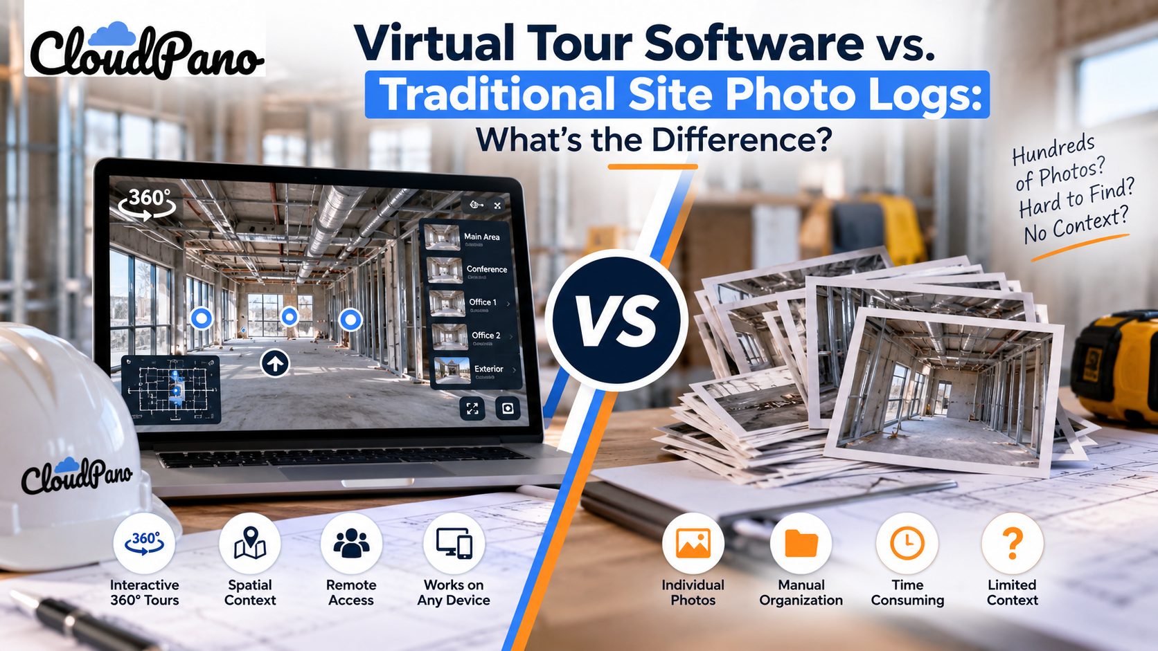
Traditional photo logs are batches of dated photos stored in folders. They are fast and familiar but hard to search and limited to one field of view. Virtual tour software links 360° scenes with hotspots into a navigable record with more spatial context. Many teams use photos for daily documentation and tours for milestones.
Every project manager has faced the same folder: hundreds of dated JPEGs named “IMG_4821.jpg,” loosely organized by date and buried in a shared drive that only a handful of people know how to navigate.
When a dispute arises or a subcontractor asks, “What did that wall look like before we closed it up?” someone may spend an afternoon scrolling through thumbnails, hoping to find the right angle from the right week.
That scenario is one reason construction teams may compare traditional photo logs with interactive alternatives like virtual tour software for construction—a shift from collections of static images toward navigable, spatially organized visual records of a jobsite at different phases.
This isn't a question of whether documentation matters—experienced construction teams already know it does. The real question is which format turns raw imagery into information people can find quickly, understand in context, and reference when it matters.
Documentation has always played an important role on a construction site. Project teams rely on records for progress tracking, communication, safety management, quality control, and many other aspects of project delivery.
Regulatory requirements also make accurate recordkeeping important. Staying current with resources such as OSHA's construction industry guidance can help contractors understand applicable workplace safety requirements and recommended practices.
However, visual documentation should complement—not replace—required inspections, safety records, reports, and other formal documentation.
At the same time, the way teams capture and manage project information is changing. Industry outlets such as Construction Dive regularly cover technologies ranging from drones and reality capture to cloud-based project-management platforms.
Traditional photo logs remain useful, but interactive 360° tours provide another option when teams need greater spatial context or remote visibility into a project.
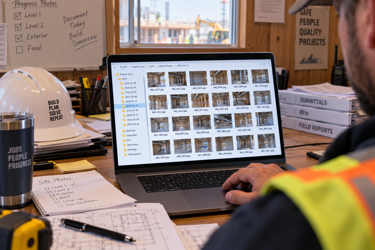
A traditional photo log is straightforward in concept: someone walks the site on a set schedule—daily, weekly, or at specific project milestones—and takes a batch of photos with a phone or camera.
Those images may then be uploaded to a shared drive, project-management platform, or another documentation system and organized by date, location, phase, or naming convention.
The workflow has real strengths.
It requires little specialized equipment, is familiar to most team members, and can be extremely fast. For quick documentation—confirming that a delivery arrived or recording that a punch-list item was addressed—a phone photo may be all that's needed.
The limitations become more noticeable when someone needs to revisit a large archive later.
A conventional photo captures a selected field of view. If the photographer didn't capture the area that later becomes important, the missing context can't be recovered from that particular image.
Finding specific photos can also depend heavily on file names, dates, captions, folder structures, or someone's memory of when and where the images were taken.
Photos captured by different people from different positions may also be difficult to compare directly. As an archive grows, teams may spend significant time reconstructing which images correspond to a particular room, floor, date, or project phase.
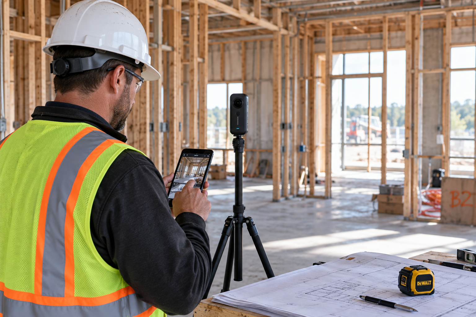
A virtual tour workflow approaches visual documentation differently.
Instead of capturing only individual directional snapshots, a 360° camera records the surrounding environment from a particular capture point. Each panoramic image can then become a “scene” within a connected virtual tour.
Those scenes can be linked using clickable hotspots, allowing viewers to navigate between rooms, floors, or other documented areas in a way that provides more spatial context than opening individual images one by one.
As construction progresses, teams can create additional tours or scenes to document important milestones and changing site conditions.
Many modern virtual tour platforms use no-code interfaces, which can reduce the technical knowledge required to assemble and update a tour. However, teams still need a consistent process for camera placement, scene organization, naming, access permissions, and capture frequency.
Depending on the platform, tours may be accessible on phones, tablets, and computers, with some platforms also supporting compatible VR headsets.
Some solutions may offer live 360° communication features as well, allowing someone on-site to guide a remote owner, architect, consultant, or other stakeholder through an area while discussing project conditions.
This structure can also support longer-term building records. Resources such as the Whole Building Design Guide emphasize the importance of information across a building's planning, design, construction, and operational lifecycle.
A dated and well-organized virtual tour can complement those records by preserving additional visual context from different phases of a project.
Depending on the platform, analytics and embedded forms may also be available. These features can be useful for client-facing or marketing applications, although engagement data should be interpreted carefully—it shows how viewers interact with a tour, not necessarily why they viewed a particular scene.
For teams evaluating virtual tour software for construction, the main advantage is therefore not simply capturing more imagery. It's organizing that imagery into a visual experience that can be easier for stakeholders to navigate and understand.
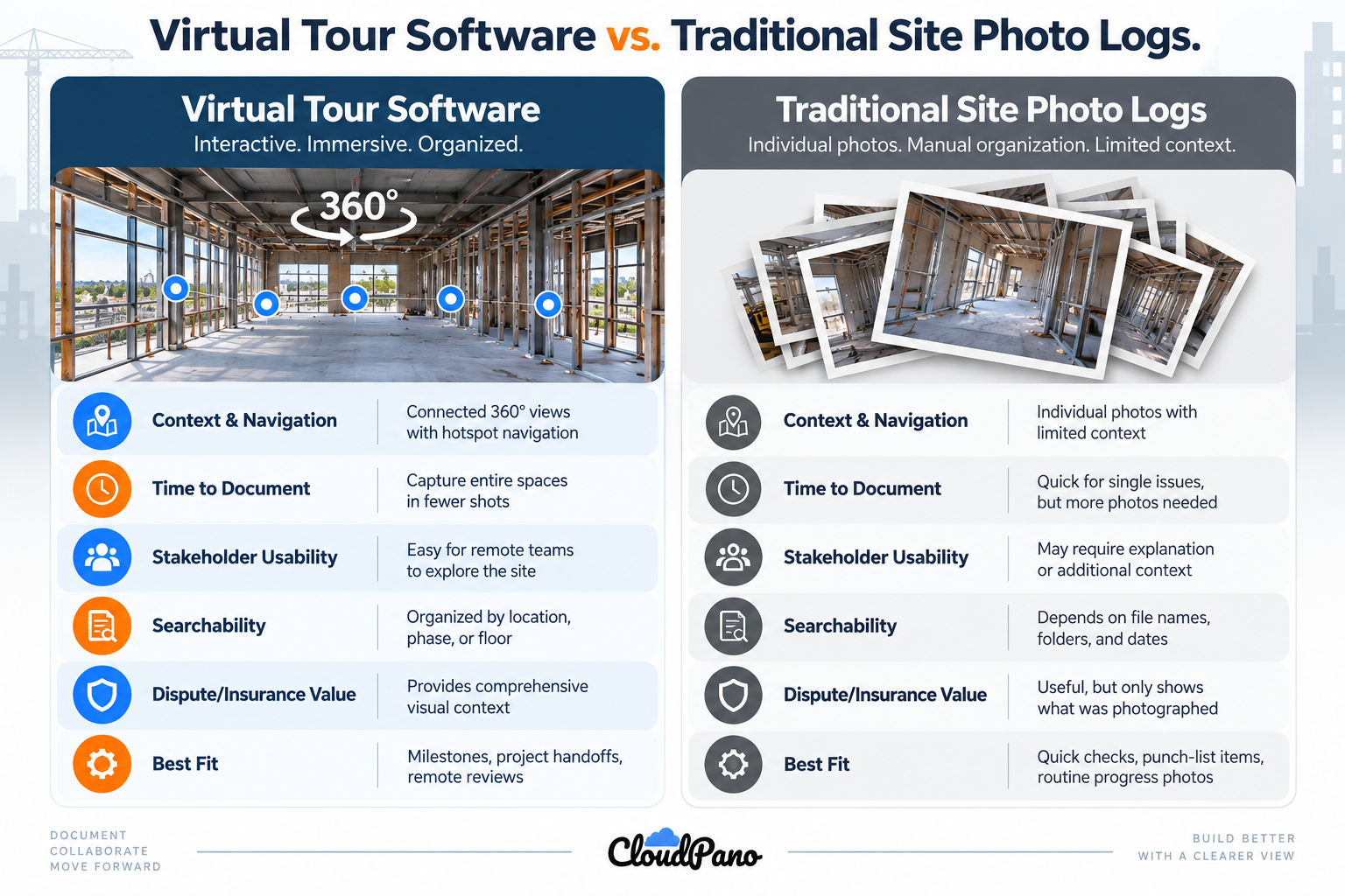
The key difference isn't that one method is universally better. It's that they capture and organize visual information differently.
Traditional photo logs still have an important place in construction documentation.
For a quick daily check-in, punch-list confirmation, delivery record, or one-off issue, taking a conventional photo may be faster and more practical than creating a 360° scene.
Teams managing small projects, limited documentation requirements, or tight technology budgets may also find that a disciplined and consistently organized photo log meets their needs.
Virtual tour software becomes particularly useful when the project benefits from broader spatial context.
Larger or longer-running projects may have owners, lenders, architects, consultants, or other stakeholders who need to review documented conditions without visiting the site in person.
360° capture can also be useful at milestones such as pre-drywall documentation, MEP rough-in, existing-condition surveys, and substantial completion—particularly when teams may need to revisit visible site conditions later.
Multi-phase projects can benefit from organizing imagery into connected tours rather than relying solely on separate folders of conventional photos.
In practice, the two methods don't have to compete.
A team might use conventional photography for day-to-day documentation while reserving 360° tours for milestone captures, pre-close-up records, project handoffs, and stakeholder-facing walkthroughs.
Not necessarily.
Traditional photos remain useful for quick updates, individual issues, deliveries, punch-list items, and other routine documentation.
360° tours can complement those records at important milestones—such as rough-in, pre-drywall, or substantial completion—when capturing more of the surrounding environment may be valuable.
You'll generally need a compatible 360° camera to capture panoramic imagery.
Many modern virtual tour platforms provide no-code tools for uploading images, organizing scenes, and creating navigation, so coding knowledge typically isn't required.
However, teams should check the specific platform's camera compatibility, workflow, and feature requirements before selecting equipment.
They can potentially serve as supporting visual documentation.
A dated 360° tour may provide useful context about visible site conditions at the time the imagery was captured. Because the viewer can look around from the camera's capture point, the imagery may preserve surrounding details that weren't the primary focus when the scene was recorded.
However, a virtual tour shouldn't automatically be considered definitive evidence of site conditions. Its usefulness in a claim, dispute, or legal proceeding can depend on factors such as capture procedures, dates, image integrity, coverage, recordkeeping practices, and the requirements of the insurer or other reviewing party.
This depends on the platform.
Many web-based virtual tour platforms allow viewers to access a shared tour through a standard browser on a phone, tablet, laptop, or desktop computer. Some also support VR viewing.
Teams should confirm device compatibility, sharing options, and privacy controls with the specific platform they're considering.
Traditional photo logs and virtual tours serve different—but often complementary—roles in construction documentation.
Photo logs are fast, familiar, and well suited to everyday snapshots and individual issues. Virtual tours can add value when teams need a more navigable visual record that preserves additional spatial context across rooms, floors, and project phases.
For many construction teams, the most practical approach may be to use both: conventional photos for routine documentation and 360° tours for milestone captures, remote reviews, and situations where understanding the surrounding space is particularly important.
As projects become more complex and stakeholders increasingly need remote access to project information, virtual tour software for construction can provide another useful layer within a broader documentation strategy—helping turn 360° site imagery into an organized visual record that teams can navigate, share, and revisit throughout the project lifecycle.
Not necessarily. Traditional photos remain useful for quick updates, individual issues, deliveries, punch-list items, and other routine documentation. 360° tours can complement those records at important milestones, such as rough-in, pre-drywall, or substantial completion, when capturing more of the surrounding environment is valuable.
You'll generally need a compatible 360° camera to capture panoramic imagery. Many modern platforms provide no-code tools for uploading images, organizing scenes, and creating navigation, so coding knowledge typically isn't required. Check the platform's camera compatibility, workflow, and feature requirements before selecting equipment.
They can serve as supporting visual documentation. A dated 360° tour may give useful context about visible site conditions when the imagery was captured. It shouldn't be treated as definitive evidence, though. Its usefulness depends on capture procedures, dates, image integrity, coverage, recordkeeping, and the requirements of the insurer or reviewing party.
It depends on the platform. Many web-based virtual tour platforms let viewers open a shared tour in a standard browser on a phone, tablet, laptop, or desktop, and some also support VR viewing. Confirm device compatibility, sharing options, and privacy controls with the specific platform you're considering.
A conventional photo is often faster and more practical for a quick daily check-in, punch-list confirmation, delivery record, or one-off issue. Teams with small projects, limited documentation requirements, or tight technology budgets may also find that a disciplined, consistently organized photo log meets their needs.


Compact, ready to go anywhere
Interchangeable lens that’s upgradeable
Dual 1-inch sensors for improved clarity and low light performance
Dynamic range and 6K 360° capture
360° photo resolution at 21MP

8K 360° video recording for ultra-detailed visuals.
4K single-lens mode for traditional wide-angle shots.
Invisible selfie stick effect for drone-like perspectives.
2.5-inch touchscreen with Gorilla Glass protection.
Waterproof up to 33ft for underwater shooting.

360° photo resolution in 23MP
Slim design at 24 mm thick
Built-in image stabilization for smooth video capture.
Internal 19GB storage for photo and video storage.
Wireless connectivity for remote control and sharing.

60MP 360° still images for high-resolution photography.
5.7K 360° video recording at 30fps.
2.25-inch touchscreen for intuitive control.
USB Type-C port for fast charging and data transfer.
MicroSD card slot for expandable storage.
.png)

.png)

Try it free. No credit card required. Instant set-up.






.svg)


.svg)