


.png)


If you've spent any time researching virtual tour software, you've probably run into terms like "equirectangular," "point cloud," or a list of supported image formats that assumes you already know what they mean. Understanding virtual tour file formats doesn't require a technical background, but it does help to have these terms actually explained rather than just used. This article breaks down the main concepts in plain language, without assuming prior expertise.
You don't need to understand file formats to use a virtual tour platform day to day — the software handles most of this automatically. But understanding the basics becomes genuinely useful in a few specific situations: deciding which camera to buy, troubleshooting a quality issue, or evaluating whether your existing content can move to a different platform. In each of these cases, knowing roughly what's happening under the hood helps you ask better questions and make more informed decisions, rather than relying entirely on a vendor's characterization.
An equirectangular panorama is the most common underlying format for 360-degree images, and it's worth understanding because it's the foundation most virtual tours are built on. In simple terms, it's a way of flattening a full spherical view — everything visible in every direction from one point — onto a single rectangular image, similar conceptually to how a world map flattens a globe onto a flat rectangle (and, similarly, introduces some distortion in the process, particularly near the top and bottom of the image).

When a virtual tour viewer displays this image, it essentially wraps that flattened rectangle back around a virtual sphere, letting you look around in any direction as if you were standing at that capture point. Understanding this helps explain why panorama images sometimes look stretched or distorted when viewed as a flat image outside of a tour viewer — they're not meant to be viewed flat; they're meant to be re-wrapped into a sphere by the viewing software.

Beyond the general equirectangular concept, there are a handful of common 360 image formats worth knowing by name, since you'll encounter them when exporting, uploading, or troubleshooting:
JPEG is the most common format for finished, compressed panoramic images — widely supported, reasonably small in file size, though it loses some image quality through compression.
PNG is less common for full panoramas due to larger file sizes, but sometimes used where lossless quality matters more than file size.
TIFF is occasionally used for high-quality archival purposes, since it supports lossless compression, though it's much larger and less practical for everyday use or web display.
Most virtual tour platforms will accept and internally convert between several of these formats, but knowing which one you're working with helps you understand why a file might be unexpectedly large, or why a quality issue might trace back to compression rather than the platform itself.
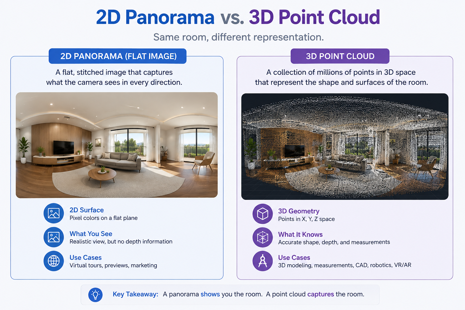
Point cloud data is a fundamentally different concept from a panoramic image, and it's worth understanding the distinction clearly. Where a panorama is a 2D image (even if it gets wrapped into a sphere for viewing), a point cloud is a set of individual 3D coordinate points in space, often generated by specialized scanning hardware like LiDAR or structured-light sensors. Each point represents a specific location in 3D space, and collectively, millions of these points can represent the physical shape and structure of a room or building with genuine spatial accuracy.
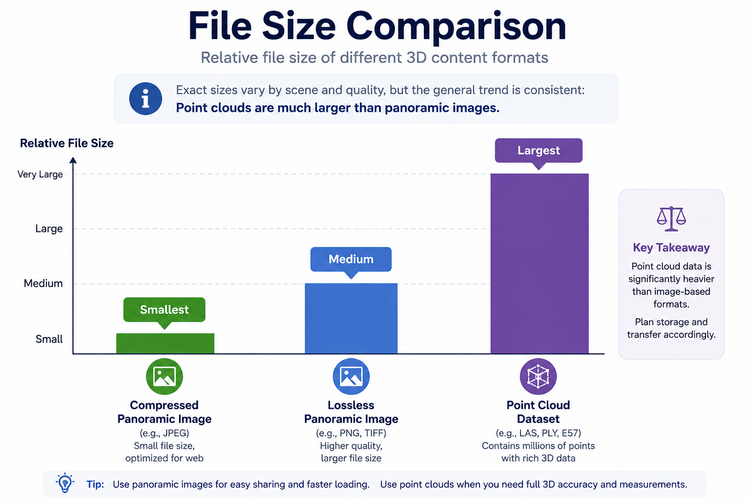
This is the technology behind features like accurate floor plans, room measurements, and dollhouse views in some virtual tour platforms — it's not just a visual trick, it's built from actual measured 3D data. Point cloud files tend to be substantially larger and more computationally intensive to process than simple panoramic images, which is part of why not every capture device or platform generates or supports this kind of data.
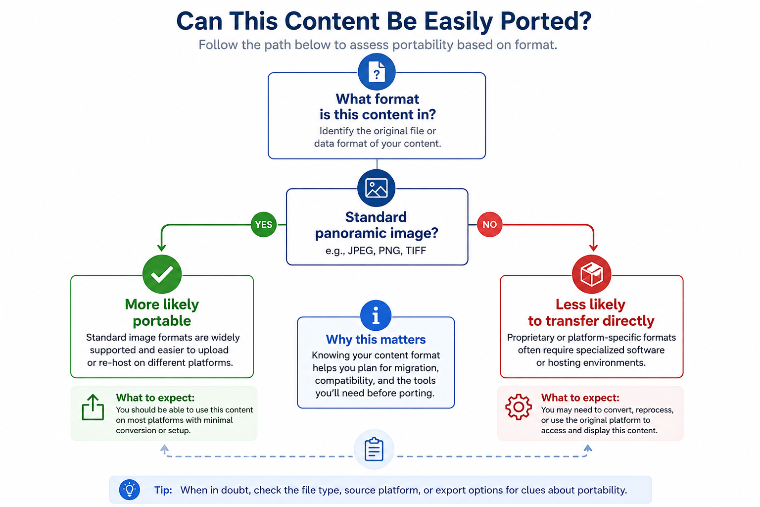
Understanding these formats helps clarify a question that comes up often when people consider switching platforms: why doesn't everything just transfer over cleanly? The answer usually comes down to which of these formats a given platform relies on, and how proprietary its specific implementation is. A platform built heavily around point cloud data and a specific hardware ecosystem has a different portability profile than one built more simply around standard panoramic images, which tend to be more universally supported.
This is covered in more practical, decision-oriented terms in our article on reusing Matterport scans when switching platforms — this article is meant to give you the conceptual background, while that one applies it directly to a migration decision.
It's worth grounding all of this in a few concrete situations rather than leaving it purely abstract. If you're shopping for a new 360 camera, knowing whether it outputs standard equirectangular JPEGs versus a more proprietary format directly affects how easily that content will work across different platforms down the line, not just the one you're currently considering. If a client asks why a particular tour looks slightly softer or more compressed than another, understanding format and compression tradeoffs gives you a real answer instead of a shrug.
And if you're specifically evaluating whether to switch platforms, understanding whether your existing library leans more heavily on simple panoramic images or on point cloud data changes how you'd realistically expect that content to behave during a migration — a library built mostly on standard panoramas has a meaningfully different portability outlook than one built around a specific platform's proprietary point cloud processing. None of this requires becoming a technical expert; it just requires knowing enough to ask the right specific question instead of a vague one.
For a deeper technical reference beyond this plain-English overview, Matterport's own documentation provides specifics on the formats and data types their own capture ecosystem generates, which is a useful primary source for understanding one major platform's specific technical approach.
On G2's virtual tour software category page, occasional reviewer comments touch on format-related frustrations — usually tied to unexpected file sizes or compatibility surprises — that make more sense once you understand the underlying format distinctions covered above.
"Do I really need to know any of this to use a virtual tour platform?"
For day-to-day use, no — this is genuinely optional background knowledge, and most platforms are built specifically so you don't need to think about file formats to get a tour published. It becomes useful specifically when you're troubleshooting, comparing camera equipment, or evaluating a platform switch, at which point having this context helps you ask sharper, more specific questions.
"Why do file sizes vary so much between similar-looking tours?"
This usually traces back to format choice and compression level, as covered above — a lossless format or an uncompressed point cloud dataset can be dramatically larger than a compressed JPEG panorama representing a visually similar space.
For anyone skimming rather than reading the full explanation, here's the short version of each term:
Equirectangular panorama — a flattened, rectangular representation of a full 360-degree view, wrapped back into a sphere by viewer software to create the immersive look-around experience.
360 image formats — the specific file types (JPEG, PNG, TIFF, among others) that panoramic images are typically stored in, each with different tradeoffs around file size and quality.
Point cloud data — a set of individually measured 3D coordinate points representing the actual physical shape of a space, distinct from a 2D image and typically used to power accurate floor plans and measurements.
Keeping these three concepts distinct in your head is really the whole point of this article — they get used interchangeably in casual conversation sometimes, but they represent genuinely different things technically, and that difference is exactly what explains many of the compatibility and quality questions that come up in this space.
Understanding the basics of virtual tour file formats — equirectangular panoramas as the foundation of most 360 images, common compressed and lossless format options, and the fundamentally different concept of point cloud data — gives you useful context for troubleshooting, equipment decisions, and platform evaluations, even if you never need to think about it during everyday tour creation.
If you're specifically weighing a platform switch and want to understand what this technical background means for your own content, our article on reusing existing scans covers that decision directly, and our complete migration guide walks through the fuller process end to end.


Compact, ready to go anywhere
Interchangeable lens that’s upgradeable
Dual 1-inch sensors for improved clarity and low light performance
Dynamic range and 6K 360° capture
360° photo resolution at 21MP

8K 360° video recording for ultra-detailed visuals.
4K single-lens mode for traditional wide-angle shots.
Invisible selfie stick effect for drone-like perspectives.
2.5-inch touchscreen with Gorilla Glass protection.
Waterproof up to 33ft for underwater shooting.

360° photo resolution in 23MP
Slim design at 24 mm thick
Built-in image stabilization for smooth video capture.
Internal 19GB storage for photo and video storage.
Wireless connectivity for remote control and sharing.

60MP 360° still images for high-resolution photography.
5.7K 360° video recording at 30fps.
2.25-inch touchscreen for intuitive control.
USB Type-C port for fast charging and data transfer.
MicroSD card slot for expandable storage.
.png)

.png)

Try it free. No credit card required. Instant set-up.







.svg)


.svg)