


.png)


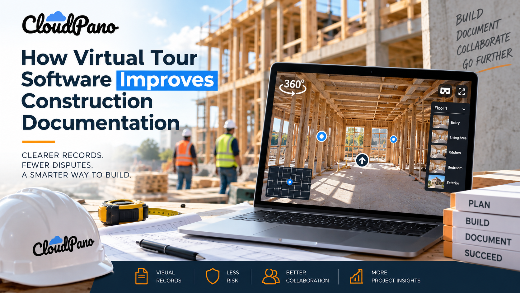
Virtual tour software for construction improves documentation by turning 360° site imagery into a navigable visual record of project conditions. Teams can revisit different phases, review surrounding context, monitor progress, document pre-construction conditions, and give remote stakeholders a clearer view of the jobsite than disconnected photos alone can provide. Autodesk
Every construction project generates a mountain of documentation—daily logs, photos, RFIs, schedules, punch lists, and more. Yet much of that visual information still lives as flat, disconnected images buried in folders that can be difficult to navigate.
When a question arises months after substantial completion, or an owner asks, “What did that wall look like before we closed it up?” teams may discover that their photo archive doesn't provide enough context.
This is where virtual tour software for construction can change the equation. Instead of relying solely on scattered still images, project teams can capture 360° scenes at different phases and connect them into a navigable tour that stakeholders can revisit later.
For project managers, superintendents, and owners' representatives, documentation isn't simply a paperwork exercise—it's an important part of project communication and risk management. Good visual records can make it easier to answer questions when warranty issues, insurance reviews, subcontractor disputes, or future renovations arise.
Below, we'll look at the specific documentation use cases where 360° virtual tours can offer advantages over traditional photo logs and why construction teams may want to incorporate regular tour capture into their site documentation workflows.
Most jobsites already take plenty of photos. The problem isn't necessarily a lack of images—it's that a flat photo shows only the portion of the space that was within the camera's frame.
If a question later involves something just outside that frame, the image may provide little or no useful context.
Photo logs can also become difficult to navigate when images are spread across different apps, devices, folders, or naming systems. Finding “the electrical rough-in photos from the northeast corner of the second floor during inspection week” can quickly turn into a time-consuming search.
The broader construction industry has increasingly adopted digital tools for documentation, communication, and project management. Publications such as Construction Dive regularly cover the industry's adoption of construction technology and digital workflows.
360° documentation addresses one limitation of conventional photography by capturing the surrounding scene from a single capture point. Rather than recording only the direction in which a conventional camera was pointed, a 360° image allows a later viewer to look around the documented environment and potentially identify details that might otherwise have fallen outside a traditional photograph's frame.
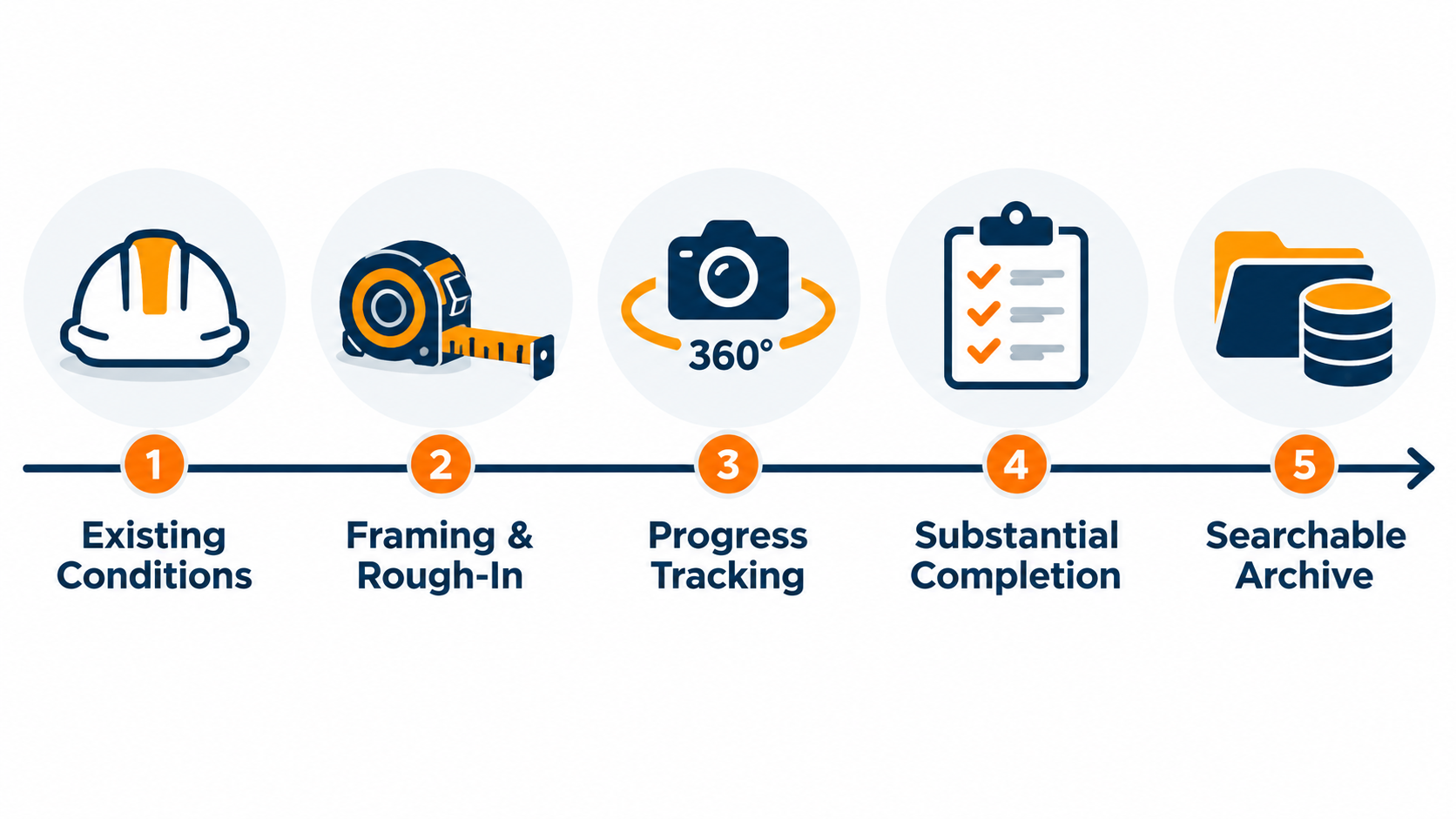
One of the most practical uses of virtual tour software on a construction site is documenting how a space looked at a particular point in the project.
Walking a floor with a 360° camera before drywall installation, again during rough-in, and later near substantial completion can create a phase-by-phase visual record of visible site conditions.
When scenes are organized by date, location, floor, or construction phase, teams can build a chronological archive without relying solely on someone's memory of when a particular photo was taken or which unit it showed.

That structure can become particularly useful later when questions arise about conditions at a particular milestone. Instead of searching through an unorganized collection of images, a team can return to the relevant tour, location, and capture period.
It's important to note that a 360° image documents visible conditions from its capture position. It shouldn't be treated as proof that every concealed component or detail was captured unless that component was actually visible in the imagery.
Disputes don't always surface while everyone still remembers the details. They may arise weeks or months later, when a subcontractor questions whether damage was already present before work began or an insurance professional needs additional context about pre-loss conditions following an incident.
In those situations, a well-organized 360° record can provide valuable supplementary visual documentation.
Because viewers can look in multiple directions from a capture point, panoramic imagery may provide more surrounding context than a small number of conventional photographs. That can make it easier to understand how documented conditions related to the surrounding space.
Maintaining useful records throughout a building's lifecycle is also consistent with broader building-management practices. Resources such as the Whole Building Design Guide, a program of the National Institute of Building Sciences, provide information spanning planning, design, construction, operations, and building lifecycle considerations.
A virtual tour shouldn't be treated as automatically admissible or definitive evidence in a dispute or insurance claim. Its usefulness will depend on factors such as capture procedures, dates, image integrity, coverage, recordkeeping practices, and the requirements of the parties reviewing the documentation.
Superintendents and owners' representatives spend a significant amount of time monitoring progress against project schedules. Routine 360° capture can provide a visual progress trail alongside traditional schedules, reports, and project-management records.
Walking a consistent route through a jobsite every week or at major milestones can create a visual timeline of the project as framing, MEP rough-ins, finishes, and other work progress.
That timeline can also help remote stakeholders.
Owners who can't regularly visit the site can open a tour and review documented conditions remotely rather than relying only on written updates and selected progress photos.
This is one practical use for virtual tour software for construction. Hotspot navigation can allow viewers to move between documented areas, rooms, or floors within a tour, making it easier to understand where individual scenes fit within the larger project.
This approach complements the broader move toward centralized digital construction information. Platforms such as Autodesk Construction Cloud similarly focus on bringing project information and workflows into connected digital environments so teams can collaborate around shared project data.
Pre-construction documentation can be one of the most valuable uses of a 360° tour.
Before demolition begins or trades start working in an existing space, capturing panoramic imagery can establish a visual baseline of visible conditions—including finishes, existing damage, equipment, fixtures, and other observable details.
This baseline can provide a useful reference if questions later arise about whether a crack, stain, damaged finish, or other visible condition existed before construction began.
It can benefit multiple parties. General contractors can reference documented pre-construction conditions, subcontractors can review what was visible before their work began, and owners' representatives can compare earlier imagery with later project stages.
The amount of time and training required will depend on the camera, platform, project size, and documentation standards being followed. However, modern 360° cameras and no-code virtual tour builders can make the capture and organization process accessible to staff who don't have specialized programming skills.
Individual photos can become difficult to use as a long-term project archive when their value depends heavily on how well they were named, categorized, and organized at the time they were captured.
A virtual tour platform can provide another organizational layer by connecting scenes according to physical location and sequence.
That structure can make the archive useful beyond active construction.
For example, a facilities team taking over a completed building may be able to revisit imagery captured before occupancy. A project manager responding to a warranty question may be able to return to scenes from an earlier construction phase rather than searching across numerous photo folders.
Some virtual tour platforms may also offer analytics or integrations that provide information about tour engagement. These metrics can help teams understand how viewers interact with the tour, although they shouldn't automatically be interpreted as evidence that a particular area is problematic or more important.
Tours may also be embedded into compatible project webpages, portals, or internal resources, depending on the platform and access configuration. This can help keep visual documentation alongside other project information rather than creating another isolated collection of files.
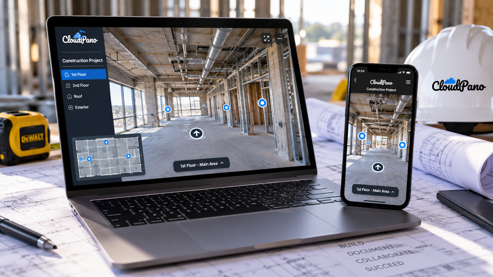
The primary advantage of 360° documentation over conventional photo logs is the amount of surrounding visual context captured from each camera position.
A conventional photograph records a selected field of view. A 360° image records the surrounding scene, allowing someone reviewing it later to look in different directions from that capture point.
That doesn't guarantee that every important detail has been documented. Camera placement, image quality, obstructions, lighting, capture frequency, and scene coverage still matter. However, panoramic capture can reduce the risk that potentially useful surrounding context was excluded simply because the photographer pointed the camera in another direction.
Navigation provides another advantage.
Traditional photo logs may require reviewers to open individual images and mentally reconstruct how different spaces relate to one another. A connected virtual tour can allow viewers to move between rooms, floors, or documented areas using hotspots, providing additional spatial context.
Depending on the platform, tours may also be accessible through desktop and mobile browsers and, in some cases, compatible VR devices. This can allow the same visual archive to serve both field personnel and remote stakeholders.
Construction documentation exists partly to answer questions that haven't been asked yet: What did this space look like before work began? What conditions were visible at a particular stage? How far had the project progressed by a certain date?
Traditional photo logs can answer many of those questions—but only when the relevant area was photographed and the resulting image can be located later.
A 360° visual record adds another layer of context by allowing project teams to capture more of the surrounding environment and organize those scenes into a navigable project history.
For project managers, superintendents, owners' representatives, and other stakeholders who need to revisit visual site information months or years later, virtual tour software for construction can complement existing documentation systems and make site imagery easier to navigate, share, and understand.
Not necessarily.Many modern virtual tour platforms use no-code interfaces that allow users to upload 360° imagery, arrange scenes, and connect them through visual navigation tools.You'll still need to learn the platform's basic workflow and establish consistent capture and organization practices. Construction teams should also determine who is responsible for capturing, naming, reviewing, and storing tour documentation.
They can potentially serve as supporting documentation, but their evidentiary or insurance value shouldn't be assumed.A dated 360° tour may provide useful visual context about site conditions at the time of capture. However, its usefulness in a particular dispute, legal proceeding, or insurance claim will depend on factors such as authenticity, completeness, timestamps, documentation procedures, applicable rules, and the requirements of the insurer or other reviewing party.For matters where evidentiary requirements are important, teams should follow their organization's document-retention procedures and obtain appropriate legal or insurance guidance.
There's no universal schedule.Some teams may capture imagery at key milestones—for example, before demolition, during rough-in, before walls are closed, and near substantial completion. Others may choose a weekly, biweekly, or project-specific cadence.The right frequency depends on the project's size, complexity, documentation requirements, and risk profile. More important than following an arbitrary schedule is capturing important conditions before they're concealed or substantially changed.
Yes, when the platform's sharing and privacy settings allow it.Virtual tours can typically be accessed remotely through a browser or shared through a project webpage or portal. Device support varies by platform, and some solutions may also provide VR viewing or live guided walkthrough capabilities.Teams working with confidential or sensitive projects should review access permissions before distributing tour links.


Compact, ready to go anywhere
Interchangeable lens that’s upgradeable
Dual 1-inch sensors for improved clarity and low light performance
Dynamic range and 6K 360° capture
360° photo resolution at 21MP

8K 360° video recording for ultra-detailed visuals.
4K single-lens mode for traditional wide-angle shots.
Invisible selfie stick effect for drone-like perspectives.
2.5-inch touchscreen with Gorilla Glass protection.
Waterproof up to 33ft for underwater shooting.

360° photo resolution in 23MP
Slim design at 24 mm thick
Built-in image stabilization for smooth video capture.
Internal 19GB storage for photo and video storage.
Wireless connectivity for remote control and sharing.

60MP 360° still images for high-resolution photography.
5.7K 360° video recording at 30fps.
2.25-inch touchscreen for intuitive control.
USB Type-C port for fast charging and data transfer.
MicroSD card slot for expandable storage.
.png)

.png)

Try it free. No credit card required. Instant set-up.






.svg)


.svg)