From Field to Screen: Reviewing Oil & Gas Sites with Virtual Tour Technology

Cloudpano
July 27, 2025
5 min read
Share this post

From Field to Screen: Reviewing Oil & Gas Sites with Virtual Tour Technology 🛢️💻🎥

Oil and gas operations are complex, remote, and resource-intensive. Whether you’re managing a drilling program, inspecting a pipeline, or overseeing a refinery, the need for timely, accurate, and safe site reviews is critical — and growing. But traveling to each location? That’s costly, risky, and time-consuming. 😩

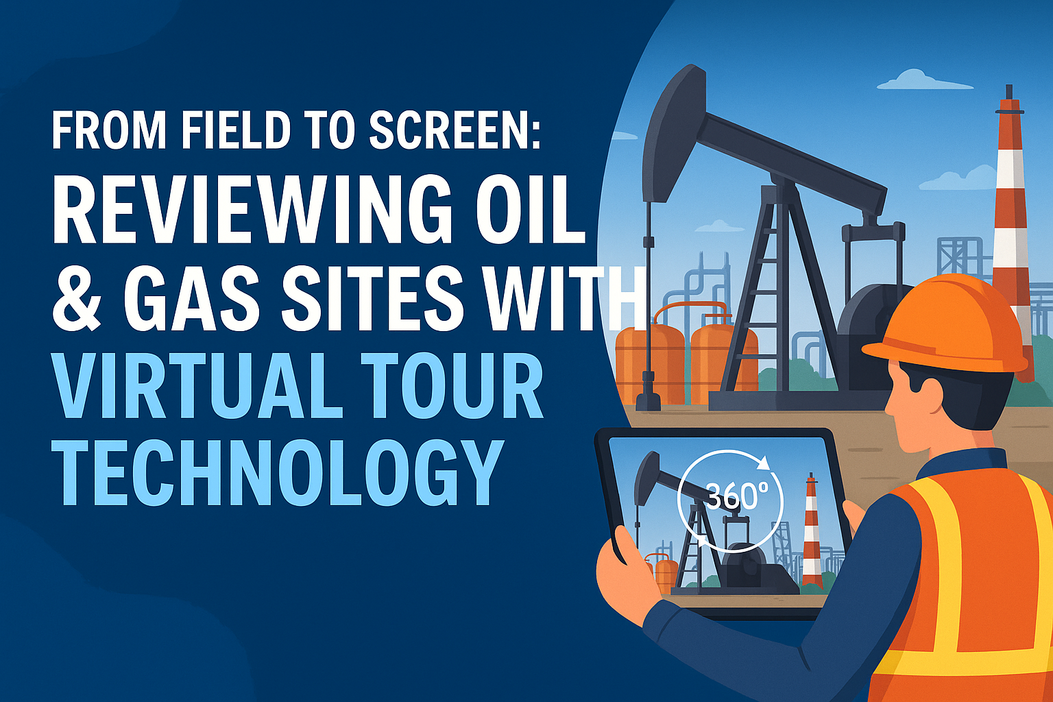
Enter virtual tour technology — a game-changing innovation that brings the entire jobsite from the field to your screen. 🎯🖥️

With 360° virtual tours, oil and gas professionals are transforming how they conduct site reviews, improving efficiency, safety, and team collaboration without leaving their desks.

The Traditional Site Review Struggle 🛬📋

Until recently, reviewing oilfield sites meant:

  • Flying to remote locations
  • Taking static photos and writing lengthy reports
  • Spending hours walking large, hazardous facilities
  • Coordinating between teams in different time zones

This process often led to delays, missed hazards, and ballooning travel costs — all while providing limited real-time visibility.

Want a deeper breakdown of these inefficiencies? 👉 How 360° Virtual Tours Transform Oil and Gas Operations Reviews

What Is Virtual Tour Technology? 🔄🌐

A virtual tour is an interactive, 360-degree digital walkthrough of your site. Using a 360° camera and a software platform like CloudPano, teams can:

  • Capture full panoramic views of rigs, pads, plants, and pipelines
  • Add data points, comments, or inspection checklists
  • Share a secure web-based link for others to explore remotely
  • Monitor progress, document milestones, and flag issues

It's like Google Street View — but private, detailed, and tailored for your operations. 👷‍♂️🔍

7 Reasons Oil & Gas Teams Are Moving from Field to Screen ✅

1. Save Time and Reduce Travel Costs 💰✈️

Why spend thousands flying engineers and inspectors to remote sites when they can review everything from the office in minutes?

Virtual tours reduce:

  • Travel expenses
  • Field time
  • Site visit delays

Need proof of reduced audit time? 👉 Remote Operations Audits Made Easy with 360 Virtual Tours

2. Improve Field Safety Without Risking Exposure 🦺🧯

Virtual walkthroughs allow HSE teams to identify risks — from missing PPE signage to hazardous terrain — without stepping into danger zones.

Hazards can be flagged, tagged, and tracked to resolution. 🛑✅

3. Enable Cross-Team and Cross-Site Collaboration 🤝🧑‍💻

With a simple link, your teams — from operations and compliance to engineering and executive leadership — can all review the same virtual site and leave notes or approvals.

This eliminates miscommunication and keeps everyone aligned. 🔗

4. Track Progress Over Time 📆🧭

By capturing weekly or milestone-based virtual tours, teams can compare construction phases, detect deviations, and monitor productivity.

It’s ideal for pipeline construction, pad expansions, or turnaround projects.

5. Create a Visual Archive for Compliance and Training 🗂️🎓

Every tour is saved and timestamped. This visual record is perfect for:

  • Regulatory audits
  • Incident reviews
  • Insurance documentation
  • New employee onboarding

Build smarter SOPs and training protocols 👉 Oil Rig Onboarding Simplified With Interactive Virtual Tours

6. Review Contractor Performance Visually 🛠️📋

Instead of relying on progress reports or phone calls, managers can see exactly what has been done through the virtual tour. Annotate poor installations, confirm progress, or approve payouts — all virtually.

Review contractor work across remote zones 👉 Oil & Gas Pipeline Projects Go Digital With Immersive Virtual Tours

7. Standardize Oversight Across Multiple Sites 🌎⚙️

Companies with assets across states or countries can standardize inspections and site reviews with 360 tours, creating consistency and improving operational control across the board.

Use Case: From Field to Screen in a Midstream Pipeline Project 🛢️🛠️

A midstream operator managing a 140-mile pipeline used CloudPano to conduct weekly 360° visual documentation of:

  • Trenching
  • HDD bore entry/exit points
  • Backfill compaction
  • Station construction

Rather than traveling to each location, project managers, inspectors, and compliance officers reviewed the pipeline virtually. The result?

✅ 65% reduction in travel
✅ 4x faster approvals
✅ $90K saved in Q1 alone
✅ Improved documentation for handoff and warranty

Where to Use Virtual Site Reviews 🔍💼

✅ Upstream

  • Well pad layout
  • Frac fleet placement
  • Sand and chemical handling zones

✅ Midstream

  • ROW clearing
  • Valve inspections
  • Pump station access roads

✅ Downstream

  • Tank farm inspections
  • Turnaround planning
  • Safety sign verification

Take oversight to the cloud 👉 From Ground to Cloud: Tracking Oilfield Workflows With 360 Virtual Tours

Getting Started: From Field to Screen in 4 Steps 🛠️📲

Step 1: Choose a 360° camera
Insta360 One X3, Ricoh Theta Z1, or GoPro Max are solid choices.

Step 2: Capture your site
Walk your facility or route with the camera mounted or handheld.

Step 3: Upload to CloudPano.com
Add labels, annotations, and route navigation.

Step 4: Share the tour
Send view-only or edit-enabled links to your team, contractors, or inspectors.

Final Thoughts: The New Standard for Oil & Gas Oversight 🚀👁️

Virtual tour technology is reshaping how the oil and gas industry conducts field reviews. It's safer, faster, and more cost-effective — giving teams real-time visibility without the real-world complications.

✅ Skip the flights
✅ Skip the guesswork
✅ Review from your screen — anytime, anywhere

Share this post
Cloudpano

Choose The Right 360° Camera

Insta360 ONE RS 1-Inch 360 Edition

  • Compact, ready to go anywhere

  • Interchangeable lens that’s upgradeable

  • Dual 1-inch sensors for improved clarity and low light performance

  • Dynamic range and 6K 360° capture

  • 360° photo resolution at 21MP

Learn More

Insta360 X4

  • 8K 360° video recording for ultra-detailed visuals.

  • 4K single-lens mode for traditional wide-angle shots.

  • Invisible selfie stick effect for drone-like perspectives.

  • 2.5-inch touchscreen with Gorilla Glass protection.

  • Waterproof up to 33ft for underwater shooting.

Learn More

Ricoh Theta Z1

  • 360° photo resolution in 23MP

  • Slim design at 24 mm thick

  • Built-in image stabilization for smooth video capture.

  • Internal 19GB storage for photo and video storage.

  • Wireless connectivity for remote control and sharing.

Learn More

Ricoh Theta X

  • 60MP 360° still images for high-resolution photography.

  • 5.7K 360° video recording at 30fps.

  • 2.25-inch touchscreen for intuitive control.

  • USB Type-C port for fast charging and data transfer.

  • MicroSD card slot for expandable storage.

Learn More
Property Marketing
Allows potential buyers to explore properties in detail from anywhere, enhancing the real estate marketing process.
Automotive Spins
Create an interactive virtual showroom and engage affluent digital buyers with live 360º video calls, all through the CloudPano mobile app for a complete automotive sales solution.
Interactive Floor Plans
Create 2D and 3D floor plans with measurements in 4 minutes or less, all from your phone. Download the Floor Plan Scanner app and get your first scan free.

360 Virtual Tours With CloudPano.com. Get Started Today.

Try it free. No credit card required. Instant set-up.

Try it free
Latest posts

See our other posts

Interviews, tips, guides, industry best practices, and news.

Mastering Compliance: The Future of Automated Property Video

This article provides a definitive guide for real estate professionals on navigating strict MLS branding regulations through AI-driven automation. It addresses the risks of compliance violations, details the limitations of manual editing workflows, and introduces a scalable, "compliance-first" system for generating high-quality, MLS-approved property videos. The post serves as a strategic blueprint for agents aiming to maintain listing visibility, avoid regulatory penalties, and streamline their marketing operations.
Read post

Future-Proofing Your Business with MLS Safe AI Video for Listings

This high-authority guide focuses on long-term operational stability and the strategic advantages of leveraging artificial intelligence to bypass the industry-wide friction between high-impact marketing and regulatory compliance. Key Takeaways & Content Structure: The Reputation-Risk Factor: Explains the high cost of compliance errors, focusing on how a single technical oversight—such as a misplaced logo or branded watermark—can trigger a systemic board audit, leading to immediate listing suspension and lasting reputational damage with sellers. The Production Disconnect: Breaks down the "two-version" operational tax, where marketing teams suffer from repetitive rendering, file-management bloat, and the persistent danger of human error when manually managing branded vs. unbranded media assets. AI as a Compliance Engine: Defines how advanced AI media platforms move beyond mere aesthetics to function as regulatory safeguards. It illustrates the technical architecture where the AI engine isolates branding data from structural property data at the rendering level, effectively "forking" the output into two distinct, safe-to-use tracks. Operational Blueprint: Maps out a transparent, 6-step automation funnel that takes a listing from flat photograph ingestion to syndicate-ready, neutral-hosted media in minutes. Strategic Scalability: Demonstrates why centralizing production into a single SaaS platform is the only way for growing brokerages to maintain consistency, remove contractor-level liability, and recover significant administrative time. The PhotoAIVideo.com Edge: Concludes by positioning the platform as a purpose-built solution that combines high-definition parallax AI motion with an automated "compliance-first" export workflow, ensuring Realtors can generate professional, engaging video content that passes even the most stringent board audits on the first attempt.
Read post

Streamlining Your Workflow with a Specialized MLS Compliant Real Estate Media App

This article functions as a tactical operations guide for real estate marketers and brokerage leaders focused on reducing technical friction and human error in their media publishing pipeline. Key Takeaways & Content Structure: The "Stop-Work" Order: Addresses the high-stakes reality of MLS compliance flags, where automated rules block properties from IDX feeds due to accidental branding, causing immediate listing velocity loss. The Fragmented Workflow Problem: Identifies the "manual bottleneck"—the inefficiency of having field photographers deliver single assets that then require internal staff to manually strip, re-render, and verify separate branded and unbranded versions. Architecture of Dual-Path Rendering: Illustrates the technological shift toward programmatic asset management. It explains how a modern app processes a single source file into two isolated rendering tracks: a lead-gen-heavy marketing track and a strictly compliant, unbranded track for MLS syndication. Operational Workflow Mapping: Provides a clear, 6-step blueprint for moving from raw photography ingestion to compliant deployment, including automated motion application, metadata scrubbing, and neutral link hosting. Risk Mitigation for Brokerages: Highlights how centralized management dashboards eliminate the "wild west" of agent-led media creation, providing brokers with a single-pane-of-glass view to ensure compliance across all active listings. The PhotoAIVideo.com Advantage: Positions the platform as the ideal MLS compliant real estate media app that leverages AI to inject cinematic motion into flat listing photos, effectively automating the entire compliance-forking process and increasing overall production capacity by up to 94%.
Read post