.png)

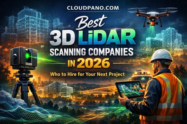
3D LiDAR scanning has quickly become one of the most important technologies in architecture, engineering, construction, real estate, and facility management. Whether you need millimeter-accurate as-built documentation for a renovation, a full digital twin of an industrial plant, or an immersive virtual tour of a commercial listing, hiring the right scanning company makes all the difference.
The challenge? There are hundreds of providers out there, and quality varies wildly. Some companies specialize in high-precision terrestrial LiDAR for the AEC industry. Others focus on Matterport-style visual scanning for real estate marketing. A few do both — and do them well.
To help you find the right partner, we put together this guide to some of the best 3D LiDAR scanning companies operating today. We evaluated them on service range, technology, industry focus, accuracy, turnaround time, and client reputation.
Website: datacaptureservice.com
Headquarters: Dallas–Fort Worth, TX (serves nationwide)
Best For: AEC professionals, emergency restoration, facility management, industrial plants
Data Capture Service (DCS) sits at the top of our list for good reason. Founded by Ramon Rodriguez in 2020, DCS has rapidly built a reputation as one of the most capable and client-focused 3D scanning firms in the country. They specialize in delivering high-quality LiDAR point cloud data, as-built documentation, Scan-to-BIM models, Xactimate sketches, AutoCAD drawings, and immersive 3D virtual walkthroughs.
What sets DCS apart is the breadth of their service offering combined with genuine technical depth. They operate with high-end Leica scanners (including the BLK360 and RTC360) and Matterport Pro3 cameras, and they hold certifications from both Leica Geosystems and Matterport, as well as IICRC certification for restoration work. Their typical scan tolerances come in at ±5 mm on architectural features and ±7 mm on MEP systems — which meets or exceeds industry standards for most AEC applications.
DCS serves a diverse client base spanning construction, architecture, engineering, commercial real estate, emergency restoration, manufacturing, and safety training. Their team handles everything from rapid damage assessment for insurance claims to detailed plant layouts for industrial facilities. Clients consistently praise their fast turnaround, competitive pricing, and responsive communication.
Key Services: 3D LiDAR scanning, as-built surveys, Scan-to-BIM, Xactimate & AutoCAD floor plans, 3D virtual tours, digital twin creation, damage assessment documentation, facility mapping, industrial plant scanning, safety training environments
Website: multivista.com
Headquarters: Phoenix, AZ (global operations across 7 countries)
Best For: Large-scale construction projects, enterprise-level clients, facility management
Multivista is one of the larger names in the construction reality capture space, with over 20 years in the industry and more than 150 scanning professionals deployed across seven countries. They are a Leica Geosystems partner and specialize in 3D laser scanning for construction verification, as-built documentation, Scan-to-BIM, deviation analysis, and floor flatness reports. Their scale makes them a strong fit for Fortune 500 companies, government entities, and large general contractors who need consistent, nationwide coverage.
Key Services: 3D laser scanning, Scan-to-Plan (CAD), Scan-to-BIM (Revit), deviation analysis, floor flatness/levelness reports, point cloud delivery, 360° imagery
Website: apexscanning.com
Headquarters: United States (serves nationwide)
Best For: AEC professionals who want a hands-on, owner-operated experience
APEX 3D Scanning Solutions brings over 16 years of experience in the AEC industry. Owner Dave Schaff personally oversees every project, which means you get consistency and direct communication from the person responsible for your deliverables. APEX offers laser scanning, Matterport virtual tours, drone imagery, and 3D modeling services. Their focus on custom-tailored solutions and their track record of working with AEC professionals across the country make them a solid mid-market option for firms looking for personalized attention.
Key Services: 3D laser scanning, building scanning, industrial scanning, as-built documentation, virtual tours, drone capture, point cloud delivery
Website: arrival3d.com
Headquarters: United States (nationwide service)
Best For: Factory and industrial facility scanning, renovation projects
Arrival 3D positions itself as a full-service 3D laser scanning provider for the AEC industry. They deliver point clouds, 2D CAD drawings, BIM models, and digital twins designed to help architects, engineers, and construction managers work from accurate existing-conditions data. Their factory and industrial scanning services are particularly noteworthy, aimed at helping engineers design around existing structures with confidence. They also offer drone scanning for large or hard-to-reach areas, and they back their work with a satisfaction guarantee.
Key Services: 3D laser scanning, Scan-to-BIM, Scan-to-CAD, digital twin creation, drone scanning, factory/plant scanning, asset tagging
Website: vec-us.com
Headquarters: United States
Best For: General contractors, trade contractors, and teams needing onsite QC support
VEC is a team of BIM and VDC professionals who pair 3D laser scanning with hands-on quality control services. Their focus on the construction workflow means they understand not just how to capture scan data, but how to integrate it into live project coordination. VEC works with general contractors, MEP trade contractors, and civil underground teams, providing millimeter-accurate existing-conditions documentation and helping reduce change orders and schedule delays. If you need a scanning partner who understands the construction side of the equation, VEC is worth a look.
Key Services: 3D laser scanning, as-built documentation, onsite QC, BIM coordination, clash detection
Website: eastcoastmetrology.com
Headquarters: East Coast, United States
Best For: Metrology-grade scanning, AEC, historical preservation, manufacturing
East Coast Metrology combines best-in-class 3D scanning hardware with deep metrology expertise. Their AEC division provides LiDAR scanning for architectural planning, construction management, facility documentation, and historical preservation. What makes ECM unique is their roots in precision measurement and industrial metrology, which means they bring a level of rigor and process discipline that pure-play scanning firms sometimes lack. They serve both small manufacturers and Fortune 500 companies across a range of industries.
Key Services: LiDAR scanning, 3D rendering, construction documentation, facility management, historical preservation, dimensional metrology
Website: cushingco.com
Headquarters: Chicago, IL
Best For: Chicago-area projects, Matterport tours, LiDAR scanning with multi-platform technology
Cushing is a Chicago-based firm that was among the first Matterport distributors in the city. They have since expanded into full LiDAR scanning services using technology from Trimble, NavVis, and Matterport. Cushing delivers high-resolution 3D Revit models, 2D AutoCAD drawings, and floor flatness/levelness reports. Their experience spans construction, architecture, real estate, and environmental planning. If your project is in the Midwest and you want a firm with deep local roots and modern multi-platform capabilities, Cushing is a strong contender.
Key Services: LiDAR scanning, Matterport reality capture, 3D Revit models, 2D AutoCAD, floor flatness reports, wide-format printing
Not every scanning company is right for every project. Here are a few things to consider before making your decision:
The 3D LiDAR scanning industry is maturing rapidly, and the companies listed above represent some of the strongest options available in 2026. Whether you're an architect planning a major renovation, a general contractor needing as-built verification, a facility manager building a digital twin, or a real estate professional looking to market properties with immersive virtual tours — the right scanning partner can save you time, reduce errors, and give your stakeholders a clearer picture of reality.
Once your scan data is captured, don't let it sit in a folder. Turn those 360° images and 3D walkthroughs into interactive experiences your clients can actually explore. CloudPano makes it simple to publish, brand, and share virtual tours from any 360° photo output — no coding required. Whether you're showcasing a construction site, a commercial property, or an industrial facility, CloudPano gives you a professional platform to present your scans to the world.
Ready to turn your 3D scans into shareable virtual tours? Get started with CloudPano for free today.

Compact, ready to go anywhere
Interchangeable lens that’s upgradeable
Dual 1-inch sensors for improved clarity and low light performance
Dynamic range and 6K 360° capture
360° photo resolution at 21MP

8K 360° video recording for ultra-detailed visuals.
4K single-lens mode for traditional wide-angle shots.
Invisible selfie stick effect for drone-like perspectives.
2.5-inch touchscreen with Gorilla Glass protection.
Waterproof up to 33ft for underwater shooting.

360° photo resolution in 23MP
Slim design at 24 mm thick
Built-in image stabilization for smooth video capture.
Internal 19GB storage for photo and video storage.
Wireless connectivity for remote control and sharing.

60MP 360° still images for high-resolution photography.
5.7K 360° video recording at 30fps.
2.25-inch touchscreen for intuitive control.
USB Type-C port for fast charging and data transfer.
MicroSD card slot for expandable storage.
.png)
.png)

Try it free. No credit card required. Instant set-up.