.png)

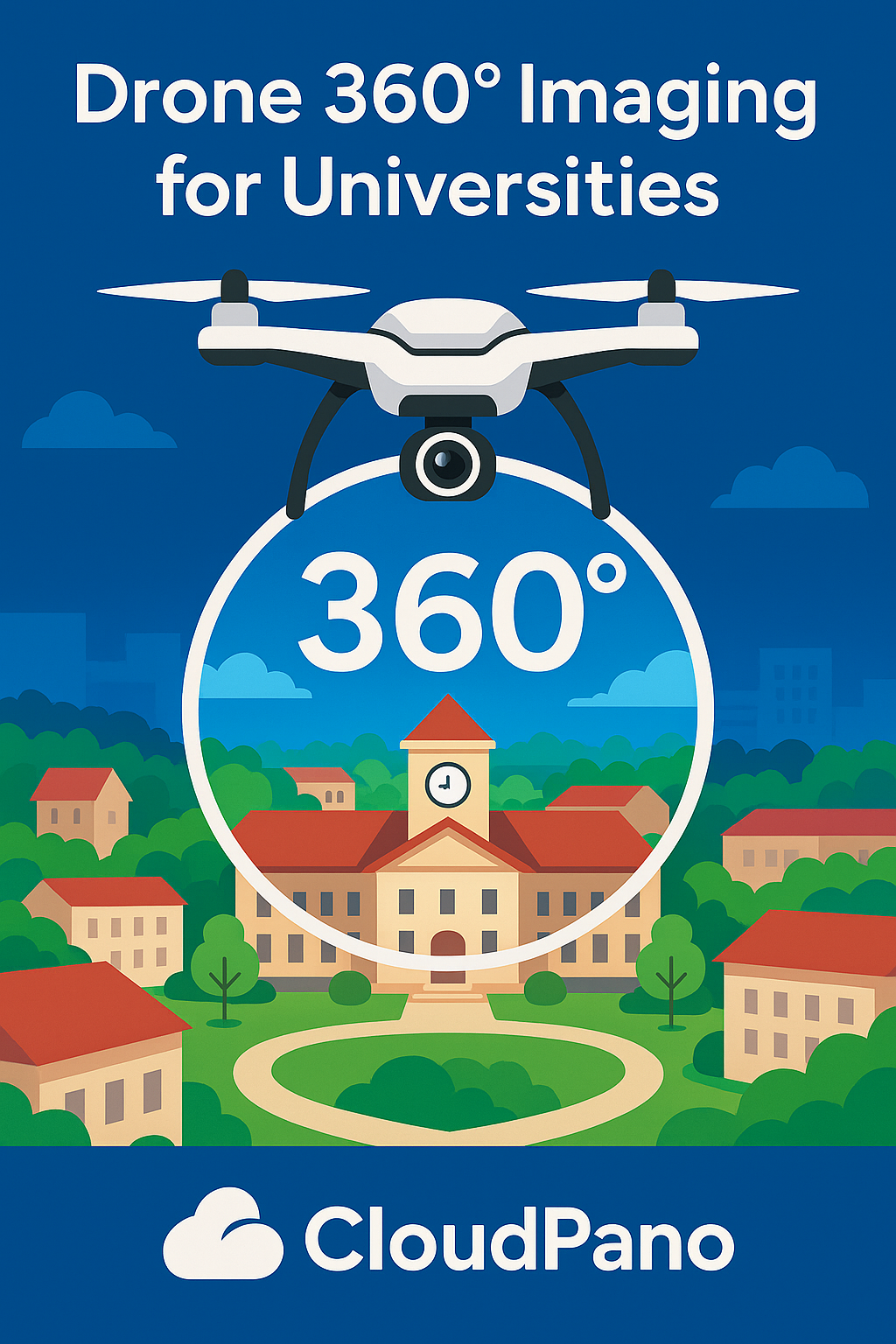
University campuses are some of the most visually stunning spaces on Earth — from historic architecture to modern student centers and sprawling green lawns. 🌳✨ But traditional photos and videos simply can’t capture the full beauty, scale, or energy of a campus experience.
That’s where drone 360° imaging comes in. 🚀 Learn more about their immersive university solutions here: CloudPano for Universities.
By combining aerial drone photography with CloudPano’s 360° virtual tour technology, universities can now showcase their campuses like never before — offering breathtaking, immersive virtual tours that attract students, engage alumni, and impress donors.
In this post, we’ll explore how drone 360 imaging works, why it’s revolutionizing university marketing, and how CloudPano makes it easy for any institution to bring their campus to life online. 🎥🏫 A real estate video app helps realtors showcase properties with immersive video content buyers expect to see today.
Drone 360° imaging is the process of capturing panoramic aerial photos and videos using a drone equipped with a 360° camera.
Unlike standard drone shots, which show a single perspective, 360° imaging allows users to look in every direction — up, down, and all around. It feels as if you’re hovering above the campus yourself!
Using platforms like CloudPano, these images can be stitched together into an interactive virtual tour, where viewers can:
This immersive format transforms how prospective students and families explore your campus from anywhere in the world. 🌎💻
Read: How Colleges Use 360° Virtual Tours to Engage Alumni and Donors
Universities face intense competition to attract students and donors. A beautifully designed website is great — but immersive visual storytelling sets you apart.
Here’s how drone 360° imaging helps universities stand out:
Aerial 360° tours offer a bird’s-eye view that instantly captures attention.
Prospective students can explore your entire campus — from academic buildings to athletic facilities — in one seamless, cinematic experience.
💡 Example: Imagine an interactive panorama that begins over your iconic clock tower, then zooms down into dorms, courtyards, and lecture halls. It’s not just a tour — it’s an adventure.
Choosing a university is an emotional decision. Students don’t just look for programs — they look for a place that feels like home.
Drone 360° imagery helps create that connection by letting viewers:
Emotion drives enrollment. And nothing evokes emotion like a sweeping aerial view of a university in full motion. 🎓🌤️
Not all prospective students can visit campus in person — especially international applicants. ✈️
With a drone 360° virtual tour hosted on CloudPano, your campus becomes accessible worldwide, 24/7.
It’s like having a permanent open house — available anytime, anywhere, on any device.
This inclusivity supports both recruitment and diversity goals by giving every student an equal opportunity to explore your school.
Virtual tours aren’t just for admissions.
Universities use CloudPano drone tours to engage:
It’s an incredibly effective way to maintain relationships and demonstrate impact visually.
Drone 360° visuals can be embedded across every stage of your marketing funnel:
“CloudPano turns your drone imagery into a full-funnel marketing tool that drives clicks, conversations, and conversions.”
Creating a professional-grade drone 360° virtual tour might sound complex — but CloudPano makes it easy and scalable for universities of any size.
Here’s how:
Use a drone equipped with 360° capture capability, such as the DJI Mavic 3, Insta360 Sphere, or Ricoh Theta Z1.
Fly above key locations:
Make sure to capture during golden hours (early morning or late afternoon) for the best lighting. 🌅
Log into CloudPano.com, upload your 360° drone images, and drag them into place.
Within minutes, you can:
No coding, no technical expertise — just pure creativity.
Once your tour is ready, CloudPano provides a simple embed code for your website. You can also share via:
Your interactive drone 360° tour can even integrate into Google Street View, expanding your online visibility across search and maps. 🌐
Want to take your tours one step further? With CloudPano Live, you can host guided video sessions inside your drone 360° tour.
This allows your admissions team to:
It’s like giving a personal walking tour — only this one happens inside the virtual sky. ☁️🎥
Read: Step-by-Step: How to Create a Virtual Campus Tour with CloudPano
Here are a few creative ways universities are using drone 360° imaging with CloudPano:
Offer virtual open houses where students can explore from home.
💬 “Experience campus life before you arrive.”
Show donors and stakeholders progress on new buildings or renovations.
Highlight innovation spaces and attract partnerships or grants.
Feature drone tours in press releases and promotional videos.
Send alumni on a virtual trip down memory lane — see what’s new and reconnect emotionally.
Once your tour is live, CloudPano provides built-in analytics to track:
This data helps universities measure ROI and understand which areas or features generate the most interest.
For example:
If 70% of users spend extra time exploring your engineering complex, your marketing team can double down on promoting STEM programs.
CloudPano isn’t just a virtual tour platform — it’s a complete visual engagement system built for scalability, accessibility, and brand excellence.
Here’s what makes it perfect for universities:
✅ Unlimited hosting for multiple campuses or facilities
✅ Custom branding with your logos and colors
✅ Accessibility support for ADA compliance
✅ Integration options with CRMs and web platforms
✅ No software installs — 100% browser-based
It’s designed for universities that want to market like tech-forward brands — professional, interactive, and future-ready. 🎓💡
When Skyview University introduced CloudPano drone 360° tours, their marketing strategy changed overnight.
Before, they relied on photos and video walkthroughs that lacked depth. Within weeks of launching an interactive drone tour:
The university’s president summed it up perfectly:
“Drone 360° imaging let us tell our story from a new perspective — literally. Students fell in love with our campus before even visiting.”
As drone and 360° imaging technologies evolve, universities that embrace immersive storytelling will dominate the digital landscape.
Prospective students expect experiences that are:
CloudPano gives institutions the tools to deliver all three — combining stunning drone visuals with powerful engagement features that drive results.
Drone 360° imaging + CloudPano = the ultimate campus showcase.
By integrating aerial virtual tours into your admissions and marketing strategy, your university can:
✅ Attract students globally
✅ Strengthen brand visibility
✅ Engage alumni and donors
✅ Offer immersive, emotional experiences
“When students can see your campus from the sky, they can feel your story.”
Ready to elevate your campus marketing? 🚁
Start building your CloudPano drone 360° tour today and bring your university’s story to life — one breathtaking view at a time. 🌤️🎓

Compact, ready to go anywhere
Interchangeable lens that’s upgradeable
Dual 1-inch sensors for improved clarity and low light performance
Dynamic range and 6K 360° capture
360° photo resolution at 21MP

8K 360° video recording for ultra-detailed visuals.
4K single-lens mode for traditional wide-angle shots.
Invisible selfie stick effect for drone-like perspectives.
2.5-inch touchscreen with Gorilla Glass protection.
Waterproof up to 33ft for underwater shooting.

360° photo resolution in 23MP
Slim design at 24 mm thick
Built-in image stabilization for smooth video capture.
Internal 19GB storage for photo and video storage.
Wireless connectivity for remote control and sharing.

60MP 360° still images for high-resolution photography.
5.7K 360° video recording at 30fps.
2.25-inch touchscreen for intuitive control.
USB Type-C port for fast charging and data transfer.
MicroSD card slot for expandable storage.
.png)
.png)

Try it free. No credit card required. Instant set-up.