Why Engineering Teams Are Adopting 360 Site Documentation Tools in 2025

Cloudpano
August 2, 2025
5 min read
Share this post

Why Engineering Teams Are Adopting 360 Site Documentation Tools in 2025 🏗️📸🧠

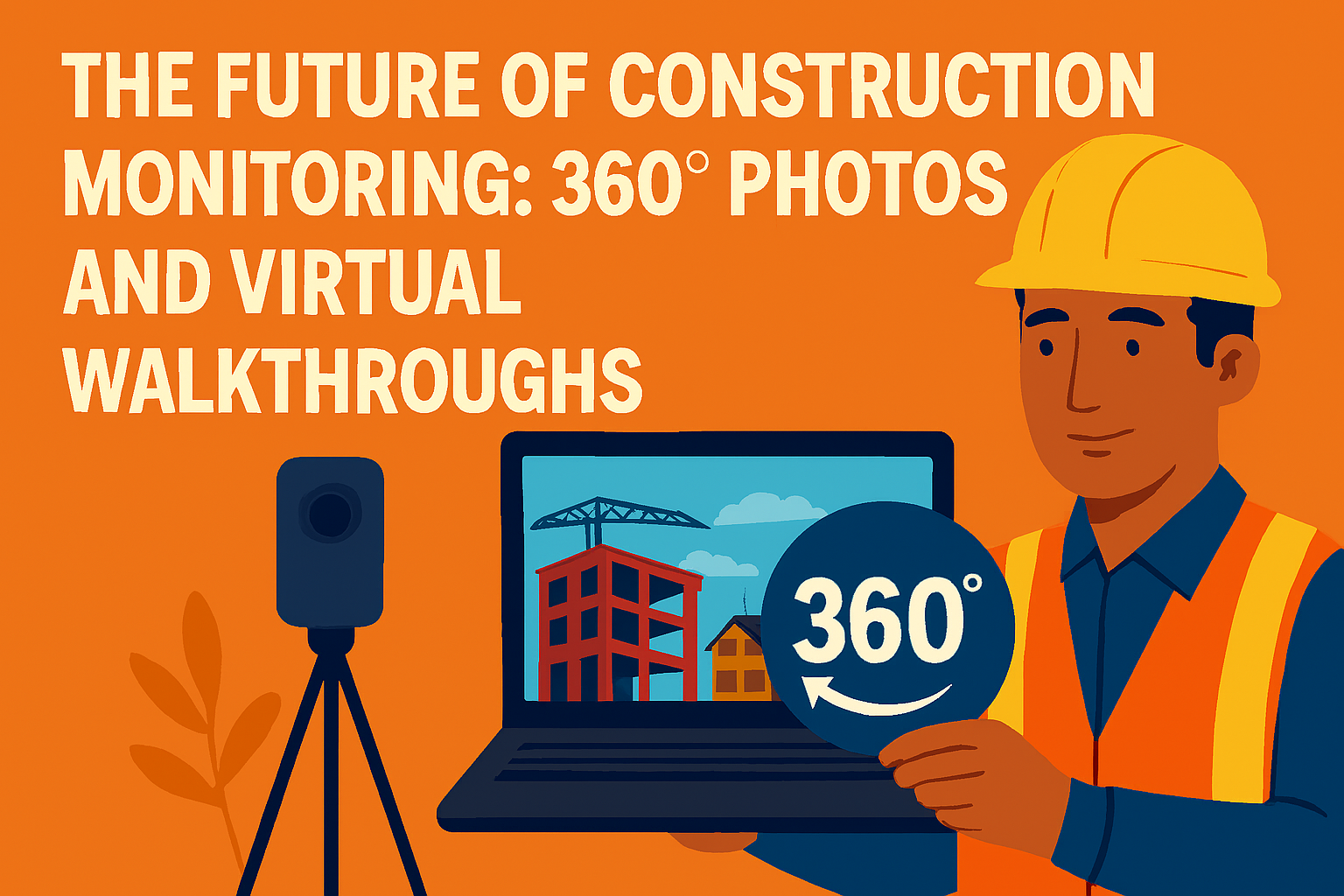
Engineering teams in 2025 face rising pressure to deliver more complex builds, with tighter margins, and greater accountability than ever before. The good news? Technology is catching up — and 360° site documentation tools are leading the charge.

With immersive photo capture and virtual walkthroughs, engineering teams can now:

  • Monitor job sites remotely 👷‍♂️
  • Reduce rework through visual accuracy 🎯
  • Improve coordination across departments 🔄
  • Create a time-stamped visual record of every project phase 🧾

Let’s dive into why 360° documentation tools have become non-negotiable for modern engineering teams — and how they’re reshaping project management from the ground up.

📸 What Is 360 Site Documentation?

360° site documentation uses specialized cameras to capture full panoramic views of spaces. These images are stitched together into interactive virtual tours, allowing viewers to:

  • “Walk through” the site remotely
  • Zoom, pan, and view every angle
  • Annotate issues or add notes
  • Review conditions over time with time-stamped views

The result? Engineers get a clear, complete view of the job site — any time, from anywhere.

📖 Related: How 360 Documentation Software Enhances Virtual Tour Creation

🧱 Why Engineers Are Embracing It

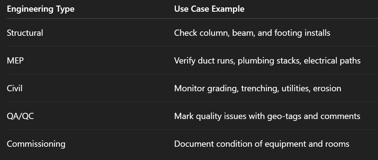
Here’s how 360° virtual documentation aligns with engineering needs:

✅ 1. Precision & Accuracy

In the world of engineering, details matter. A missed conduit placement or misaligned anchor can lead to major delays. With 360 tools, teams can verify install accuracy visually, avoiding costly errors.

✅ 2. Fewer Site Visits

Structural engineers, MEP consultants, and QA managers no longer need to drive hours to verify basic progress. A quick virtual walkthrough saves time, reduces costs, and accelerates decision-making.

📚 Related: Top 5 Ways Engineers Use 360 Photo Documentation for Project Accuracy

👥 Streamline Team Collaboration

On large builds, engineers are spread across firms and time zones. Virtual tours give everyone equal access to current job site conditions.

  • Architects can double-check spatial layouts 🧮
  • MEP teams can flag interference or routing issues ⚙️
  • Structural teams can verify connections before they’re covered

This creates a unified source of visual truth that drives smarter coordination and faster approvals.

🔁 Capture Site Evolution Over Time

With time-stamped 360 documentation, engineers can compare:

  • Pre-pour vs post-pour slab conditions
  • Rough-in vs close-in milestones
  • Pre- and post-inspection work

This visual history is a powerful tool for:

  • Dispute resolution
  • Payment approvals
  • Legal protection
  • Punch list review

In 2025, these visual timelines are replacing static PDFs and phone-based updates.

📖 Bonus: The Future of Visual Reporting: 360° Documentation Tools and Virtual Tours

🛠️ Use Cases by Discipline

🔍 Real-Time Monitoring, Anytime

No more waiting for “weekly update emails.” Engineers can:

  • Log in from anywhere
  • Access up-to-date views
  • Mark areas of concern
  • Share with stakeholders instantly

It’s site monitoring, on-demand.

🌍 Reduce Carbon Footprint & Travel Costs

By enabling remote collaboration, 360° documentation reduces:

  • Car/plane travel to job sites
  • Printing of site photos and plans
  • Delays due to site access or scheduling conflicts

This supports sustainability initiatives and aligns with green project goals.

⚙️ Integrations with Other Tools

Platforms like CloudPano integrate or export easily for use with:

  • BIM software
  • Project management platforms
  • Scheduling apps
  • Inspection workflows

Engineering teams can embed virtual tours into their dashboards, creating a seamless ecosystem of visual and technical data.

📈 Future-Proofing Your Team

By 2025, teams that adopt visual-first workflows will:

  • Win more contracts 💼
  • Deliver higher-quality outcomes 🏗️
  • Reduce litigation risk 🧾
  • Improve internal productivity 🔧

Whether it’s residential, commercial, industrial, or infrastructure — 360° documentation is the new foundation for engineering excellence.

🎯 Final Thoughts

Engineering projects demand accuracy, visibility, and control — and 360° site documentation provides all three.

As this technology becomes more accessible and expected by stakeholders, engineering teams that adopt it now will gain a competitive edge in every project.

📣 Get Started with Visual Engineering Tools Today

Want to bring immersive 360° site documentation into your workflow? Explore these tools:

Share this post
Cloudpano

Choose The Right 360° Camera

Insta360 ONE RS 1-Inch 360 Edition

  • Compact, ready to go anywhere

  • Interchangeable lens that’s upgradeable

  • Dual 1-inch sensors for improved clarity and low light performance

  • Dynamic range and 6K 360° capture

  • 360° photo resolution at 21MP

Learn More

Insta360 X4

  • 8K 360° video recording for ultra-detailed visuals.

  • 4K single-lens mode for traditional wide-angle shots.

  • Invisible selfie stick effect for drone-like perspectives.

  • 2.5-inch touchscreen with Gorilla Glass protection.

  • Waterproof up to 33ft for underwater shooting.

Learn More

Ricoh Theta Z1

  • 360° photo resolution in 23MP

  • Slim design at 24 mm thick

  • Built-in image stabilization for smooth video capture.

  • Internal 19GB storage for photo and video storage.

  • Wireless connectivity for remote control and sharing.

Learn More

Ricoh Theta X

  • 60MP 360° still images for high-resolution photography.

  • 5.7K 360° video recording at 30fps.

  • 2.25-inch touchscreen for intuitive control.

  • USB Type-C port for fast charging and data transfer.

  • MicroSD card slot for expandable storage.

Learn More
Property Marketing
Allows potential buyers to explore properties in detail from anywhere, enhancing the real estate marketing process.
Automotive Spins
Create an interactive virtual showroom and engage affluent digital buyers with live 360º video calls, all through the CloudPano mobile app for a complete automotive sales solution.
Interactive Floor Plans
Create 2D and 3D floor plans with measurements in 4 minutes or less, all from your phone. Download the Floor Plan Scanner app and get your first scan free.

360 Virtual Tours With CloudPano.com. Get Started Today.

Try it free. No credit card required. Instant set-up.

Try it free
Latest posts

See our other posts

Interviews, tips, guides, industry best practices, and news.

How to Create Virtual Tours of Your Construction Site Using 360 Photos

Learn how to capture, build, and share interactive 360° virtual tours of your construction site using just a camera and simple software. This guide walks you through the exact steps to improve communication, reduce errors, and visually document every phase of your construction project — from foundation to finish. Perfect for project managers, engineers, and stakeholders who want clarity at every step.
Read post

Why Engineering Teams Are Adopting 360 Site Documentation Tools in 2025

In 2025, engineering teams are rapidly adopting 360° site documentation tools to increase precision, streamline collaboration, and reduce costly rework. This post explores how immersive visual records improve remote monitoring, cut travel time, and help engineers maintain accuracy across every project phase — from MEP to QA/QC.
Read post

The Future of Construction Monitoring: 360° Photos and Virtual Walkthroughs

360° photo documentation and virtual walkthroughs are redefining construction monitoring. This post explains how immersive, real-time visuals increase stakeholder trust, reduce miscommunication, and streamline inspections — all while creating a digital record of every phase. Learn why future-ready builders are adopting these tools now to stay ahead.
Read post