See Every Stage: Virtual Tour Solutions for Oil Pipeline Construction Oversight

Cloudpano
July 26, 2025
5 min read
Share this post

See Every Stage: Virtual Tour Solutions for Oil Pipeline Construction Oversight 👷‍♂️🛢️📸

Oil pipeline construction projects are high-stakes, high-cost, and high-risk. From right-of-way clearing to final backfill, every phase demands precision, compliance, and oversight. But with teams spread across vast distances and timelines that stretch for months, maintaining accurate visibility is a constant challenge.

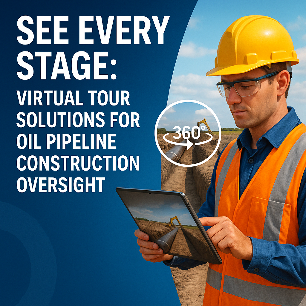
That’s where 360° virtual tour solutions come in. 🧠💡

These immersive tools give project managers, regulators, and contractors the power to "see every stage" of the pipeline lifecycle — without ever stepping foot on-site. Let’s explore how this technology is reshaping oil pipeline oversight, step by step.

Why Traditional Oversight Methods Fall Short 🚫📷

Historically, project teams relied on:

  • Weekly status reports 📝
  • Drone snapshots or photos
  • Delayed walkthroughs with inspectors
  • On-site visits requiring travel and scheduling logistics ✈️

While these tools worked, they lacked context, timeliness, and interactivity — all essential for making fast, informed decisions.

By contrast, virtual tour platforms like CloudPano allow stakeholders to virtually walk the project in real-time, complete with zoom, angle control, and embedded notes. No more "guesstimating" what’s happening in the field.

What is a Virtual Tour for Pipeline Construction? 🧭🌐

At its core, a virtual tour is a stitched-together series of 360° images that users can navigate like a Google Street View — but tailored to your pipeline site. Each capture can be tagged with metadata like:

  • Date and time
  • GPS coordinates
  • Crew activity
  • Equipment staging
  • Milestone completions ✅

These tours are updated weekly or even daily and give your team a live snapshot of progress — all accessible from a browser or mobile device.

Need a deeper dive into how this improves jobsite performance? 👉 Boost Efficiency with Remote Site Inspections for Oil and Gas Operations

Key Stages Captured With Virtual Tour Oversight 📍📅

1. Pre-Construction Site Survey

Capture the condition of the land, terrain elevation, environmental markers, and adjacent infrastructure before work begins. This serves as a baseline for future comparison. 📍

2. Trenching and Excavation

Document the depth and spacing of trenches. Confirm safety barriers, slope grading, and soil compaction measures visually. 👷‍♀️

3. Pipe Laying and Welding

Take snapshots at every weld point. If an inspector wants to review joint fusion later, they can do so virtually. 🧰

4. Coating, Wrapping, and Backfilling

Ensure protective coating was applied properly before the pipeline is covered. Great for verifying compliance and warranty documentation. 💬

5. Final Grading and Restoration

Capture “after” shots of environmental restoration and verify erosion control measures. 🌱

Real-Time Collaboration Across Teams 🤝💬

One of the most underrated benefits of virtual tour oversight?

Cross-functional collaboration. 🛠️📡

  • Engineers can log in and confirm installation accuracy
  • Safety managers can flag potential hazards
  • Clients and regulators can leave comments or request inspections
  • Construction managers can assign tasks remotely based on what they see

Virtual tours eliminate the need for repeated site visits or lengthy update calls. Everyone works from the same visual record — with zero delay.

Regulatory Compliance Made Easier 📋🛡️

Pipeline projects are subject to intense scrutiny from:

  • Environmental agencies
  • State and federal regulators
  • Third-party inspectors
  • Legal review teams

With virtual tours, your compliance team can document and archive:

  • Permit compliance activities
  • Spill prevention barriers
  • Water crossings and HDD work
  • Inspection results with visuals

It’s a defensible audit trail you can reference long after construction is complete.

Need a tour solution for onboarding safety teams? Don’t miss 👉 Oil Rig Onboarding Simplified With Interactive Virtual Tours

Case Study Example: See the Entire Route 📍🛣️

A recent 12-mile oil pipeline project used weekly virtual tour updates to document:

  • Wetland boundary compliance
  • Weld inspection stations
  • Coating crews at work
  • Daily weather conditions
  • Final backfill and reseeding

When heavy rains washed out one section, the project team used the archived 360° data to show that erosion controls were in place — and avoid fines.

Virtual tours didn’t just save time — they saved money and liability exposure.

See more digital pipeline use cases 👉 Oil & Gas Pipeline Projects Go Digital With Immersive Virtual Tours

Getting Started: What You Need 🎥📱

🔧 Tools Required:

  • 360 camera (Ricoh Theta, Insta360, GoPro Max)
  • Tripod or helmet mount
  • Virtual tour software like CloudPano
  • Basic capture training for field teams

🔁 Weekly Workflow:

  1. Walk the pipeline route
  2. Capture photos at key markers
  3. Upload to your platform
  4. Tag and annotate
  5. Share the link with your team ✅

Final Thoughts: Oversight in Every Phase 🧠📍📈

From the first trench to the final layer of topsoil, 360 virtual tours empower you to see every stage of your oil pipeline project.

They're affordable, scalable, and instantly impactful.

Whether you’re managing field operations, proving compliance, or sharing status with stakeholders, virtual tours deliver clarity, trust, and accountability.

💡 Stop relying on static reports. Step into the next phase of project visibility — virtually.

Share this post
Cloudpano

Choose The Right 360° Camera

Insta360 ONE RS 1-Inch 360 Edition

  • Compact, ready to go anywhere

  • Interchangeable lens that’s upgradeable

  • Dual 1-inch sensors for improved clarity and low light performance

  • Dynamic range and 6K 360° capture

  • 360° photo resolution at 21MP

Learn More

Insta360 X4

  • 8K 360° video recording for ultra-detailed visuals.

  • 4K single-lens mode for traditional wide-angle shots.

  • Invisible selfie stick effect for drone-like perspectives.

  • 2.5-inch touchscreen with Gorilla Glass protection.

  • Waterproof up to 33ft for underwater shooting.

Learn More

Ricoh Theta Z1

  • 360° photo resolution in 23MP

  • Slim design at 24 mm thick

  • Built-in image stabilization for smooth video capture.

  • Internal 19GB storage for photo and video storage.

  • Wireless connectivity for remote control and sharing.

Learn More

Ricoh Theta X

  • 60MP 360° still images for high-resolution photography.

  • 5.7K 360° video recording at 30fps.

  • 2.25-inch touchscreen for intuitive control.

  • USB Type-C port for fast charging and data transfer.

  • MicroSD card slot for expandable storage.

Learn More
Property Marketing
Allows potential buyers to explore properties in detail from anywhere, enhancing the real estate marketing process.
Automotive Spins
Create an interactive virtual showroom and engage affluent digital buyers with live 360º video calls, all through the CloudPano mobile app for a complete automotive sales solution.
Interactive Floor Plans
Create 2D and 3D floor plans with measurements in 4 minutes or less, all from your phone. Download the Floor Plan Scanner app and get your first scan free.

360 Virtual Tours With CloudPano.com. Get Started Today.

Try it free. No credit card required. Instant set-up.

Try it free
Latest posts

See our other posts

Interviews, tips, guides, industry best practices, and news.

Mastering Compliance: The Future of Automated Property Video

This article provides a definitive guide for real estate professionals on navigating strict MLS branding regulations through AI-driven automation. It addresses the risks of compliance violations, details the limitations of manual editing workflows, and introduces a scalable, "compliance-first" system for generating high-quality, MLS-approved property videos. The post serves as a strategic blueprint for agents aiming to maintain listing visibility, avoid regulatory penalties, and streamline their marketing operations.
Read post

Future-Proofing Your Business with MLS Safe AI Video for Listings

This high-authority guide focuses on long-term operational stability and the strategic advantages of leveraging artificial intelligence to bypass the industry-wide friction between high-impact marketing and regulatory compliance. Key Takeaways & Content Structure: The Reputation-Risk Factor: Explains the high cost of compliance errors, focusing on how a single technical oversight—such as a misplaced logo or branded watermark—can trigger a systemic board audit, leading to immediate listing suspension and lasting reputational damage with sellers. The Production Disconnect: Breaks down the "two-version" operational tax, where marketing teams suffer from repetitive rendering, file-management bloat, and the persistent danger of human error when manually managing branded vs. unbranded media assets. AI as a Compliance Engine: Defines how advanced AI media platforms move beyond mere aesthetics to function as regulatory safeguards. It illustrates the technical architecture where the AI engine isolates branding data from structural property data at the rendering level, effectively "forking" the output into two distinct, safe-to-use tracks. Operational Blueprint: Maps out a transparent, 6-step automation funnel that takes a listing from flat photograph ingestion to syndicate-ready, neutral-hosted media in minutes. Strategic Scalability: Demonstrates why centralizing production into a single SaaS platform is the only way for growing brokerages to maintain consistency, remove contractor-level liability, and recover significant administrative time. The PhotoAIVideo.com Edge: Concludes by positioning the platform as a purpose-built solution that combines high-definition parallax AI motion with an automated "compliance-first" export workflow, ensuring Realtors can generate professional, engaging video content that passes even the most stringent board audits on the first attempt.
Read post

Streamlining Your Workflow with a Specialized MLS Compliant Real Estate Media App

This article functions as a tactical operations guide for real estate marketers and brokerage leaders focused on reducing technical friction and human error in their media publishing pipeline. Key Takeaways & Content Structure: The "Stop-Work" Order: Addresses the high-stakes reality of MLS compliance flags, where automated rules block properties from IDX feeds due to accidental branding, causing immediate listing velocity loss. The Fragmented Workflow Problem: Identifies the "manual bottleneck"—the inefficiency of having field photographers deliver single assets that then require internal staff to manually strip, re-render, and verify separate branded and unbranded versions. Architecture of Dual-Path Rendering: Illustrates the technological shift toward programmatic asset management. It explains how a modern app processes a single source file into two isolated rendering tracks: a lead-gen-heavy marketing track and a strictly compliant, unbranded track for MLS syndication. Operational Workflow Mapping: Provides a clear, 6-step blueprint for moving from raw photography ingestion to compliant deployment, including automated motion application, metadata scrubbing, and neutral link hosting. Risk Mitigation for Brokerages: Highlights how centralized management dashboards eliminate the "wild west" of agent-led media creation, providing brokers with a single-pane-of-glass view to ensure compliance across all active listings. The PhotoAIVideo.com Advantage: Positions the platform as the ideal MLS compliant real estate media app that leverages AI to inject cinematic motion into flat listing photos, effectively automating the entire compliance-forking process and increasing overall production capacity by up to 94%.
Read post