From Trenches to Tech: 360 Virtual Tours of Pipeline Projects

Cloudpano
July 26, 2025
5 min read
Share this post

From Trenches to Tech: 360 Virtual Tours of Pipeline Projects 🚧🛠️

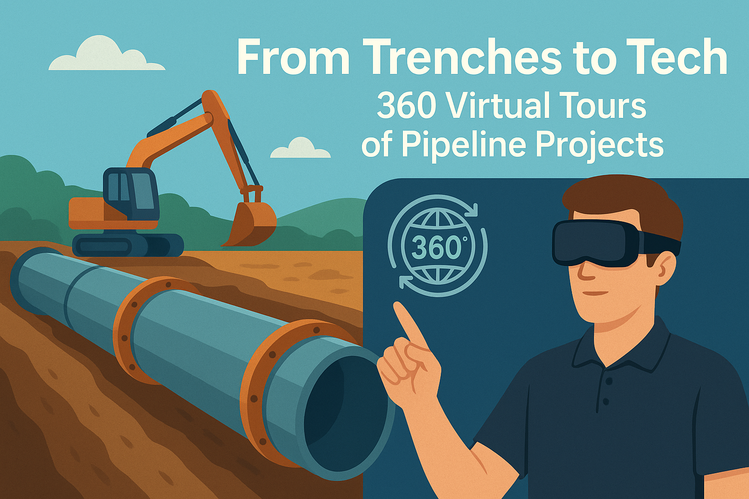
The oil and gas industry is evolving at a rapid pace, with digital transformation revolutionizing every stage of operations. One of the most exciting developments? The use of immersive 360° virtual tours to map, monitor, and manage pipeline construction projects. From trench excavation to final installation, this technology brings clarity, speed, and precision to the table. 📈💻

Whether you're a pipeline project manager, EPC contractor, or HSE officer, leveraging virtual tours is quickly becoming essential to improving efficiency and minimizing costly surprises.

Why Traditional Pipeline Monitoring Falls Short 📝❌

Pipeline construction is complex — involving multiple crews, regulators, environmental constraints, and critical safety checks. Traditionally, project updates relied on:

  • Static photos and drone flyovers 📷
  • Weekly site reports 📊
  • Occasional in-person inspections 🧍‍♂️

But these methods are time-consuming, disconnected, and often outdated by the time they're shared.

Enter 360° virtual tours.

By capturing every angle of the job site in high-definition, you can provide stakeholders with an interactive, navigable, real-time view of progress. No more guessing — just clarity. 🔍🌐

How 360 Virtual Tours Work for Pipeline Projects 🛠️🎥

With a 360 camera and software like CloudPano or similar, contractors can:

  1. Walk the pipeline route and capture stitched 360 scenes at regular intervals
  2. Upload the scenes to a secure platform
  3. Create an interactive timeline of the pipeline’s progression
  4. Share the link with stakeholders for review and markup

This is especially helpful in remote locations, where travel is expensive and inspection time is limited.

Key Benefits of 360° Pipeline Documentation ✅📅

🔍 Better Progress Tracking

Instead of waiting for weekly updates, project managers can view the job site daily — down to the trench depth, weld line, and valve placement.

🤝 Improve Collaboration

Multiple teams can annotate, comment, and share views inside the tour. Field teams, engineers, and execs stay aligned.

🧠 Historical Jobsite Records

360 tours serve as a living archive of your pipeline project. Perfect for audits, insurance claims, and warranty discussions.

From Dirt to Digital: Real Examples of Pipeline Use Cases 🛣️📲

Let’s take a real-world walkthrough:

1. Pre-Construction Route Survey

Use a 360 tour to document terrain, easements, and environmental features before any equipment arrives. This saves on unexpected clearance issues and helps during permit reviews.

💡 Pro Tip: Combine your virtual tour with GIS mapping for maximum visibility.

2. Active Construction Phase

As trenches are dug and pipe sections laid, capture the exact layout with time-stamped 360 images. Identify problems early, such as misalignments or soil instability.

3. Inspection & Pressure Testing

Use virtual walkthroughs to confirm pipeline bedding, joint inspections, and pressure test equipment placements. Compliance teams love having this level of detail archived. 🧪

Use 360 Tours to Improve Regulatory Compliance 📋✅

Pipeline projects are heavily regulated. You need clean records of:

  • Weld joints and inspections
  • Environmental protection measures
  • HDD bore paths and crossings
  • Restoration and backfill documentation

360 tours make this simple. Regulators can log in and virtually walk the ROW (Right of Way) without setting foot on-site.

This minimizes delays and streamlines approvals. 🔄

Need an onboarding system for new crews too? Don’t miss 👉 Oil Rig Onboarding Simplified With Interactive Virtual Tours

Remote Stakeholder Visibility Is Now Expected 🌍👷‍♀️

Today's pipeline clients, investors, and engineers want instant access to what's happening on the ground — without physically flying in.

With virtual tours:

  • Investors can monitor milestones
  • Engineers can approve layout changes
  • Safety officers can log hazards from anywhere

No Zoom call can compete with this level of spatial awareness.

Thinking bigger? Explore 👉 Oil & Gas Pipeline Projects Go Digital With Immersive Virtual Tours

How to Get Started with 360 Tours for Pipeline Construction 🚀🎬

Getting started is easier than you think:

  1. Choose a 360 camera (Insta360, Ricoh Theta, GoPro Max)
  2. Use software like CloudPano to upload and create tours
  3. Train field teams to capture consistently during key milestones
  4. Create shared links to distribute to stakeholders

You’ll instantly reduce confusion, boost transparency, and provide a professional experience that sets your company apart.

Final Thoughts: The New Era of Pipeline Project Oversight 📡🌐

The oil and gas industry has always been about moving energy across long distances. Now it’s time to move information just as efficiently.

From trenches to tech, virtual tours are the smart way to document, review, and share pipeline progress. They're cost-effective, easy to deploy, and bring your entire team into the field — virtually.

👷‍♂️💡 Start turning your construction sites into interactive workspaces today.

Want a Demo of 360 Tours for Your Pipeline Project? 🎥

Book a live tour or get started free at CloudPano.com

Share this post
Cloudpano

Choose The Right 360° Camera

Insta360 ONE RS 1-Inch 360 Edition

  • Compact, ready to go anywhere

  • Interchangeable lens that’s upgradeable

  • Dual 1-inch sensors for improved clarity and low light performance

  • Dynamic range and 6K 360° capture

  • 360° photo resolution at 21MP

Learn More

Insta360 X4

  • 8K 360° video recording for ultra-detailed visuals.

  • 4K single-lens mode for traditional wide-angle shots.

  • Invisible selfie stick effect for drone-like perspectives.

  • 2.5-inch touchscreen with Gorilla Glass protection.

  • Waterproof up to 33ft for underwater shooting.

Learn More

Ricoh Theta Z1

  • 360° photo resolution in 23MP

  • Slim design at 24 mm thick

  • Built-in image stabilization for smooth video capture.

  • Internal 19GB storage for photo and video storage.

  • Wireless connectivity for remote control and sharing.

Learn More

Ricoh Theta X

  • 60MP 360° still images for high-resolution photography.

  • 5.7K 360° video recording at 30fps.

  • 2.25-inch touchscreen for intuitive control.

  • USB Type-C port for fast charging and data transfer.

  • MicroSD card slot for expandable storage.

Learn More
Property Marketing
Allows potential buyers to explore properties in detail from anywhere, enhancing the real estate marketing process.
Automotive Spins
Create an interactive virtual showroom and engage affluent digital buyers with live 360º video calls, all through the CloudPano mobile app for a complete automotive sales solution.
Interactive Floor Plans
Create 2D and 3D floor plans with measurements in 4 minutes or less, all from your phone. Download the Floor Plan Scanner app and get your first scan free.

360 Virtual Tours With CloudPano.com. Get Started Today.

Try it free. No credit card required. Instant set-up.

Try it free
Latest posts

See our other posts

Interviews, tips, guides, industry best practices, and news.

Mastering Compliance: The Future of Automated Property Video

This article provides a definitive guide for real estate professionals on navigating strict MLS branding regulations through AI-driven automation. It addresses the risks of compliance violations, details the limitations of manual editing workflows, and introduces a scalable, "compliance-first" system for generating high-quality, MLS-approved property videos. The post serves as a strategic blueprint for agents aiming to maintain listing visibility, avoid regulatory penalties, and streamline their marketing operations.
Read post

Future-Proofing Your Business with MLS Safe AI Video for Listings

This high-authority guide focuses on long-term operational stability and the strategic advantages of leveraging artificial intelligence to bypass the industry-wide friction between high-impact marketing and regulatory compliance. Key Takeaways & Content Structure: The Reputation-Risk Factor: Explains the high cost of compliance errors, focusing on how a single technical oversight—such as a misplaced logo or branded watermark—can trigger a systemic board audit, leading to immediate listing suspension and lasting reputational damage with sellers. The Production Disconnect: Breaks down the "two-version" operational tax, where marketing teams suffer from repetitive rendering, file-management bloat, and the persistent danger of human error when manually managing branded vs. unbranded media assets. AI as a Compliance Engine: Defines how advanced AI media platforms move beyond mere aesthetics to function as regulatory safeguards. It illustrates the technical architecture where the AI engine isolates branding data from structural property data at the rendering level, effectively "forking" the output into two distinct, safe-to-use tracks. Operational Blueprint: Maps out a transparent, 6-step automation funnel that takes a listing from flat photograph ingestion to syndicate-ready, neutral-hosted media in minutes. Strategic Scalability: Demonstrates why centralizing production into a single SaaS platform is the only way for growing brokerages to maintain consistency, remove contractor-level liability, and recover significant administrative time. The PhotoAIVideo.com Edge: Concludes by positioning the platform as a purpose-built solution that combines high-definition parallax AI motion with an automated "compliance-first" export workflow, ensuring Realtors can generate professional, engaging video content that passes even the most stringent board audits on the first attempt.
Read post

Streamlining Your Workflow with a Specialized MLS Compliant Real Estate Media App

This article functions as a tactical operations guide for real estate marketers and brokerage leaders focused on reducing technical friction and human error in their media publishing pipeline. Key Takeaways & Content Structure: The "Stop-Work" Order: Addresses the high-stakes reality of MLS compliance flags, where automated rules block properties from IDX feeds due to accidental branding, causing immediate listing velocity loss. The Fragmented Workflow Problem: Identifies the "manual bottleneck"—the inefficiency of having field photographers deliver single assets that then require internal staff to manually strip, re-render, and verify separate branded and unbranded versions. Architecture of Dual-Path Rendering: Illustrates the technological shift toward programmatic asset management. It explains how a modern app processes a single source file into two isolated rendering tracks: a lead-gen-heavy marketing track and a strictly compliant, unbranded track for MLS syndication. Operational Workflow Mapping: Provides a clear, 6-step blueprint for moving from raw photography ingestion to compliant deployment, including automated motion application, metadata scrubbing, and neutral link hosting. Risk Mitigation for Brokerages: Highlights how centralized management dashboards eliminate the "wild west" of agent-led media creation, providing brokers with a single-pane-of-glass view to ensure compliance across all active listings. The PhotoAIVideo.com Advantage: Positions the platform as the ideal MLS compliant real estate media app that leverages AI to inject cinematic motion into flat listing photos, effectively automating the entire compliance-forking process and increasing overall production capacity by up to 94%.
Read post