.png)

If you’re a 360° photographer, virtual tour creator, or marketing pro who wants to upload content directly to Google Maps, this guide is for you. 💼 Join now and discover how to earn with Google Street View virtual tours!
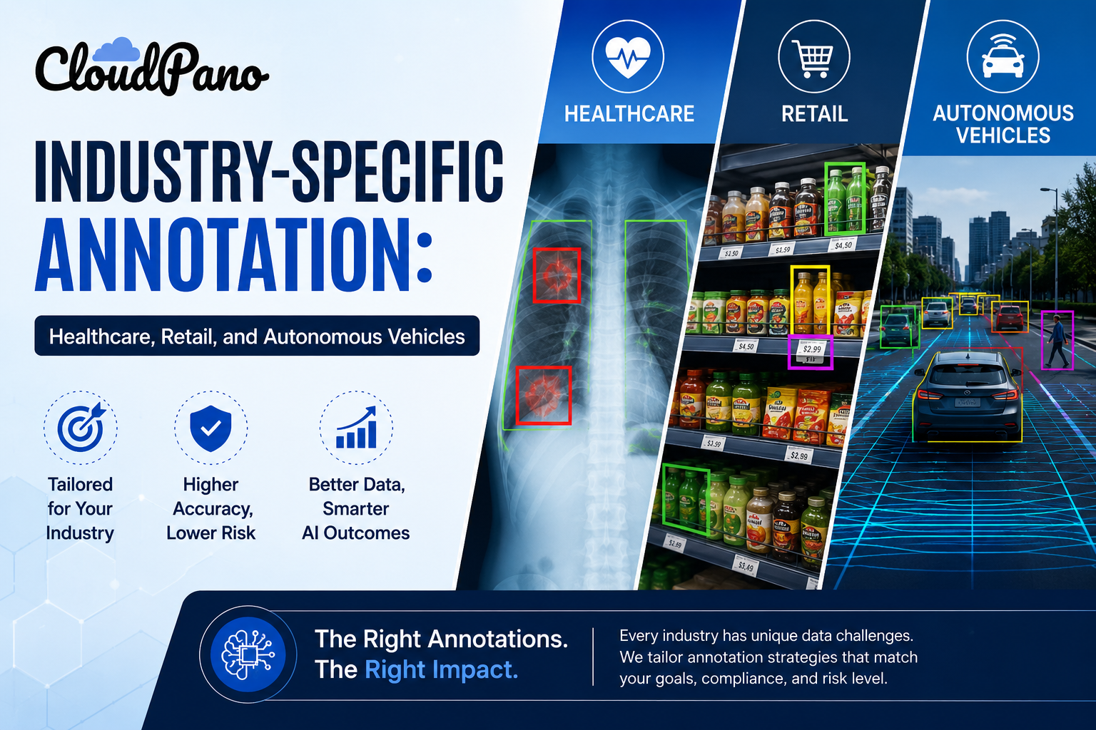
Publishing high-quality imagery to Google Street View helps businesses stand out, improves local SEO visibility, and allows customers to “step inside” before visiting. But with so many tools on the market, choosing the right one can be confusing. With a real estate video app, agents can quickly produce professional listing videos that attract more buyers.
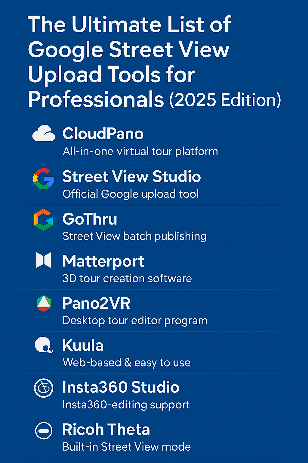
So here it is — the ultimate list of Google Street View upload tools for professionals in 2025. 📸✨
We’ll cover everything from simple upload platforms to enterprise-level software designed for 360° pros.
Before we dive in, let’s get clear on why Street View uploads matter in the first place.
✅ Boost visibility: Businesses with immersive 360° tours attract more attention on Google Maps and Search.
✅ Increase engagement: Viewers spend longer exploring listings that include virtual tours.
✅ Build trust: Transparency through visual experiences drives more conversions.
✅ Improve local SEO: Google prioritizes listings that include verified imagery.
Whether you’re showcasing a café, real estate property, or an entire resort, Street View publishing gives you a powerful marketing edge.
Read: Google Maps and Street View for Local SEO: Tips That Actually Work
If you’re serious about growing your business with 360° tours, CloudPano is the gold standard. 🌟
CloudPano lets you create, host, and publish virtual tours — then connect them directly to Google Street View with a single click.
For professionals, CloudPano isn’t just an upload tool — it’s a complete virtual tour business platform.
💡 Best For: Real estate photographers, agencies, property managers, and anyone selling 360° services.
Street View Studio is Google’s in-house platform for uploading and managing 360° content. It’s completely free and works directly in your browser.
It’s designed for contributors, organizations, and mapping enthusiasts who want to add imagery to the Street View layer of Google Maps.
It’s a fantastic tool for mappers or hobbyists who want visibility on Google — but it doesn’t include branding or customization options.
💡 Best For: Public contributors, non-commercial creators, or anyone documenting outdoor environments.
If you’re managing lots of Google Street View projects each month, GoThru is a lifesaver.
This platform is specifically built for Street View Trusted Photographers and agencies that need efficient workflows.
GoThru bridges the gap between technical mapping tools and polished business solutions.
💡 Best For: Certified Google Street View photographers, agencies, and advanced users managing bulk uploads.
When it comes to realistic 3D spaces, Matterport is in a league of its own. 🏗️
Matterport creates 3D digital twins of real spaces using LiDAR-based capture and advanced rendering. Its integration with Google Street View allows you to export virtual tours directly to Maps.
Matterport is ideal for real estate, architecture, and hospitality — where the wow-factor of realism matters most.
💡 Best For: Real estate agents, developers, architects, and premium-brand marketers.
Pano2VR is desktop software built for creators who want full control over their virtual tours before publishing.
While it’s not a cloud platform, it offers an in-depth Google Street View exporter, allowing you to precisely control metadata, image linking, and map positioning.
For users who love total precision and aren’t afraid of complexity, Pano2VR is an absolute powerhouse.
💡 Best For: Developers, technical creators, or agencies with complex project requirements.
Kuula is a web-based platform known for its gorgeous virtual tour design and effortless usability.
While its main focus isn’t on Google Maps publishing, you can export your panoramas and upload them manually through Street View Studio.
Kuula doesn’t directly integrate with Street View yet, but it’s a great choice for creatives who value design.
💡 Best For: Designers, educators, or storytellers who prioritize aesthetics over automation.
If you shoot with Insta360 cameras, this free software is a must.
Insta360 Studio lets you edit, stabilize, and export 360° videos or photos ready for Google Street View upload.
It’s simple, efficient, and perfect for creators using the Insta360 ecosystem.
💡 Best For: Content creators capturing Street View imagery with Insta360 ONE RS, X3, or Pro 2 cameras.
For advanced users or companies wanting to build their own upload systems, Google offers the Street View Publish API.
This interface allows apps and software to upload imagery directly to Street View — with full control over geolocation, privacy settings, and linking.
It’s not for beginners — but for software developers or tech-savvy pros, it’s the ultimate flexibility.
💡 Best For: Developers, startups, or platforms building their own Street View integration tools.
The Ricoh Theta Z1 and Theta X remain two of the most popular professional 360° cameras.
Ricoh offers a built-in Street View mode that lets you upload directly from the camera or via the Theta app.
This workflow is perfect for professionals who want to minimize editing and speed up delivery.
💡 Best For: Real estate, car dealerships, hotels, and any on-site 360° capture professionals.
Panoskin is another great option for photographers focused on local business tours. It integrates with the Google Street View ecosystem and adds marketing tools for agencies.
It’s part of the LCP360 family, a company that’s been creating immersive content for Google since the early days of Street View.
💡 Best For: Agencies managing large numbers of local business clients.
Read: Google Street View + Maps: A Hidden Lead Generation Engine for Local Businesses
These aren’t direct Street View upload tools, but they complement your 360° workflow — helping you monetize your tours and scale your business.
Uploading to Google Street View is more than a technical step — it’s a growth opportunity for creators and businesses alike.
The right tool depends on your goals:
Whatever you choose, make sure your 360° workflow is fast, optimized, and connected — because in 2025, visibility on Google Maps is visibility to the world. 🌍📸

Compact, ready to go anywhere
Interchangeable lens that’s upgradeable
Dual 1-inch sensors for improved clarity and low light performance
Dynamic range and 6K 360° capture
360° photo resolution at 21MP

8K 360° video recording for ultra-detailed visuals.
4K single-lens mode for traditional wide-angle shots.
Invisible selfie stick effect for drone-like perspectives.
2.5-inch touchscreen with Gorilla Glass protection.
Waterproof up to 33ft for underwater shooting.

360° photo resolution in 23MP
Slim design at 24 mm thick
Built-in image stabilization for smooth video capture.
Internal 19GB storage for photo and video storage.
Wireless connectivity for remote control and sharing.

60MP 360° still images for high-resolution photography.
5.7K 360° video recording at 30fps.
2.25-inch touchscreen for intuitive control.
USB Type-C port for fast charging and data transfer.
MicroSD card slot for expandable storage.
.png)
.png)

Try it free. No credit card required. Instant set-up.