Drone Mapping and Surveying: How Profitable Is It Really?

Cloudpano
January 7, 2026
5 min read
Share this post

Drone Mapping and Surveying: How Profitable Is It Really? 🚁📍

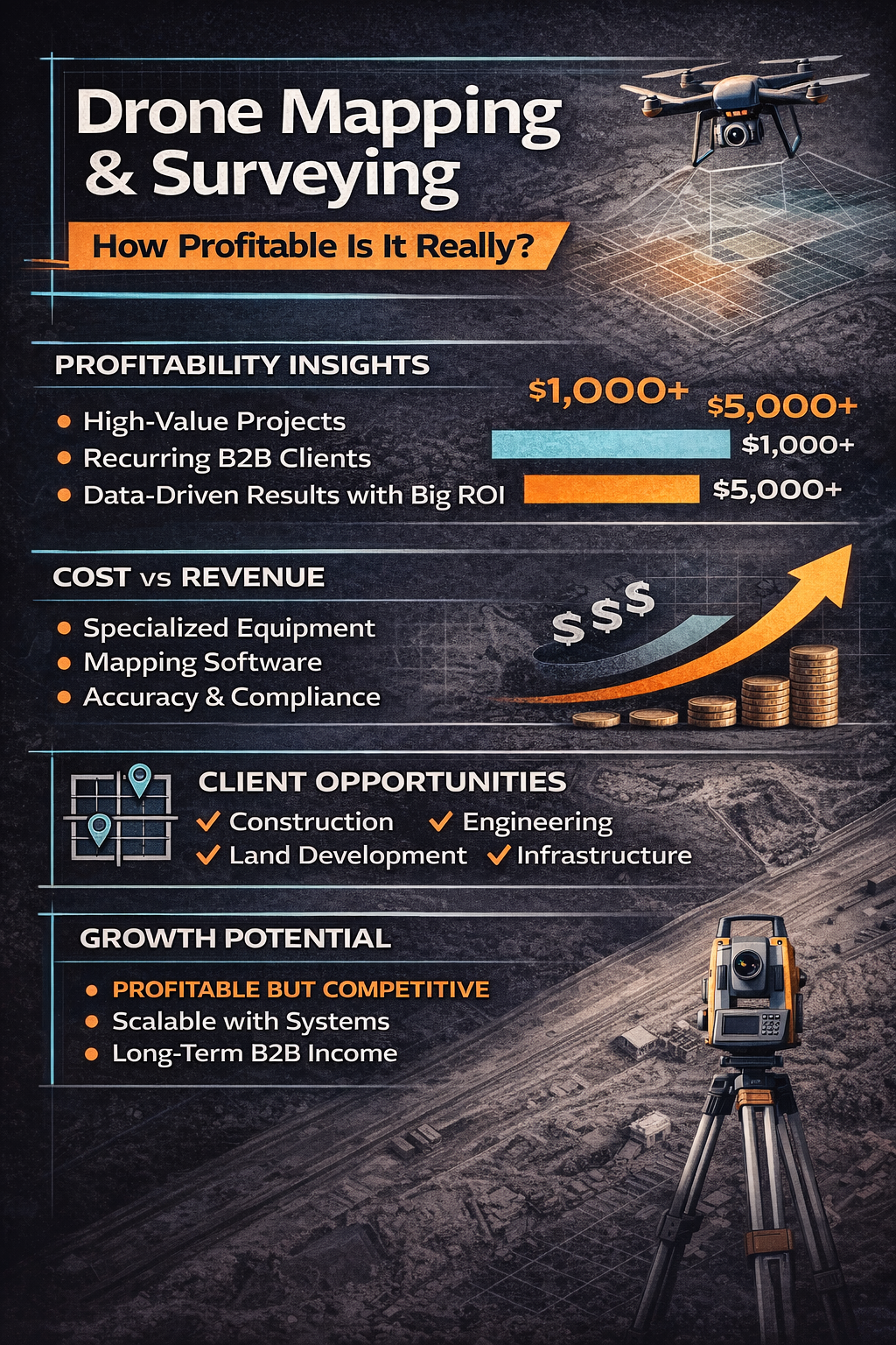
Drone mapping and surveying is often described as one of the most lucrative applications in the drone industry. Between construction sites, land development, agriculture, and infrastructure projects, the demand for aerial data continues to grow.

But the real question most pilots ask before investing time, money, or training is simple:

How profitable is drone mapping and surveying—really?

In this guide, we’ll break down the real earning potential, business realities, and what separates a profitable drone business from one that struggles to gain traction. If you’re looking to make money with a drone beyond photography and video, this drone business guide will give you clarity without hype.

What Is Drone Mapping and Surveying? 🧭

Drone mapping and surveying involves capturing aerial data and converting it into measurable outputs such as:

  • Orthomosaic maps
  • 2D and 3D models
  • Elevation data
  • Volume measurements
  • Site progress documentation

These deliverables are used by professionals who need accuracy, efficiency, and repeatable data, not just visuals.

Industries that rely on drone mapping include:

  • Construction and development
  • Engineering and surveying firms
  • Agriculture and land management
  • Mining and materials
  • Infrastructure and utilities

This is where mapping differs from creative drone work—it’s a data-driven drone services business, not a visual one.

Why Drone Mapping Has a Reputation for High Profit 💰

Drone mapping is often seen as more profitable than traditional drone photography because it:

  • Solves operational problems
  • Replaces slower or riskier manual methods
  • Saves clients time and labor costs
  • Produces repeatable, measurable value

Businesses don’t hire mapping pilots for “cool footage.” They hire them to reduce risk, increase efficiency, and support decision-making.

That’s an important distinction if your goal is to build a profitable drone business instead of chasing one-off gigs.

How Drone Mapping Makes Money (In Practice) 📈

Drone mapping becomes profitable when it is positioned as a professional service, not a technical hobby.

Mapping services are typically sold based on:

  • Project scope
  • Site size or complexity
  • Data accuracy requirements
  • Frequency of updates
  • Business impact

Most successful operators do not charge by flight time. They charge based on deliverables and outcomes, which is a core principle of every scalable drone services business.

Typical Revenue Ranges (Realistic, Not Hype) ⚖️

Drone mapping can generate strong revenue, but income varies widely depending on focus, clients, and systems.

Common income scenarios include:

  • Entry-level operators handling small sites or one-off jobs
  • Specialized operators serving construction or engineering clients
  • Advanced operators offering recurring mapping or progress tracking

The biggest difference between low and high earners is not equipment—it’s client type, pricing structure, and repeat work.

Mapping supports higher pricing because accuracy and reliability matter more than aesthetics.

What Makes Drone Mapping Profitable (And What Doesn’t) 🎯

Not every mapping pilot makes good money. The difference between success and frustration usually comes down to fundamentals.

Profitable drone mapping businesses focus on:

  • One or two industries, not everyone
  • Clear deliverables, not vague “data capture”
  • Repeatable workflows
  • Business clients, not consumers

Struggling operators often:

  • Undercut pricing to win jobs
  • Buy expensive equipment before landing clients
  • Offer mapping without understanding client use cases
  • Treat mapping like photography with extra steps

Mapping is a business tool, not a creative service. Treating it that way changes profitability.

Industries Where Drone Mapping Performs Best 🏗️🌾

Some industries consistently produce better results for pilots looking to make money with a drone long-term.

Construction and Development

Construction sites need:

  • Progress documentation
  • Volume measurements
  • Site planning support
  • Consistent updates

This creates recurring demand, which is the backbone of any profitable drone services business.

Agriculture and Land Management

Farmers and land managers use mapping to:

  • Monitor crop health
  • Identify drainage or erosion issues
  • Improve planning decisions

While pricing may vary by region, repeat work is common.

Mining, Materials, and Aggregates

These clients value:

  • Accuracy
  • Safety improvements
  • Volume calculations

Fewer clients exist, but contracts tend to be higher value.

Infrastructure and Utilities

Mapping supports:

  • Inspections
  • Planning
  • Compliance documentation

These projects often require professionalism, insurance, and reliability—factors that justify higher pricing.

Equipment and Software: Cost vs Return ⚙️

Drone mapping does require more than a basic camera drone, but profitability does not come from buying the most expensive gear.

Smart operators:

  • Start with capable but cost-effective equipment
  • Invest in software only after landing clients
  • Match tools to real client needs

Buying advanced sensors without revenue is one of the fastest ways to kill profit early.

In a profitable drone business, revenue justifies upgrades—not the other way around.

Licensing, Accuracy, and Expectations 📋

Drone mapping often comes with higher expectations than creative work.

Clients expect:

  • Consistency
  • Clear deliverables
  • Professional documentation
  • Legal compliance

You must operate legally and ethically, especially when working near construction sites or sensitive infrastructure.

Trust and professionalism are major profit drivers in this space.

Pricing Drone Mapping Services Correctly 💡

Pricing is where most drone mapping businesses succeed—or fail.

Common pricing mistakes include:

  • Charging per flight
  • Competing with hobbyists
  • Discounting too early
  • Not accounting for prep, processing, and delivery

Mapping should be priced based on:

  • Scope of work
  • Data complexity
  • Turnaround time
  • Business impact

Clients are paying for clarity, accuracy, and reduced risk, not airtime.

This mindset is essential if you want to make money with a drone consistently.

Why Recurring Work Changes Everything 🔁

One-off mapping jobs can be profitable, but recurring services are what create stability.

Recurring opportunities include:

  • Weekly or monthly site updates
  • Long-term construction projects
  • Seasonal agricultural monitoring
  • Ongoing land development

Recurring work:

  • Reduces sales pressure
  • Improves cash flow
  • Increases lifetime client value

Every scalable drone services business eventually shifts toward repeatable income.

Common Mistakes That Limit Profit ⚠️

Many pilots struggle with drone mapping not because demand is low, but because strategy is weak.

Profit-killing mistakes include:

  • Trying to serve too many industries
  • Overspending on gear early
  • Failing to explain value clearly
  • Pricing based on fear instead of outcomes
  • Treating mapping as a technical service instead of a business solution

The most profitable operators think like consultants, not pilots.

Is Drone Mapping Saturated? 🚦

Drone mapping is not saturated, but it is selective.

Clients don’t hire dozens of mapping providers. They hire one or two they trust.

This creates opportunity for operators who:

  • Communicate clearly
  • Deliver consistently
  • Understand client goals
  • Operate professionally

You don’t need hundreds of clients. You need the right ones.

Can Drone Mapping Replace a Full-Time Income? 🏆

Yes—but not instantly, and not accidentally.

Operators who replace full-time income typically:

  • Specialize in a specific niche
  • Build relationships, not transactions
  • Price for value
  • Offer repeatable services
  • Invest in systems

Mapping rewards focus and professionalism far more than hustle.

Long-Term Outlook for Drone Mapping 🔮

Drone mapping demand continues to grow because:

  • Construction timelines are tightening
  • Safety regulations favor remote data capture
  • Businesses want faster insights
  • Visual documentation is becoming standard

The industry rewards operators who treat mapping as a business, not a side project.

Don’t Miss These Articles:

Final Verdict: Is Drone Mapping Really Profitable? 🧠

Drone mapping can be highly profitable, but only when approached correctly.

It is not:

❌ Easy money
❌ A shortcut to fast riches
❌ Guaranteed without effort

But it is:

✅ One of the strongest high-value drone services
✅ Well-suited for recurring income
✅ Ideal for business-focused operators

If your goal is to build a profitable drone business, drone mapping and surveying can be a powerful path—when paired with the right strategy.

Final Thoughts: Think Like a Business Owner 🏁

Drone mapping isn’t about flying better—it’s about solving problems better.

If you want to:

  • Make money with a drone
  • Build a scalable drone services business
  • Create long-term income

Then focus on:

  • Value, not flight time
  • Clients, not gear
  • Systems, not hustle

🚁 The drone is the tool.
💼 The business model is what creates profit.

When mapping is positioned correctly, profitability follows.

🚀 Your All-In-One Virtual Experience Stack Starts Here

Share this post
Cloudpano

Choose The Right 360° Camera

Insta360 ONE RS 1-Inch 360 Edition

  • Compact, ready to go anywhere

  • Interchangeable lens that’s upgradeable

  • Dual 1-inch sensors for improved clarity and low light performance

  • Dynamic range and 6K 360° capture

  • 360° photo resolution at 21MP

Learn More

Insta360 X4

  • 8K 360° video recording for ultra-detailed visuals.

  • 4K single-lens mode for traditional wide-angle shots.

  • Invisible selfie stick effect for drone-like perspectives.

  • 2.5-inch touchscreen with Gorilla Glass protection.

  • Waterproof up to 33ft for underwater shooting.

Learn More

Ricoh Theta Z1

  • 360° photo resolution in 23MP

  • Slim design at 24 mm thick

  • Built-in image stabilization for smooth video capture.

  • Internal 19GB storage for photo and video storage.

  • Wireless connectivity for remote control and sharing.

Learn More

Ricoh Theta X

  • 60MP 360° still images for high-resolution photography.

  • 5.7K 360° video recording at 30fps.

  • 2.25-inch touchscreen for intuitive control.

  • USB Type-C port for fast charging and data transfer.

  • MicroSD card slot for expandable storage.

Learn More
Property Marketing
Allows potential buyers to explore properties in detail from anywhere, enhancing the real estate marketing process.
Automotive Spins
Create an interactive virtual showroom and engage affluent digital buyers with live 360º video calls, all through the CloudPano mobile app for a complete automotive sales solution.
Interactive Floor Plans
Create 2D and 3D floor plans with measurements in 4 minutes or less, all from your phone. Download the Floor Plan Scanner app and get your first scan free.

360 Virtual Tours With CloudPano.com. Get Started Today.

Try it free. No credit card required. Instant set-up.

Try it free
Latest posts

See our other posts

Interviews, tips, guides, industry best practices, and news.

Property Manager Video Hub: Scaling Rental Visibility with AI Photo-to-Video Workflows

This article explains how property managers can use PhotoAIVideo to build a property manager video hub: a repeatable system for turning rental photos, amenity images, floor plans, exterior shots, and neighborhood visuals into reusable rental marketing videos. The main idea is that property managers do not just need more listing exposure. They need clearer visual answers that help renters decide whether to schedule a tour. PhotoAIVideo is positioned as a practical tool for creating: Unit availability videos Amenity highlight videos Neighborhood videos Tour reminder clips Leasing follow-up videos Owner marketing proof videos Social media rental teasers Application or availability reminder videos Key takeaways: Property managers already have the media they need; the challenge is organizing it and turning it into reusable video assets. A video hub helps teams create consistent videos across units, floor plans, amenities, communities, and owner updates. Rental videos can reduce friction by answering renter questions about layout, condition, amenities, parking, pet features, and community feel. One rental photo set can become multiple video outputs for listings, social media, email, text follow-up, tour reminders, and owner reporting. Photographers can sell AI rental video packages to property managers as an upsell. Brokerages with property management divisions can use the same workflow to standardize leasing content. The article ends with a step-by-step process, video hub framework, mistakes to avoid, visual recommendations, FAQs, and a CTA encouraging readers to use PhotoAIVideo to turn rental photos into a scalable video system for rental visibility.
Read post

YouTube Shorts Listing Teasers: The 3-Scene Structure for Higher Property Clicks

This article explains how real estate agents, photographers, brokerages, and property managers can use YouTube Shorts listing teasers to drive more property clicks and showing requests. The main idea is that a YouTube Short should not try to show the entire house. Instead, it should use a simple 3-scene structure: Scene 1: Hook — stop the scroll with the strongest property feature. Scene 2: Proof — show the visuals that support the hook. Scene 3: Click Path — tell the viewer what to do next. The article positions PhotoAIVideo as a practical tool for turning listing photos into short vertical videos for YouTube Shorts, Reels, open house promotion, and listing campaigns. Key takeaways: YouTube Shorts should create curiosity, not replace the full listing video. The strongest property feature should appear first, not necessarily the front exterior. Agents should build each Short around one click reason, such as backyard, kitchen, layout, neighborhood, open house, or price point. One listing can become multiple Shorts instead of one generic video. Photographers can offer YouTube Shorts teaser packs as a video upsell. Brokerages can standardize the 3-scene structure across agents. Property managers can use the same structure to promote rentals and tours. The article ends with practical scripts, visual recommendations, FAQs, a visual placement guide, and a CTA encouraging readers to use PhotoAIVideo to create YouTube Shorts listing teasers from property photos.
Read post

Video Retargeting for Listings: Turning Photo-Based AI Videos into Appointment Follow-Up

This article explains how Realtors, photographers, brokerages, and property managers can use photo-based AI videos as follow-up assets after someone shows interest in a listing. The main idea is that most real estate marketing focuses on getting the first click, but many buyers and sellers need multiple touchpoints before booking a showing or appointment. Video retargeting helps agents re-engage people who already clicked a listing, watched a Reel, opened an email, attended an open house, asked about a property, or went quiet after showing interest. PhotoAIVideo is positioned as a practical tool for turning listing photos into short follow-up videos, including: Feature reminder videos Layout explainer videos Neighborhood fit videos Open house recap videos Price update videos Seller proof videos Showing request videos Rental tour recovery videos Key takeaways: A first-touch listing video introduces the property, while a retargeting video answers the next likely question. Follow-up videos should be short, usually 10–30 seconds, and focused on one action. Agents should send different videos based on behavior, such as email clicks, open house attendance, listing views, or showing interest. A good video follow-up feels helpful, not pushy. Photographers can package retargeting video clips as an upsell. Brokerages can standardize video retargeting workflows across agents. Property managers can use the same strategy to recover rental leads and book tours. The article ends with a simple retargeting sequence, visual recommendations, FAQs, and a CTA encouraging readers to use PhotoAIVideo to turn listing photos into appointment-driving follow-up videos.
Read post