Construction Drone Training: Certified Course for Surveying and Site Monitoring

Cloudpano
December 2, 2025
5 min read
Share this post

Construction Drone Training: Certified Course for Surveying and Site Monitoring 🚀

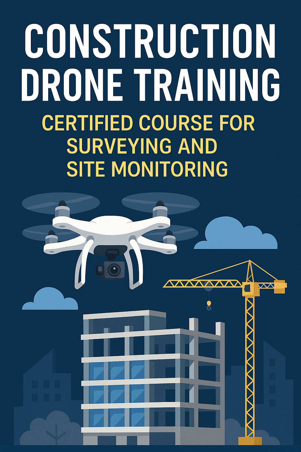
The construction world is changing fast—and drones are leading the transformation. Today, builders, engineers, and developers rely on drone technology for aerial construction surveys, progress reports, structural inspections, and real-time monitoring. As demand explodes, trained pilots with certified drone training are becoming some of the most in-demand professionals in the field.

Whether you're expanding drone services for real estate, growing a real estate drone photography business, or launching a drone roof inspections business, earning your certification unlocks massive opportunities. The construction sector needs skilled pilots who can deliver accurate data, safely operate on complex job sites, and support multimillion-dollar projects with confidence.

This guide breaks down everything you need to know about construction drone training, equipment, certification steps, and how to turn your training into a profitable business.

Why Construction Drone Training Is Essential 🏗️

Drone adoption in construction isn’t slowing down—it’s accelerating. Here’s why professional training is no longer optional.

Safer Work Sites 🦺

Construction zones can be dangerous. Instead of placing workers on unstable surfaces or elevated structures, site monitoring drones can capture data without risking injuries.

Faster Surveying & Progress Tracking ⚡

Traditional surveying methods can take hours or days. With drones, teams can generate accurate maps, 3D models, and progress timelines in minutes.

Accurate Data for Project Management 📊

Developers rely on precise measurements to avoid delays and costly rework. Aerial construction surveys deliver:

  • Stockpile volume calculations
  • Terrain maps
  • Earthwork measurements
  • Elevation models
  • Phase-by-phase progress records

Compliance With FAA Regulations ✈️

To operate legally and professionally, pilots must meet FAA guidelines. A construction drone course ensures you're trained, certified, and ready for commercial operations.

Step-by-Step Construction Drone Training Overview 🎓

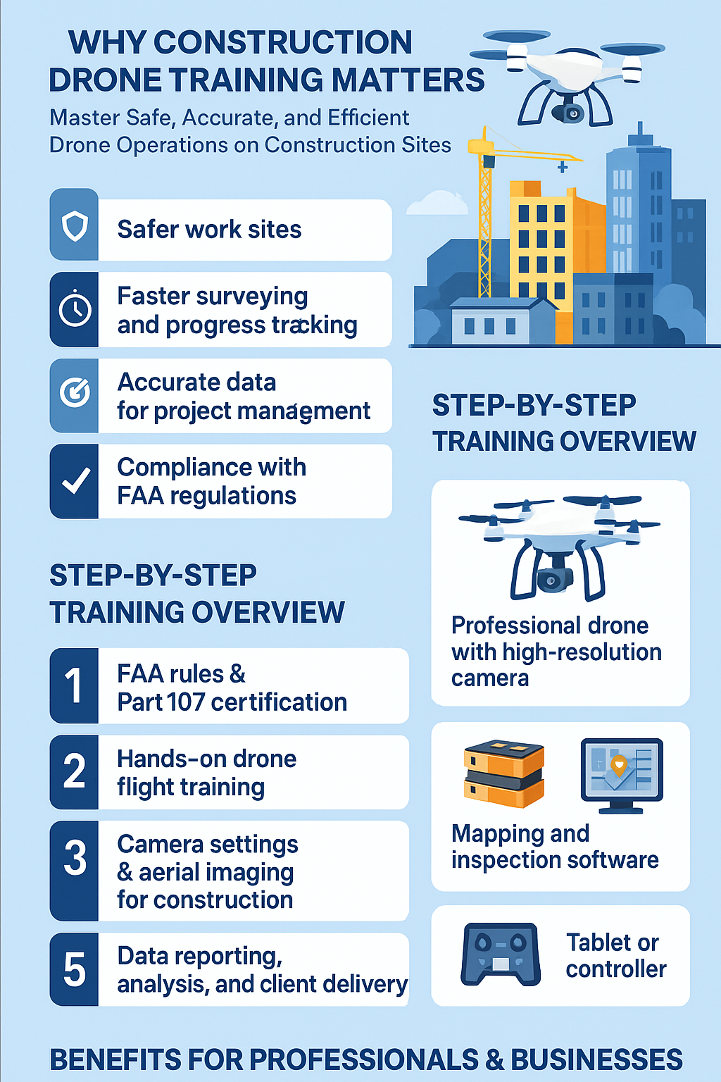
A professional training program ensures you understand airspace, flight operations, mapping, and data delivery from start to finish.

Step 1: FAA Rules & Part 107 Certification 📝

Every commercial drone pilot must pass the Part 107 exam. Training includes:

  • Airspace classes
  • Weather patterns
  • Emergency procedures
  • Operational rules
  • Crew resource management
  • Pre-flight protocols

This certification forms the foundation of your drone career.

Step 2: Hands-On Drone Flight Training 🕹️

You’ll learn how to fly in real work environments, mastering:

  • Manual and automated flight
  • Grid and waypoint missions
  • Altitude management
  • Orbit and tracking modes
  • Situational awareness on active job sites

Step 3: Camera Settings & Aerial Imaging for Construction 📷

Construction imaging is about clarity, precision, and measurable detail. Training covers:

  • Camera exposure settings
  • Proper shutter speed
  • Avoiding distortion
  • Capture angles for mapping
  • Oblique and nadir photography

These skills also strengthen your drone services for real estate work.

Step 4: Site Mapping & Monitoring Techniques 🌍

This is where drones shine. You’ll learn how to perform:

  • Orthomosaic mapping
  • 3D structure modeling
  • Digital Elevation Models (DEM/DTM)
  • Volumetrics for material measurement
  • Automated flight mission planning

Step 5: Data Reporting, Analysis & Client Delivery 💼

Professionals deliver insights—not just images.

You’ll learn to create:

  • Progress reports
  • Inspection summaries
  • Engineering-ready maps
  • Developer-friendly data presentations

This step sets you apart as a true expert.

Equipment Needed for Construction Drones 🛠️

To perform well in the field, you need the right gear. Here’s the essential equipment list.

Professional Drones With High-Resolution Cameras 🤖

Look for drones offering:

  • 20–48MP cameras
  • Mechanical shutters
  • RTK accuracy
  • Long flight time (30+ minutes)

Great models include:

  • DJI Mavic 3 Enterprise
  • DJI Matrice 300 RTK
  • Autel Evo II Dual Enterprise

Batteries & Flight Accessories 🔋

Construction missions require long flight days. Bring:

  • Extra batteries
  • Charging hub
  • Spare propellers
  • ND filters
  • Safety case

Mapping & Inspection Software 🖥️

Top platforms include:

  • DroneDeploy
  • Pix4D
  • RealityCapture
  • WebODM

These tools help convert raw images into high-accuracy models and maps.

Tablets or Smart Controllers 📱

A larger screen makes planning missions and reviewing progress significantly easier.

How Drone Training Benefits Construction & Real Estate Professionals 🧱🏡

Whether you're already in real estate or just starting out, construction drone skills create new revenue streams.

Expand Drone Services for Real Estate 🏘️

With certified skills, you can offer:

  • Land development overviews
  • Construction progress reports
  • Pre-construction aerial surveys
  • Property monitoring

This elevates your service offerings beyond standard listing photos.

Grow a Real Estate Drone Photography Business 📸

Construction surveying can become a high-ticket extension of your existing brand.

You move from:

  • Basic aerial photos
    to
  • Full-scale surveying and site monitoring services

This shift increases your earning potential dramatically.

Add Drone Roof Inspections Business Services 🏚️

With training, you can offer:

  • Storm damage assessments
  • Pre-purchase inspections
  • Insurance documentation
  • Commercial roof evaluations

This niche is in high demand and recurring year-round.

Starting a Drone Construction Services Business 📈

Once trained and certified, you can launch a profitable service business quickly.

Certifications & Licensing Required ✔️

You’ll need:

  • FAA Part 107 license
  • Liability insurance
  • Airspace waivers (when applicable)
  • Industry-specific safety training

Pricing Strategies 💰

Common pricing ranges:

  • Aerial maps: $300–$750 per mission
  • Monthly monitoring: $1,000–$5,000
  • Full-site surveys: $2,000–$10,000+
  • Inspections: $150–$450 per roof or structure

Construction clients typically offer long-term contract potential.

Marketing to Construction Companies & Developers 🧑‍💼

Target:

  • General contractors
  • Home builders
  • Civil engineers
  • Real estate developers
  • Property managers

Use outreach tools like:

  • Case study videos
  • Before/after project sequences
  • 3D model demos

Build a Strong Portfolio 📂

Include:

  • Orthomosaic maps
  • Elevation models
  • 3D renderings
  • Progress timelapse videos
  • Inspection reports

This is critical for winning big clients.

SEO & Marketing Tips for Drone Services 🔍

Marketing is where many pilots struggle. Here’s how to generate consistent leads.

Local SEO for Construction & Real Estate Clients 📍

Optimize pages around keywords like:

  • “construction drone survey services near me”
  • “drone services for inspections”
  • “drone roof inspections business”

Important local SEO actions:

  • Add geotagged photos
  • Publish case studies
  • Earn Google reviews

Video Marketing 🎥

Short videos showcasing missions or progress maps help build trust.

Examples:

  • Jobsite flight footage
  • 3D model walkthroughs
  • Before/after comparisons

Social Media Campaigns 📣

Top platforms for construction clients:

  • LinkedIn
  • Facebook groups
  • YouTube
  • Instagram Reels

Consistency builds authority.

Checklists & Best Practices 🧩

Equipment Checklist

  • Drone + backup drone
  • Batteries + hub
  • Smart controller/tablet
  • Mapping software
  • Safety vest & helmet

Pre-Flight Safety Checklist

  • Check NOTAMs
  • Review weather
  • Inspect propellers
  • Confirm GPS lock
  • Establish takeoff/landing zones

Site Inspection Workflow Checklist

  • Fly nadir grid
  • Capture oblique angles
  • Perform automated mapping missions
  • Upload data immediately
  • Send client-ready reports

Read:

Conclusion 🚀📢

Construction is one of the fastest-growing opportunities in the drone industry—and trained pilots are in high demand. With certified drone training, you can confidently offer drone services for inspections, aerial construction surveys, and progress monitoring that construction companies rely on every day.

Whether you're stepping into construction for the first time or expanding an existing real estate drone photography business, a construction drone course unlocks new revenue streams and long-term client relationships.

Your all-in-one virtual experience solution starts here.

Share this post
Cloudpano

Choose The Right 360° Camera

Insta360 ONE RS 1-Inch 360 Edition

  • Compact, ready to go anywhere

  • Interchangeable lens that’s upgradeable

  • Dual 1-inch sensors for improved clarity and low light performance

  • Dynamic range and 6K 360° capture

  • 360° photo resolution at 21MP

Learn More

Insta360 X4

  • 8K 360° video recording for ultra-detailed visuals.

  • 4K single-lens mode for traditional wide-angle shots.

  • Invisible selfie stick effect for drone-like perspectives.

  • 2.5-inch touchscreen with Gorilla Glass protection.

  • Waterproof up to 33ft for underwater shooting.

Learn More

Ricoh Theta Z1

  • 360° photo resolution in 23MP

  • Slim design at 24 mm thick

  • Built-in image stabilization for smooth video capture.

  • Internal 19GB storage for photo and video storage.

  • Wireless connectivity for remote control and sharing.

Learn More

Ricoh Theta X

  • 60MP 360° still images for high-resolution photography.

  • 5.7K 360° video recording at 30fps.

  • 2.25-inch touchscreen for intuitive control.

  • USB Type-C port for fast charging and data transfer.

  • MicroSD card slot for expandable storage.

Learn More
Property Marketing
Allows potential buyers to explore properties in detail from anywhere, enhancing the real estate marketing process.
Automotive Spins
Create an interactive virtual showroom and engage affluent digital buyers with live 360º video calls, all through the CloudPano mobile app for a complete automotive sales solution.
Interactive Floor Plans
Create 2D and 3D floor plans with measurements in 4 minutes or less, all from your phone. Download the Floor Plan Scanner app and get your first scan free.

360 Virtual Tours With CloudPano.com. Get Started Today.

Try it free. No credit card required. Instant set-up.

Try it free
Latest posts

See our other posts

Interviews, tips, guides, industry best practices, and news.

Construction Drone Training: Certified Course for Surveying and Site Monitoring

This in-depth guide explores how construction drone training prepares professionals to perform accurate aerial construction surveys, site monitoring, and inspection work. Readers learn why certified training is essential for safety, compliance, and data accuracy—plus how to expand into lucrative niches like drone services for real estate, a real estate drone photography business, or a drone roof inspections business. The post breaks down FAA certification, hands-on flight training, mapping techniques, required equipment, business opportunities, and proven SEO marketing strategies. It concludes with checklists, best practices, and a strong call to action encouraging readers to enroll in a construction drone course and begin offering high-value drone services for inspections.
Read post

Step-by-Step Training for Drone Roof Inspections: Safety and Certification Included

Drone roof inspections are transforming the real estate, roofing, and insurance industries by offering safer, faster, and highly accurate property assessments. This step-by-step guide walks readers through the complete training process required to perform professional aerial roof inspections—including FAA Part 107 certification, safe flight operations, camera techniques, roof mapping, and data reporting. The article also covers essential equipment, business startup tips, marketing strategies, and workflow checklists for new operators. Whether you're enhancing your real estate drone photography business or launching a dedicated drone roof inspections business, this training provides the foundation needed for success. Learn how certified drone training can help you expand your services, attract high-value clients, and build a profitable inspection career.
Read post

Professional Drone Course for Roof Inspections and Property Assessments

This in-depth guide explores the essentials of becoming a professional drone inspector for roof assessments and property evaluations. Readers will learn why drones are transforming safety, accuracy, and efficiency in the inspection industry—especially for real estate, insurance, and construction sectors. The article breaks down flight skills, mapping workflows, equipment requirements, reporting methods, and business strategies for launching or scaling a drone roof inspections business. It also highlights how drone services for real estate create new revenue opportunities and strengthen a real estate drone photography business. Whether you're a beginner or an experienced operator looking to expand into drone services for inspections, this guide shows you how to master the process and deliver premium results.
Read post