Bringing Blueprints to Life: Virtual Tours for Architecture and Design

Cloudpano
August 6, 2025
5 min read
Share this post

Bringing Blueprints to Life: Virtual Tours for Architecture and Design 🏗️✨

Imagine handing a client a set of blueprints — and watching their eyes glaze over. That’s because most people don’t “speak blueprint.” But what if you could show them exactly what the space will look like — before it’s built?

Thanks to virtual tours powered by 360° documentation tools, architects and designers are now doing just that.

In this post, you’ll learn how to turn your blueprints into immersive walkthroughs, how top firms are using 360° tools in every phase of the architecture process, and how to start offering this high-value experience to your own clients today.

🧱 Why Blueprints Alone Aren’t Enough Anymore

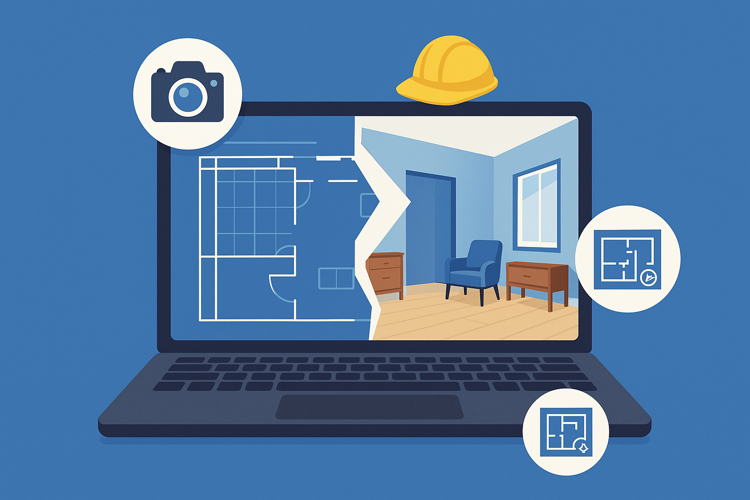
While blueprints and renderings are the foundation of any project, they often fall short in communicating spatial intent to clients, stakeholders, and contractors.

That’s where 360° virtual tours bridge the gap.

These immersive experiences let your audience:

  • “Walk through” a project before it's built
  • Explore layouts, flow, and functionality in real time
  • Provide feedback early — reducing costly redesigns

Want to explore how architects are using this right now? Read:
👉 Case Study: 360 Photo Documentation Software in Large-Scale Facility Maintenance

🎥 Virtual Tours Turn Plans into Reality

When you layer your blueprints and CAD models with real-world visuals, your clients don’t need to “imagine” — they see.

With 360° tours, you can:

  • Present design proposals with interactive context
  • Overlay proposed changes on existing conditions
  • Replace static PDF plans with dynamic walkthroughs

This transforms design reviews from confusing to crystal-clear — and builds trust at every phase.

See how this improves project buy-in:
👉 How 360 Virtual Tours Documentation Help Real Estate Developers Monitor and Present Site Progress

🚧 Real-World Construction Visibility

Architecture doesn’t end with the concept. During construction, staying aligned with on-site crews is critical.

With 360° site documentation, you can:

  • Track progress visually
  • Compare design vs. build conditions
  • Remotely inspect work and provide feedback

🛠️ Enhanced Coordination Across Teams

Forget back-and-forth email threads, misread floor plans, or confusing markups.

Using virtual tour links, you can:

  • Share site conditions with engineers, consultants, and contractors
  • Annotate key areas within the tour for clearer instructions
  • Keep everyone aligned — no site visit required

🛰️ Level Up With Drone + Floor Plan Integration

Want to take things to the next level? Combine your 360° virtual tours with:

  • 2D/3D floor plans 🧱
  • Drone-captured site maps 🛰️

This layered approach gives your team a full situational awareness — from overhead to eye-level.

✅ Top Use Cases for Virtual Tours in Architecture

1. Pre-Design Site Surveys

Capture the existing conditions in full 360° — no more incomplete site photos.

2. Client Concept Reviews

Help your clients “walk through” multiple design options — no guessing needed.

3. Design-Build Collaboration

Keep design, engineering, and construction teams on the same page visually.

4. Compliance and Permitting

Show local agencies exactly how your design meets code — no physical inspection needed.

💡 Better Design Decisions with 360° Context

When you combine visual documentation with your technical models, decision-making becomes faster and smarter.

Your team can:

  • Spot clashes early
  • Validate spatial flow
  • Identify construction feasibility in real environments

🖼️ Virtual Tours in the Presentation Phase

Clients love visuals. With virtual tours, your firm can:

  • Deliver interactive project links branded to your company
  • Create a wow-factor experience that wins more bids
  • Reduce the need for physical model-building or repetitive render updates

See the future of architecture visualization here:
👉 The Future of Architecture Visualization with 360° Photo Documentation

🚀 Start Turning Your Blueprints into Walkthroughs Today

With platforms like PropertyEdits.ai, it’s easier than ever to generate and share 360° tours from your site photos or design visuals.

You can:

  • Upload your own 360° images or drone maps
  • Generate interactive, annotated tours
  • Create branded links for clients and project teams
  • Layer design files, blueprints, and voice notes

🔧 Your Next Steps:

  • 📐 Upload your blueprint visuals and turn them into 360° walkthroughs
  • 📸 Document your construction progress with immersive, time-stamped visuals
  • 📤 Share branded links with clients and collaborators
  • 🧠 Reduce confusion and improve clarity across every stage of your project

🔗 Explore More Tools for Architects

🧲 Bonus: Copy-Paste CTA Block (Rotating Version)

  • 🏗️ Create immersive 360° virtual walkthroughs in minutes
  • 🖼️ Auto-generate 2D/3D floor plans from your photos
  • 🎥 Turn blueprints into visual stories with AI-powered video
  • 🔗 Deliver stunning, branded client experiences with shareable project sites

Share this post
Cloudpano

Choose The Right 360° Camera

Insta360 ONE RS 1-Inch 360 Edition

  • Compact, ready to go anywhere

  • Interchangeable lens that’s upgradeable

  • Dual 1-inch sensors for improved clarity and low light performance

  • Dynamic range and 6K 360° capture

  • 360° photo resolution at 21MP

Learn More

Insta360 X4

  • 8K 360° video recording for ultra-detailed visuals.

  • 4K single-lens mode for traditional wide-angle shots.

  • Invisible selfie stick effect for drone-like perspectives.

  • 2.5-inch touchscreen with Gorilla Glass protection.

  • Waterproof up to 33ft for underwater shooting.

Learn More

Ricoh Theta Z1

  • 360° photo resolution in 23MP

  • Slim design at 24 mm thick

  • Built-in image stabilization for smooth video capture.

  • Internal 19GB storage for photo and video storage.

  • Wireless connectivity for remote control and sharing.

Learn More

Ricoh Theta X

  • 60MP 360° still images for high-resolution photography.

  • 5.7K 360° video recording at 30fps.

  • 2.25-inch touchscreen for intuitive control.

  • USB Type-C port for fast charging and data transfer.

  • MicroSD card slot for expandable storage.

Learn More
Property Marketing
Allows potential buyers to explore properties in detail from anywhere, enhancing the real estate marketing process.
Automotive Spins
Create an interactive virtual showroom and engage affluent digital buyers with live 360º video calls, all through the CloudPano mobile app for a complete automotive sales solution.
Interactive Floor Plans
Create 2D and 3D floor plans with measurements in 4 minutes or less, all from your phone. Download the Floor Plan Scanner app and get your first scan free.

360 Virtual Tours With CloudPano.com. Get Started Today.

Try it free. No credit card required. Instant set-up.

Try it free
Latest posts

See our other posts

Interviews, tips, guides, industry best practices, and news.

DIY Virtual Tour Solutions: The Matterport Alternative for Real Estate Photographers

This in-depth guide explores why real estate photographers are choosing CloudPano as their go-to DIY Matterport alternative. From full branding control and lightning-fast publishing to Google Street View integration, discover how CloudPano empowers photographers to deliver high-quality virtual tours without expensive subscriptions or hardware lock-ins. Packed with pro tips, internal resources, and strategies for boosting profits, this post is a must-read for photographers ready to scale their business.
Read post

Affordable DIY Matterport Alternatives for Real Estate Photography Pros

This in-depth guide explores the best DIY Matterport alternatives for real estate photographers who want high-quality virtual tours without expensive monthly fees. Discover how CloudPano delivers pro-level 360° tours, custom branding, Google Street View integration, and a flexible pricing model—making it the ideal choice for photographers looking to boost sales and keep more profits.
Read post

How Real Estate Photographers Can Use a DIY Matterport Alternative to Boost Sales

This guide shows real estate photographers how to replace costly Matterport subscriptions with CloudPano, a powerful DIY virtual tour platform. Learn how to capture and deliver immersive tours, upsell clients with floor plans and Google Street View integration, and brand your services for maximum impact—all while cutting costs and increasing profits.
Read post